Articles & Stories SERVIR Profile of Nguyen Hanh Quyen Meet Nguyen Hanh Quyen, Remote Sensing Officer for ADPC/SERVIR-Mekong. December 6, 2017
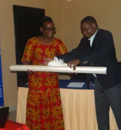
Articles & Stories World Bank and SERVIR working together to map for Natural Capital Accounting in Rwanda SERVIR-Eastern and Southern Africa (E&SA) at the Regional Centre for Mapping of Resources for Development (RCMRD), together with the government of Rwanda, recently released new 2015 land cover maps, disseminating them during a workshop in May 2017 in Kigali. June 22, 2017
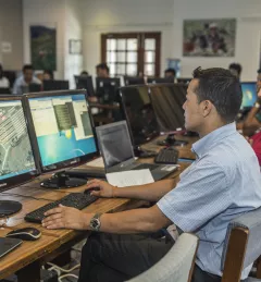
Articles & Stories Adding new tools for tracking a changing landscape Monitoring land cover change over time is essential to understanding ecosystem health, biodiversity, forest carbon cycling, and much more. Land cover/land use (LCLU) data and maps are critical components for climate monitoring applications such as Greenhouse Gas (GHG) emissions reports. March 23, 2017
Articles & Stories Keeping a high-tech watch over green space With state-of-the art satellite remote sensing techniques, countries can conduct accurate forest inventories as well as map and monitor land use change. March 3, 2017
Articles & Stories FAO and SERVIR Helping to keep Sharper Eye on Forests and Land Use around the world According to the World Wildlife Fund, over 2 billion people rely on forests for shelter, livelihoods, water, food, and fuel security. Forests even help renew our air supply, as they take in large amounts of carbon dioxide and release oxygen. September 30, 2016