
Use Case: Uganda Directorate of Water Resources Management (DWRM)
User: Ministry of Water and Environment, Directorate of Water Resources Management, Uganda
SERVIR Hub: SERVIR-Eastern and Southern Africa (E&SA)
Geographic Location: Atari River Catchment in the Kyoga Water Management Zone (KWMZ), Uganda
User Background: The Directorate of Water Resources Management (DWRM), which falls under the Ministry of Water and Environment (MWE), is responsible for managing and developing Uganda’s water resources in an integrated and sustainable manner. DWRM’s goal is to provide water of adequate quantity and quality for all social and economic needs for the present and future generations.
Service Summary: The Regional Stream Flow Monitoring and Forecasting Service provides real-time stream flow and flood forecasts for several watersheds in East Africa as well as bias-corrected satellite precipitation products that enable the timely prediction and monitoring of water resources and extreme hydrological events (flood and drought). The service employs multiple hydrological models, multiple satellite-derived precipitation products and other climatic data from CHIRPS, IMERG, TRMM, CMORPH, PERSIANN and ECMWF to simulate stream-flow products at different temporal scales. Products include stream flow monitoring and forecast time series, bias corrected satellite precipitation, water resources allocation indices, and a visualization platform with data download capability. The service builds the capacity of stakeholders on the use of the streamflow and hydrological modelling products to support water resources development and management in the region.
The service continues to be developed and adapted in order to provide improved, simple and user-friendly tools for water resources assessments as well as streamflow monitoring and forecasting to aid in the management of water resources and hydro-climatic disaster risk reduction. The products, tools and platform use Earth Observation (EO) and remote sensing products to complement scarce in situ data.
One such product is the Ensemble Framework for Flash Flood Forecasting (EF5) model. EF5 is an open source distributed hydrological modelling software that was developed under this service to help users study the catchment hydrological characteristics and to monitor and forecast hydrological conditions (flood and drought). The model combines the use of in situ rainfall data or remote sensing (satellite) rainfall products with other geospatial data (land use, topography and soil), which is very useful in areas that have limited ground-based observation. (See related journal article).
Situation: Prior to the design and construction of any water supply system or flood control and drainage infrastructure, it is necessary to carry out a hydrological or water resources assessment to understand the availability of water, especially as it relates to the intended abstraction process. Conducting such an assessment ensures the sustainability of the system and value-for-money investment.
The use of observed streamflow data from hydrometric stations has been the gold standard for monitoring streamflow and water resources assessment. However, the instrumentation and infrastructure required are often expensive and limited to only key stations within the watershed. The data acquired from other areas of interest within the catchment are often inferred from nearby hydrometric stations that estimate discharge amounts with inherent spatial uncertainty.
Such hydrological assessments rely on the expertise of the modeler as well as rainfall and streamflow data from monitoring gauge stations, which are often scarce and unreliable in the Sub-Saharan region. The observed discharge data exists for only major rivers that are gauged while ungauged smaller rivers and streams have no observed time series discharge data.
As a result, within Uganda, DWRM is only able to estimate streamflow via hydrological modelling for the ungauged rivers. Having more precise streamflow data would help to support water resources planning and management decisions, including those that involve water supply, irrigation, drainage and flood control. In addition to the lack of accurate and reliable streamflow data, the institutions in Uganda do not have the technical skills and capacity to apply hydrological models to better assess, plan and manage water resources.
On behalf of the Ministry of Water and Environment, DWRM identified and prioritized Ngenge Sub-County to receive funding from Water and Sanitation Development Facility-East (WSDF-E), which aimed to improve water supply and sanitation provisions to small towns in the Eastern and North Eastern region of Uganda.
To meet these needs, DWRM identified the Atari River as a potential water source for the Sub-County, but first needed to quantify the river system’s water supply. According to the Ministry’s Water Act (Cap. 152) of 1998 and Water Resources Management Regulations of 2012 and 2015, any design engineering of a water supply and storage system must be preceded by a water resources assessment (commonly referred to as a hydrological assessment) to determine whether a river system would be able to meet the current and future water demand for the Sub-County.
To comply with this requirement, DWRM conducted a detailed hydrological assessment of the Atari River Catchment using the EF5 model to determine the feasibility and sustainability of the water supply system. The model was used to simulate and generate historical streamflow data for the past 30+ years at the proposed intake point. Using the data, DWRM assessed the long-term seasonal and temporal variability as well as the distribution of streamflow for the Atari River. These analyses included the long-term low flows, which are critical in the design and operation of the water supply system. Designers must adhere to abstraction regulations, which stipulate the conditions for water abstraction and environmental flows.
User Need: Previously, the Atari River Catchment was ungauged and did not have any in situ streamflow, ground-based rainfall, or evapotranspiration data available that would support the water resources assessment and engineering design decisions on the Ngenge Sub-County water supply project.
Without a model to provide streamflow and historical observed streamflow data, hydrologists and water resources engineers rely on instantaneous streamflow measurements of ungauged catchments for hydrological assessment. However, this approach is time and resource consuming and can make it difficult to characterize the catchment’s streamflow regime (low and high flows). The resulting data may be inaccurate or incomplete and may lead stakeholders to over- or under-design water resources and supply infrastructure, which could have cost and service implications.
In order to generate accurate and reliable streamflow data for a river catchment and water resources assessment, DWRM required the use of a hydrological model that was driven by free and open-source Earth Observation and satellite-derived datasets. DWRM then explored the observed streamflow data for the neighboring gauged river catchments that had similar characteristics to the Atari River, but with reliable and sufficient data for model calibration and validation. The EF5 model was set up, calibrated and validated for the nearby gauged Sipi River Catchment. The calibrated model parameters for the Sipi River Catchment were then pedo-transferred to simulate the long-term flows regime of Atari River catchment at the proposed water supply intake.
User Quote:
"The application of the EF5 model, in combination with remote sensing data in the water resources assessment and the determination of long term seasonal, temporal variability and distribution of Atari River streamflow, positively contributed to the water management decisions of the ungauged Atari River Catchment. Ensuring that design flows were met with the full range of river flows, which can vary due to seasonable rainfall patterns, it gave us confidence when designing the entire water supply system. Such tools will continue to be vital for Uganda, as most of the small catchments are still ungauged and, yet, demand for water abstractions for various uses continues to rise."
– Maximo B. Twinomuhangi, Senior Hydrologist, Ministry of Water and Environment, Uganda
Example of Use: In May 2016, SERVIR E&SA conducted a needs assessment workshop in Uganda. The Ministry of Water and Environment, through the Directorate of Water Resources Management (DWRM) and the Directorate of Water Development (DWD), participated as a key stakeholder.
DWRM and DWD identified several needs:
- Improving reliable and accurate data for water resources planning and management.
- Generating streamflow data from nearby catchments (using a hydrological model driven by open source EO datasets for 30+ years) that would replicate streamflow.
- Enhancing access to EO data and improving the skills needed to understand and apply the EO data to water resources planning and management.
- Establishing a river flow monitoring framework for water resources assessment and forecasting.
In response to these needs, SERVIR E&SA, in close consultation with DWRM, DWD, and other users, designed a service plan for the proposed Regional Streamflow Monitoring and Forecasting Service that would help to enhance skills in the use of Earth Observation and remote sensing datasets. Since then, the hub has engaged the users through hands-on trainings and workshops including:
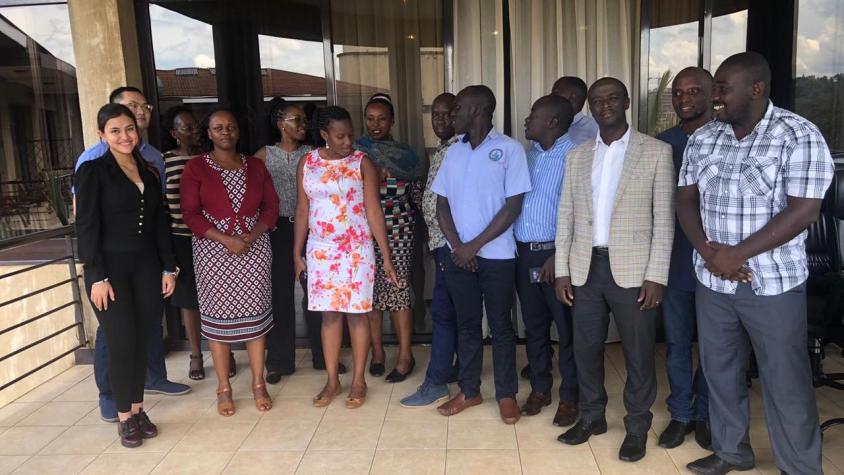
- February 2017: In partnership with the University of Oklahoma, SERVIR E&SA conducted a four-day technical training workshop on the Ensemble Framework for Flash Flood Forecasting (EF5) in Kampala. The training included 19 professionals from the DWRM, DWD, Uganda National Meteorology Authority (UNMA), among others. The training focused on an introduction to hydrological concepts, Geographic Information Systems (GIS) techniques, remote sensing of hydrological quantities, and the use of hydrological modelling outputs for various tasks. By the end of the training, users were able to understand basic hydrological and modeling concepts as well as how GIS software can be incorporated into hydrological analysis.
- April 2018: SERVIR E&SA conducted an EF5 hydrological modelling training in Kampala. The hands-on training included topics such as: EOs geospatial and meteorological data download, processing, EF5 model set up, simulation, calibration and validation using observed streamflow data. The training included 17 professionals from Ministry of Water and Environment - Directorate of Water Resources Management, Directorate of Water Development, Uganda National Meteorology Authority, among others.
- November 2019: SERVIR E&SA conducted an advanced EF5 training in Kampala. The training included 11 professional staff from the DWRM, UNMA, Uganda Red Cross Society and Office of the Prime Minister - Disaster Preparedness. Topics included: preparation of EO precipitation data forcing with numerical weather prediction (NWP) for EF5, EF5 global forecasting system, EF5 control file set up and execution, download and visualization for streamflow and PET data for the Kyoga Water Management Zone Basin. Other activities included using the open-source Jupyter Notebook to view the EF5 model simulation results, the application of multiple gauges for cascading calibration and validation, reviewing a flood inundation map from the EF5 output for three river basins, the application of an EF5 output for streamflow monitoring and forecasting and visualization, and reviewing an EF5 East African demo platform for regional flood monitoring and forecasting and alert notification system.
Outcome of Use: As of December 2021, the Kyoga Water Management Zone and Ministry of Water and Environment was in the final stages of selecting a contractor and the subsequent tendering for construction and development. Based on projections of population growth and water demands, it is estimated that the water supply system will support 21,870 people for the initial year 2023 and 41,704 people for the ultimate year 2043.
DWRM applied the EF5 model to the hydrological assessment that established the flow regime and quantified the water availability for Ngenge Sub-County’s domestic water supply. The assessment then informed the engineering design and management decisions for the Ngenge Sub-County Water Supply System and the sustainable rate of abstraction from the river system without compromising the quality of ecosystem services downstream.
The study provided a metric indication derived from catchment water balance that indicated that the estimated water potential at the catchment and proposed abstraction site greatly exceeds the estimated water abstraction for current demand and the ultimate year (2043) demand. This implies that the water abstraction can be sustained within the renewable rate while maintaining the environmental flow for the downstream environmental and ecosystem services.
In 2019, the output of this work was presented and featured at the Ugandan Water and Environment Week. The event was themed “Water and Environment: A Strategic Driver in Attainment of Sustainable Development Goals 2030” and focused on the use of the EF5 model.
The study also demonstrated some of the processes and extents of compliance with the directive by Ministry of Water and Environment through the Water Use Regulations and Guidelines 2012 and 2015 regarding abstraction and environmental/reserved flow for ecosystems service provisions.

Hydrological Assessment for the Proposed Atari River Intake for the Ngenge Sub-County Water Supply System Report. Credit: Maximo B. Twinomuhangi, Senior Hydrologist, Ministry of Water and Environment, Uganda
Future Collaborations: As part of the SERVIR E&SA’s Regional Stream Flow Monitoring and Forecasting service, the EF5 model is being reviewed and improved upon in order to support more users with flood forecasting and monitoring capacity to enable a more robust early warning and early action strategy. The EF5 model serves as a basis of collaboration with DWRM, UNMA, the Uganda Red Cross Society and the Office of the Prime Minister of Uganda, particularly regarding disaster risk reduction.
Additional Documents:
- Uganda Water and Environment Week 2019 Report (page 42 -43). The findings of the linked report were featured in the Ugandan Water and Environment Week 2019.
- Hydrological Assessment for the Proposed Atari River Intake for the Ngenge Sub-County Water Supply System Report 2019.