Strategy & Guidance USAID Geospatial Strategy USAID’s 2024-2028 Geospatial Strategy promotes leveraging the power of geospatial data and technology to target the delivery of international programs. November 15, 2023
Tool SERVIR Gender Analysis Tool This Gender Analysis Tool provides clear guidance on a foundational step for service design and programming, to contribute to SERVIR’s goals of ensuring that women, along with men, are realizing equal benefits from SERVIR’s geospatial services. March 6, 2023
Tool SERVIR Service Planning Toolkit The Service Planning Toolkit is a resource for SERVIR Hubs and their partners to implement SERVIR's service planning approach. May 1, 2021
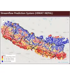
Use Case Use Case: Nepal Department of Hydrology and Meteorology The Nepal DHM is the national agency responsible for monitoring and managing the hydrological resources of Nepal. This Use Case describes how they used the SERVIR Enhancing Flood Early Warning Services (EWS). September 16, 2020
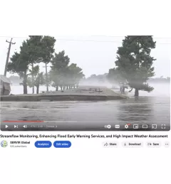
Video Streamflow Monitoring, Enhancing Flood Early Warning Services, and High Impact Weather Assessment July 28, 2020