Video
Regional Drought Monitoring and Early Warning System
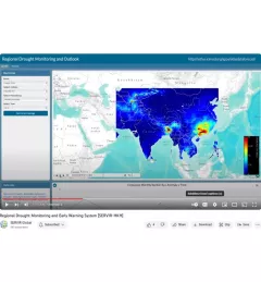
SERVIR scientists discuss the how the Regional Drought Monitoring and Early Warning System is being used in the Hindu Kush Himalaya region.

15 results
SERVIR scientists discuss the how the Regional Drought Monitoring and Early Warning System is being used in the Hindu Kush Himalaya region.

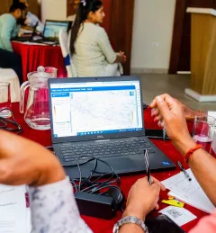
SERVIR recently collaborated with the Central American Aerospace Network to lead the Jóvenes Geoespaciales (“Geospatial Youth”) workshop for 45 young students in San Miguel, El Salvador. The students used NASA Earth data and open access tools to create their own projects for local climate resilience, including maps for monitoring crop health, wildfires, and deforestation.
|Lena Pransky, NASA Science Coordination Office

At the Jóvenes Geoespaciales training in El Salvador, 45 talented young students worked in groups to use NASA satellite data and Google Earth Engine to develop projects for local climate resilience. Each group learned how to develop their own ArcGIS StoryMaps web page for displaying their data, which they can use to advocate for climate action.
|Lena Pransky, NASA Science Coordination Office
SERVIR Hindu Kush Himalaya helps improve environmental management and resilience in critical areas like food security, water resources management, disaster resilience, and sustainable lan
The Monitoring Extreme Weather in the Hindu Kush Himalaya (HKH) service provides a customized numerical weather prediction toolkit to assess high impact convective weather events over the HKH region.

Meet Finu Shrestha, GIS Research Associate for ICIMOD/SERVIR-Hindu Kush Himalaya.

ICIMOD, under its SERVIR-Hindu Kush Himalaya (SERVIR-HKH) and Climate Services for Resilient Development (CSRD) Initiatives, is collaborating with technical organizations in the United States and meteorological and agricultural institutions in the HKH to establish a regional agricultural drought monitoring and early warning system.

The Hindu Kush Himalayan (HKH) region is no stranger to water- and weather-induced hazards. Every year, these disasters result in loss of lives, livelihoods, and damage to infrastructure throughout HKH countries.

The SERVIR program, launched in 2005, connects NASA, U.S. researchers, a network of development partners around the world, and companies like Google to harness the power of satellite observations — helping countries see, with greater clarity, how their environments affect well-being and safety.
![SHUKLA_Shrad_photo[1].jpeg](/sites/default/files/styles/card_flag/public/article/image/SERVIR-HKH_thematic_illustration.jpg.webp?itok=isSkllDk)
The International Centre for Integrated Mountain Development (ICIMOD) has been implementing the SERVIR-HKH Initiative — one of five regional hubs of the SERVIR network — in its Regional Member Countries, prioritizing capacity building and science activities in Afghanistan, Bangladesh, Myanmar, Nepal, and Pakistan.