
Leveraging the Cloud and Earth observations for monitoring development in Africa
How does one leverage the latest scientific and technological advances to place the power of the Cloud and Earth observations (EO) at the fingertips of researchers based in dynamically changing countries? Answering that question was precisely the focus of SERVIR’s most recent capacity building exercise, which introduced researchers from across the length and breadth of Africa to the power of Google Earth Engine (GEE) – Google’s potent cloud-based geospatial analysis platform. As a pre-session to the 2017 AfriGEOSS* Symposium, scientists from the SERVIR Science Coordination Office (SCO) shared their remote sensing and coding know-how with colleagues from across Africa during a training workshop held in Accra, Ghana, from 7-8 June 2017.
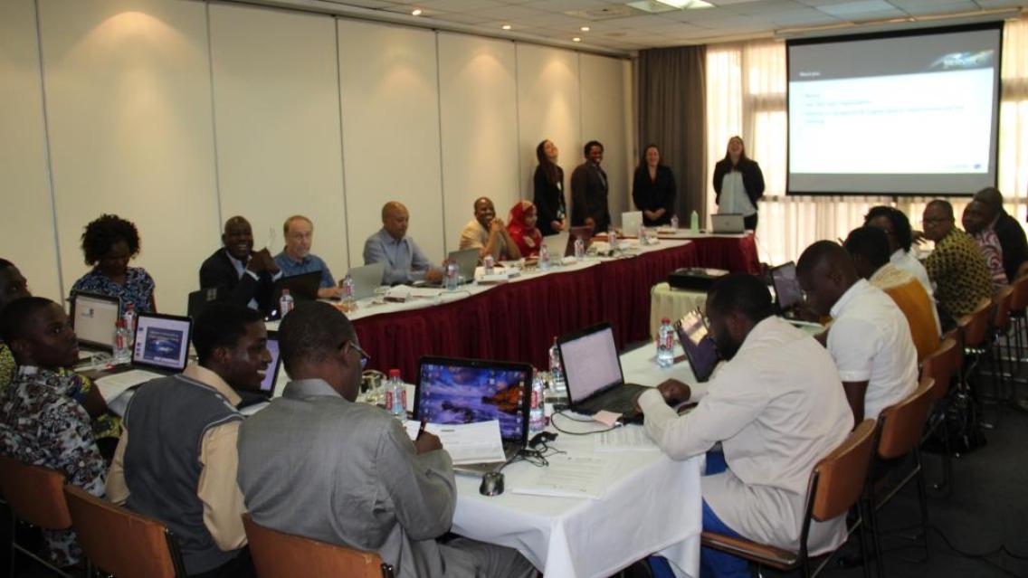
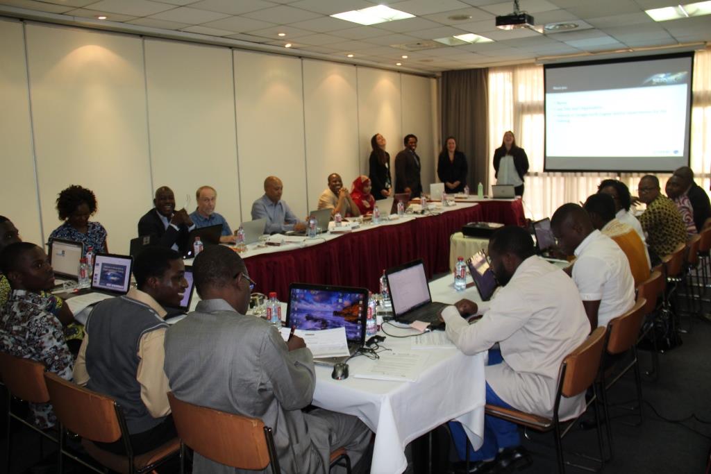 |
| GEE Training session underway in Ghana |
A different way to work with EO data
Ambitious in scope, the workshop packed a lot of content into a short period of time. It covered a wide range of topics, including
- Importing data collections into the GEE platform
- Basic image processing functions
- Creation of cloud-free image mosaics
- Generation of vegetation indices such as EVI and NDVI
- Supervised spectral classification
- Time series analysis
This training, the first of its kind at a regional level in Africa, introduced researchers to the use of coding and cloud computing to apply remote sensing in environmental monitoring. As a collaborative effort of the United States Agency for International Development (USAID) and the National Aeronautics & Space Administration (NASA), SERVIR has always strived to lower barriers to using EO data for tackling development challenges. This was one of the workshop’s primary focus areas. GEE integrates 40+ years of data from NASA satellites – as well as data from the European Space Agency and other sources – and is equivalent to a large sandbox with an expanding number of datasets and processing algorithms. It provides specialists with a ‘one stop shop’ platform for accessing datasets ranging from Landsat reflectance estimates to MODIS sea surface temperatures to Sentinel-1 radar backscatter estimates. But beyond GEE’s versatility, the platform is well suited to help researchers overcome a few persistent road blocks to their work.
New ways of surmounting old obstacles
Many of the over two dozen participants remarked that their current modes of operation have involved processing EO data directly on their desktop computers, using specialized software packages. They indicated that the challenges they faced included getting access to expensive software for image processing, and downloading gigabytes upon gigabytes of satellite data across limited Internet bandwidth. The opening of decadal archives of data such as Landsat and new data streams coming online, such as through the Copernicus program, made things even more challenging, akin to ‘drinking from a firehose.’ However, platforms like GEE actually shift the paradigm by allowing researchers to ‘bring their processing algorithms to the data’ – which is more efficient than traditional means of processing EO data. With GEE, researchers can process massive amounts of data in seconds instead of months – taking advantage of processing on Google’s servers. And since processing is done on the server side, little Internet bandwidth is used, so researchers working with slow Internet connections are not at a disadvantage.
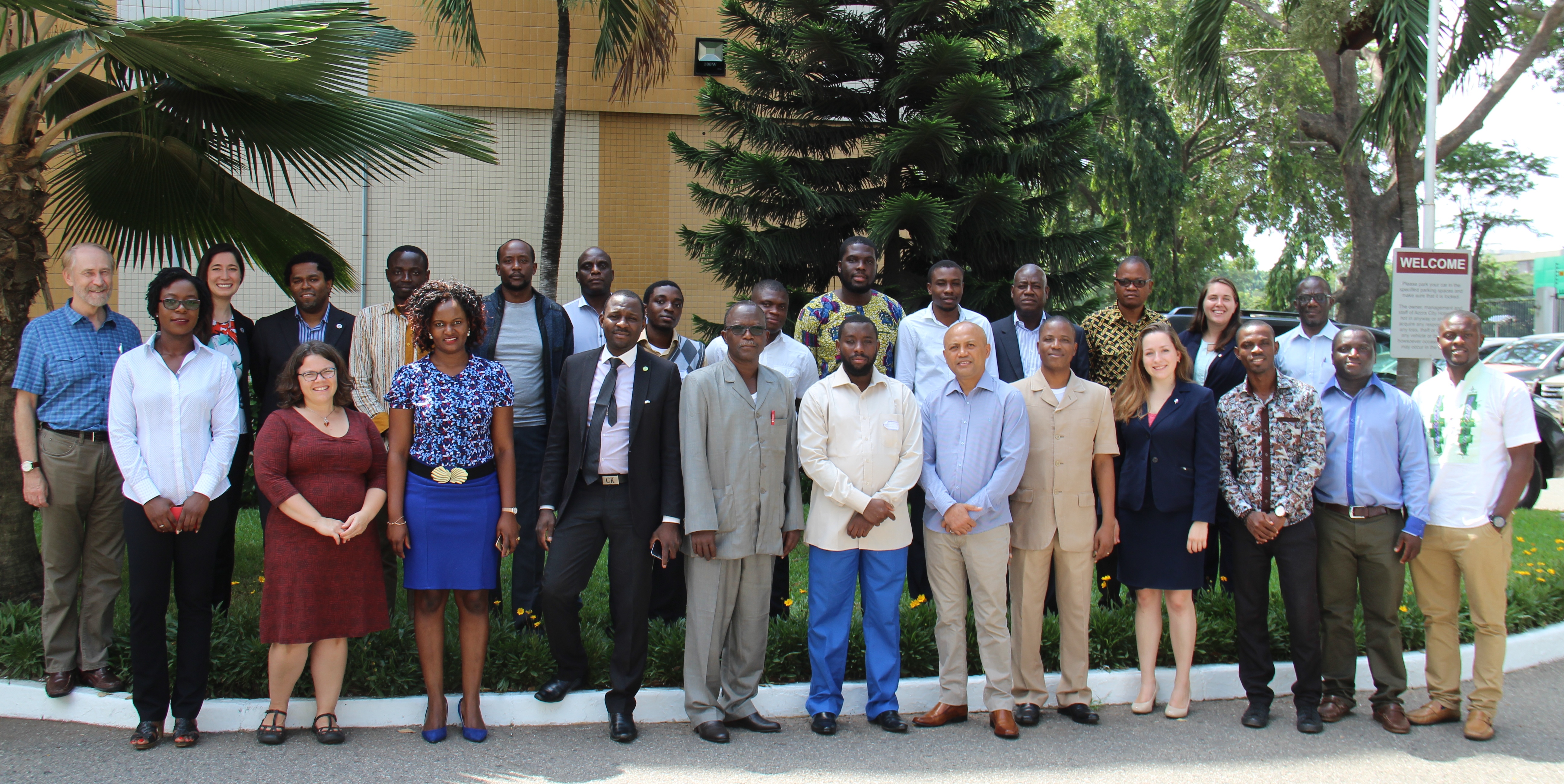 |
| Group photo of training workshop participants |
The researchers who participated in the GEE training hailed from different corners of northern, western, eastern, central, and southern Africa, representing eight nationalities. This included representation from the SERVIR-Eastern & Southern Africa Hub, the Regional Centre for Mapping of Resources for Development (RCMRD), and the SERVIR-West Africa consortium, including the Agrometeorology, Hydrology, and Meteorology Regional Centre (AGRHYMET), the African Centre of Meteorological Applications for Development (ACMAD), the International Crops Research Institute for the Semi-Arid Tropics (ICRISAT), the African Regional Institute for Geospatial Science and Technology (AFRIGIST), and Ghana’s Centre for Remote Sensing and Geographic Information Services (CERSGIS). While these institutions were represented by seasoned remote sensing professionals, programming is not usually part of a geospatial scientist’s repertoire and GEE’s Code Editor command line differs quite a lot from traditional graphic user interfaces common to standard GIS packages.
Forming a community of practice in Africa
Regardless of the learning curve, Andiswa Mlisa, the AfriGEOSS coordinator at the Secretariat for the inter-governmental Group on Earth Observations and one of the original proposers of the training, expressed her hope that the workshop could galvanize the development of a critical mass of EO professionals leveraging the Cloud for monitoring development across Africa, under the banner of both SERVIR and AfriGEOSS. Toward that end, beyond imparting an exchange of skills, the SERVIR SCO also provided the workshop participants with sample GEE codes in the form of a code repository which the participants can in turn customize for their own respective applications. (The code repository itself was a modification of algorithms developed in the context of the sister SERVIR-Mekong initiative by researchers from Google and the Spatial Informatics Group, SIG.)
Next steps
It is likewise hoped that the members of the community of practice formed during the training will support each other in developing novel applications leveraging GEE, and representatives from the SERVIR-West Africa consortium institutions have begun discussing how GEE might be incorporated into services being developed for that region. For instance, the SERVIR-West Africa Hub has been implementing a pilot project on the use of satellite data to monitor ephemeral water bodies in arid parts of West Africa, and GEE provides a way to rapidly process such data. The idea is that pastoralists could make use of such information to guide their livestock to areas with adequate supplies of water and forage.
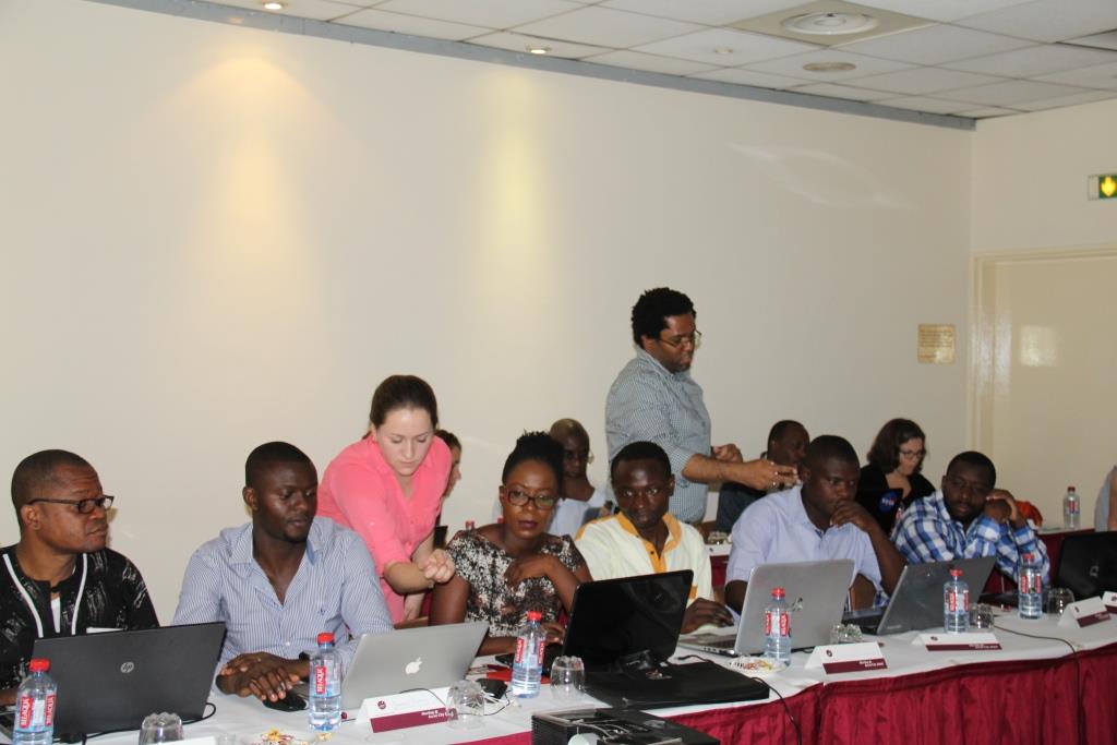 |
| Personnel from SERVIR’s Science Coordination Office assist workshop participants with hands-on data processing activities |
While it may be too soon to gauge the overall impact of providing African researchers from regional and national centers of excellence with access to the powerful GEE processing suite, an exit questionnaire from the training did reveal a great deal of participant interest in mainstreaming use of GEE and Cloud computing into their everyday work. Beyond the code repositories, SERVIR SCO personnel will be available to collaborate remotely with the workshop’s graduates on further development of applications.
Notes
*AfriGEOSS is the African continental implementation of the Global Earth Observation System of Systems (GEOSS), which was created by the inter-governmental Group on Earth Observations “to better integrate observing systems and share data by connecting existing infrastructures using common standards.”
The trainers were Rebekke Muench, Kelsey Herndon, Emily Adams, and Emil Cherrington. Click here to view the Agenda for the workshop.