
Reflecting on a Decade of Collaboration between NASA and USAID: Lessons Learned About Deriving Value from Space for International Development
In 2005, NASA scientists and USAID staff saw the potential for a powerful collaboration between their agencies and launched SERVIR. The program combines NASA’s science and technology and USAID’s development investments to empower developing countries to better monitor, predict and respond to environmental challenges using Earth observation satellite data.
 |
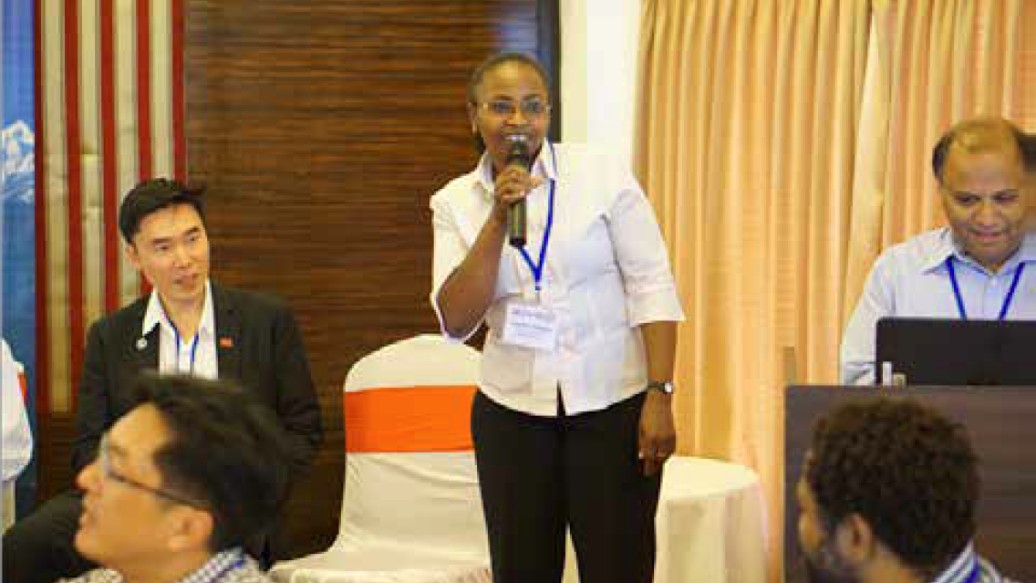
| Anastasia Wahome (Eastern and Southern Africa SERVIR hub) provides comments during a session on best practices at the SERVIR Annual Global Exchange, in Pokhara, Nepal, October 2016. |
Despite their very different missions, USAID and NASA have a lot in common. Among NASA’s goals is improving life on Earth, which it advances through closely observing Earth from a constellation of satellites, sharing data for free with the public, and leading an extensive earth and space science research portfolio. Within USAID’s mission is the objective to end extreme poverty and promote resilience in developing countries. USAID works to address issues such as food security, natural resources management, health and humanitarian assistance through a global network of in-country assistance programs and local staff and offices that work with on-the-ground partners. All these issues require good data in places that are often data-limited. SERVIR’s network of experts around the world possesses a wealth of experience creating user-driven information products and services with Earth observation data. Many of these efforts have succeeded over the years, but certainly not all of them. SERVIR is capturing good practices that are relevant for a much broader community of practice.
Purposes and Principles
SERVIR was developed to strengthen the ability of regional organizations and national decision-makers to work with Earth observation data and derived applications to improve their countries’ food security, water security, disaster management, climate resilience and sustainable land use.
The use of Earth observation data is particularly limited in developing countries, which often lack the analysts and experts, research, and monitoring budgets to support data collection and validation, computing infrastructure and bandwidth, and software licenses. In countries where ground-based observations are lacking, sporadic or incomplete — as is the case in many developing countries — satellite data can be used for monitoring and enforcement around resource use or informing disaster response.
SERVIR aims higher than simply developing analytical products using Earth observation data at NASA and delivering them to partner countries. It seeks to enable organizations in the regions to develop and sustain solutions themselves for use by member countries and sub-national entities.
In line with these principles, SERVIR activities must be needs-driven rather than supply-driven, use the right data and science (not necessarily the state-of-the-art), and be developed through collaboration, with sustainability built in from the start. All of the products, applications and source code developed by the program are available online, in keeping with the principles of open data and exchange (with accommodations made to safeguard certain sensitive input data if required by local partners).
The three-step process for developing SERVIR activities ensures that the program not only disseminates science and data, but understands needs and establishes relationships to increase the chances of sustained buy-in and the use of science and data.
- Step 1 - Consultation and Needs Assessment: SERVIR Hub teams engage local stakeholders broadly, including USAID field offices and their partners, to identify and prioritize development challenges and identify SERVIR’s specific niche and likely user groups.
- Step 2 - Service Design: SERVIR Hub teams engage a smaller set of decision-makers and experts to design a specific service and develop plans for the component products, tools, data sets, trainings and outreach activities.
- Step 3 - Service Delivery: SERVIR Hub teams work with decision-makers and collaborating scientists to pilot, disseminate, evaluate and transition the service.
Lessons Learned
- Shift from one-off products to sustainable services. The Earth observation community uses the term “products” to describe the outputs of analytical efforts that add value to raw data, whether processed datasets, maps, bulletins, or other formats of analysis. These products are valuable in and of themselves, but they are more valuable as part of a sustained service that packages information in the most useful way for decision-makers and combines it with training, outreach, monitoring, and a dissemination strategy. A focus on “services” requires a client orientation: understanding users’ needs, tailoring services to meet those needs, working together, integrating data, and being responsive to feedback and updating the service components over time.
- One type of organization cannot serve as the only connection between Earth observation data to decision-making. SERVIR has developed a simple framework to help the program think holistically about the context for Earth observation information. Discussions used to focus on “supply and demand” or “providers and users.” Now, however, SERVIR uses a more nuanced understanding and a “chain” analogy (Figure 1) that reflects the different functions and types of organizations that are involved in connecting data to decisions. There is a tendency to focus on one point in the chain, depending on one’s bias, for instance, assuming that data is the biggest gap, and that if we improve the data or make it more accessible, it will naturally lead to the desired use and development results. Or a focus may be placed either on the product itself or on the dissemination method, without spending sufficient time thinking about what comes before and after, or how information will flow from one actor to another, or whether users even have the ability to take action on the information they ultimately receive. The capacities and gaps that exist all the way through this chain must be examined in order to optimize investments to increase the use of Earth observation data.
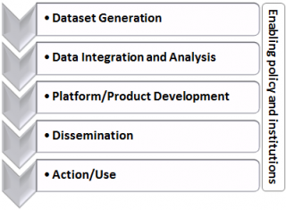 |
| The Decision Support Investment Chain |
The SERVIR program is just one of many efforts globally that derives value from space science to support economic growth and resilience in developing countries, but it is unique in its longevity and global breadth. The original aims and objectives of the program persist, but a culture of adaptive management and learning has enabled many adjustments over the years. Those adjustments have helped SERVIR get closer to truly putting Earth observation data and science into the service of society, finding ways to work across organizations and disciplines and more effectively capitalize on the different skillsets required to connect space to village.
This blog was originally featured on Climatelinks, a global knowledge portal for USAID staff, implementing partners, and the broader community working at the intersection of climate change and international development. Click here to go to the original blog post.
Jenny Frankel-Reed is a senior climate change specialist with USAID’s Climate Change Office. She leads USAID’s Adaptation Team and coordinates the SERVIR program, a joint initiative with NASA to help developing countries access satellite data. She has provided technical support to programs in 20 countries and regions. Frankel-Reed’s career has focused on the vulnerability and adaptation dimensions of climate change, including vulnerability assessment, adaptation project design and planning, and climate finance. Prior to joining USAID in 2010, she served as technical advisor for an adaptation program focused on rural development in India with GIZ; as an adaptation advisor with the UN Development Program; and as a climate change consultant to the Global Environment Facility Secretariat. She holds a master’s degree from the Yale School of Forestry and Environmental Studies.