
Use Case: A Rocha Ghana
User: A Rocha Ghana
SERVIR Hub: SERVIR-West Africa
Geographic Location: West Gonja and Sene Districts, Ghana
User Background: A Rocha Ghana (ARG) is an established environmental organization in Ghana which, through practical conservation interventions, helps communities adapt to their changing natural environments and the effects of climate change. ARG supports local participation in the sustainable management of protected areas and currently works in the West Gonja District in the Savannah Region in northern Ghana where charcoal production is widespread.
Service Summary: The Charcoal Production Site Monitoring Service for West Gonja and Sene Districts in Ghana is a web-based platform that utilizes the spatial distribution of charcoal production to monitor deforestation and forest degradation in the West Gonja District in Ghana.
Situation: Firewood and charcoal represent Ghana’s primary domestic energy source. The 2010 National Population and Housing Census indicated that (1) 80% of people living in rural areas depend on wood fuel as their primary source of fuel and (2) more than 50% of the urban population use charcoal as their primary source of domestic energy.
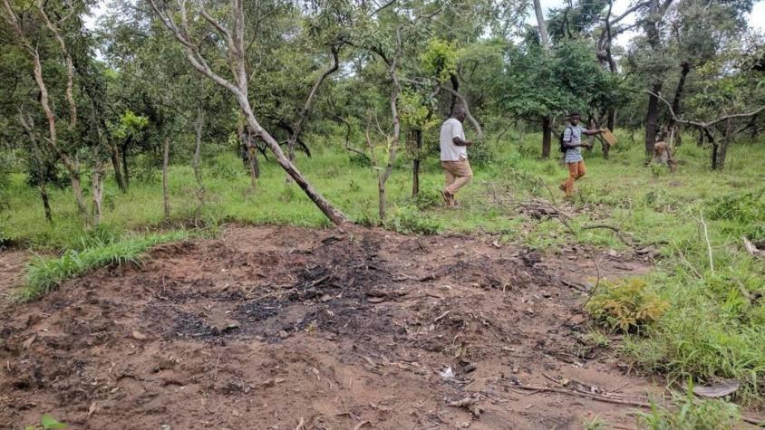
Local peoples depend on charcoal for fuel in subsistence and livelihood capacities, including cooking. Despite Ghana maintaining a nationwide ban on charcoal production in woodland areas, the demand for charcoal is so great that laws are often overlooked by local authorities and local communities. In addition, woodland damage has largely been indiscriminate, including degradation within Mole National Park – a protected area that is managed by Ghana’s Forestry Commission.
Enforcement of the charcoal production ban has been a challenge for several reasons: (1) Access to affordable fuel alternatives is lacking. In an effort to reduce fuelwood consumption nationwide, the Government of Ghana launched the Rural LPG program in 2013 with the goal of providing access to 50% of Ghana’s population by 2020. However, many of the communities in West Gonja are remote and the infrastructure and supply chain for LPG still does not exist. Until accessible and affordable fuel alternatives are introduced and accepted, charcoal will remain the preferred fuel source. (2) Companies from Accra and other population centers come to West Gonja to profit off charcoal production, which generates jobs and is an important livelihoods component. While earnings are modest, the industry provides traditional West Gonja families with a vital income that they, otherwise, would not have. (3) West Gonja District lacks a formal plan to coordinate monitoring and compliance efforts between independent NGOs and law-enforcing local authorities. As a result of these challenges, the existing law has neither been accepted by the public nor enforced by local authorities.
User Need: While ARG has been working with the local authorities and communities in West Gonja for several years to address the array of existing environmental and livelihood issues, the organization was lacking a means to assess and understand the full scale and complexity of the charcoal production problem.
ARG needed satellite imagery and spatial analysis to create maps that would provide evidence of ecological change in charcoal production sites and tree cover density over the last 10+ years in West Gonja. Such a resource would help decision-makers and community leaders in the region (1) understand the detrimental effects of these land use changes, and (2) establish effective intervention and monitoring programs that would yield evidence-based, sustainable, and collaborative land use planning.
Before partnering with CERSGIS and SERVIR West Africa, ARG sent field officers into the field to manually collect data on the number of active and inactive charcoal production sites. However, this “in situ” data collection process was inefficient because it monitored only a small portion of affected areas and was exceedingly labor-intensive. As the data was incomplete, ARG didn’t have the requisite information necessary to understand and address the widespread effects of deforestation and forest degradation.
User Quote:
"This mapping service has helped us do a better job by targeting the exact areas where charcoal production activities are taking or have taken place for planning restoration activities. It will also be a useful advocacy tool for engaging our stakeholders and decision makers at district and national levels for interventions designed to mitigate climate change and for behavior changes."
– Daryl Bosu, Deputy National Director, A Rocha Ghana
Example of Use: In 2016, the Centre for Remote Sensing and Geographic Information Services (CERSGIS) and SERVIR West Africa, as part of its service planning approach, convened a meeting with local, regional, and national stakeholders to identify service needs of users within Ghana.
One of the service needs identified was the creation of a tool that used earth-observation technology to identify and monitor charcoal production sites and estimate change in tree cover density in the West Gonja District in northern Ghana.
To create this tool, CERSGIS first employed high-resolution imagery from Google Earth and remote sensing data from NASA’s Landsat 7 and Landsat 8 satellites to identify and monitor charcoal production sites from 2008 to 2017. In addition, CERSGIS partnered with Dr. Mike Wimberly’s team at the University of Oklahoma to develop an algorithm that mapped tree cover density.
By providing analysis-ready, tree cover density data to ARG, the District Assembly, and traditional authorities, CERSGIS has enabled regional actors to quantify the number of trees that can be harvested with minimal impacts to tree cover and ecosystem function. District and land use planners are then able to incorporate population statistics for nearby communities to better gauge fuel wood demand and more aptly designate tree lots that can be sustainably co-harvested by selected communities to contain and minimize deforestation.
Identifying charcoal production sites allows ARG to target hot spots in order to (1) prevent indiscriminate forest degradation and (2) begin the restoration process. Given that Mole National Park has encountered a recent surge in charcoal production sites, a satellite-based detection and monitoring system will help to curb indiscriminate forest degradation within the park.
The maps produced by CERSGIS were also the catalyst for ARG conducting a comprehensive analysis of the charcoal value chain, which included best approaches to: (1) engage with local authorities on sustainable land use planning and the adherence to environmental laws, (2) produce charcoal sustainably, (3) develop alternative energy solutions for cooking, (4) establish practical, alternative livelihoods, and (5) formalize wood harvesting cooperatives – both at the community and industry level.
Outcome of Use: On March 26, 2019, ARG facilitated a meeting in the West Gonja District with the Department of Agriculture of Ghana, National Commission for Civic Education, Environmental Protection Agency of Ghana, Forestry Commission of Ghana, Gonja Traditional Council, Charcoal producers and buyers, and West Gonja District Assembly to address the negative impacts of charcoal production, discuss ways to create a charcoal value chain, and identify additional “information needs” of stakeholders.
During the meeting, ARG used outputs from the Charcoal Production Site Monitoring Service that, ultimately, established an initial roadmap towards launching a traceable green charcoal value chain for the entire region of Gonjaland.
The meeting also resulted in the following conclusions:
- Elected local authorities should register and aggregate all charcoal producers and buyers in their electoral areas into associations.
- All charcoal buyers should be registered within a database that is managed by the District Assembly and Gonja Traditional Council.
- District bylaws on tree felling and charcoal productions should be strictly enforced by Assembly, while charcoal producers and buyers should comply with existing regulations.
- There is a need to set up a fund – financed by charcoal producers and buyers – to support the landscape restoration within the region.
- There is a need for a strong institutional collaboration between the District Assembly, the Traditional Council, the police, and civil society and development partners to effectively regulate and supervise a sustainable value chain for the charcoal industry.
- Ghana’s Energy Commission, which is sanctioned to explore alternative energies for the country, is also requesting findings from ARG, as they do not have adequate information of charcoal production at the community level.
Future Collaborations: CERSGIS and SERVIR West Africa maintain a collaborative partnership with A Rocha Ghana in which CERSGIS will continue to support A Rocha Ghana’s initiatives through remote sensing, spatial analysis mapping, and the ongoing monitoring of tree density and charcoal production sites.
CERSGIS and SERVIR West Africa intend to scale up this pilot service in West Gonja to cover all charcoal production areas in Ghana and, perhaps a future target, the entire West Africa sub-region. The funding agency interested in upscaling the service is the Global Environment Facility (GEF).
Future technical service enhancements will include:
- Collection and utilization of data and information from the Sentinel satellite, which will provide new imagery every five days and with an improved resolution of 10 meters. This imagery will allow more frequent and more accurate monitoring of the selected target areas.
- Replacement of the visual identification method of charcoal production sites with a machine learning/automated detection method that is to be developed by the NASA Science Coordination Office (SCO) and partners. This approach will allow an automated scan of the region and identification of impacted areas.
- Calculation of carbon emissions associated with charcoal production that will help address national and international reporting requirements for climate change mitigation activities.
Additional Documents: Report on District-Level Stakeholder Engagement On Charcoal Production In West Gonja District, Savanna Region