
Use Case: Mekong River Commission (MRC)
User: Mekong River Commission
SERVIR Hub: SERVIR-Mekong
Geographic Location: Lower Mekong Region (Cambodia, Lao PDR, Thailand and Vietnam)
User Background: The Mekong River Commission (MRC) is an intergovernmental organization that provides coordination and technical input on flood management to the members of the Lower Mekong countries including Cambodia, Lao PDR, Thailand, and Vietnam.
The primary objective of the organization is to jointly manage shared water resources to enable sustainable development within the Lower Mekong River. Using the expertise within its own Technical Support Division, which includes a Flood Forecasting Team, the MRC provides early warning and real-time updates via the Decision Support Framework (DSF) to support flood management.
Service Summary: SERVIR-Mekong is helping to improve the MRC’s regional flood forecasting service through the integration of new satellite-derived precipitation products in order to increase the accuracy of flood forecasts. By introducing the updated Global Precipitation Measurement (GPM) data, performing bias-correction, and integrating the data into the existing Virtual Rain and Stream Gauge Information Service (VRSGIS), SERVIR-Mekong is providing more frequent, high accuracy, near real-time precipitation products that can be fully integrated and fed into their existing flood forecasting and hydrological models. This ultimately improves mid-term riverine flood forecasts.
VRSGIS is a web-based tool that provides near real-time rainfall and stream height data from publicly available satellite measurements, which can be used in hydrological modelling, flood forecasting, landslide risk assessment, early warning systems, and river basin management. The service supports the adoption of improved satellite-derived data, which is at a higher resolution both spatially and temporally, allowing for quicker forecasting and improved accuracy.
- Service: Improving the Mekong River Commission's Regional Flood Forecasting Service
- Tool: Virtual Rain and Stream Gauge Information Service (VRSGIS)
Situation: Countries in the Lower Mekong, namely Cambodia, Lao PDR, Thailand, and Vietnam, are subject to seasonal flash floods that are caused by monsoon rains and tropical storms. However, the impacts are geographically uneven. Although the region contends with natural cycles of seasonal flooding, these weather-related events are exacerbated by extensive land-use change and modifications to the natural hydrology. Due to accelerating economic development and an expansion of water use, the Mekong River Basin is currently facing rapid social, economic, and political changes.
The majority of the 60 million people who live within the Lower Mekong Region maintain water-related livelihoods and are, therefore, heavily impacted by floods. Although the Mekong seasonal flooding is a critical process in bringing nutrients to low-lying farmland, it can also lead to loss of life, biodiversity, and damage to agricultural production, infrastructure, and human settlements throughout the region. Disruption to both social and economic activities across the region results in huge monetary losses. According to the MRC’s 2018 State of the Basin Report, average annual economic losses amount to $71 million in the Mekong Delta in Vietnam and approximately $88 million in the Lower Mekong Basin in Thailand.
Tropical storms and the Southwest Monsoon are generally the root causes of many flood-related disasters in the Lower Mekong Region. According to a United Nations Office for Disaster Risk Reduction (UNISDR) report, between 1995 and 2015, 2.3 billion people worldwide were affected by flooding with 95 percent living within Asia. With the increasing frequency and severity of weather-related disasters, unless countries in the Lower Mekong Region can adapt, then loss of life and property damages will only continue to increase.
User Need: Before partnering with SERVIR-Mekong, the MRC Flood Forecasting Team used a variety of precipitation data sources, including remotely-sensed data from the decommissioned Tropical Rainfall Measurement Mission. However, these datasets lacked spatial and temporal coverage. The MRC was not using the most up-to-date data from the GPM, a next generation satellite-based project that offers near real-time observations. Previously, the MRC only carried out flood forecasting during the monsoon season and used outdated models that were in use since the early 1970s with a forecasting accuracy of only 10-15 percent.
Together, Lower Mekong countries recognized the need for cooperation and mutual consideration to facilitate joint assessment of resources, coordination of development planning, and the management of the river as a shared resource. While the MRC prepares, forecasts, monitors, and responds to flood risk, the organization requires a range of information at different temporal and spatial scales in order to assist in the decision-making process.
As countries rely on forecasts and early warnings to take action, they need more reliable and accurate flood forecasts, including improved in-country and cross-border data on rainfall, water flow, and reservoir and river levels. Improving the quality of satellite-derived products, through the creation of a virtual network of rain and stream gauges, is important to maintain and sustain the basin-wide flood monitoring network. To be effective, flood warnings and related information needs to be understandable and relevant on a local scale, particularly as they relate to local communities and non-technical users.
User Quote:
"Bias corrections with the global rainfall product from the GPM will significantly improve our flood forecasting and warning system for better accuracy. We want to continue our cooperation with SERVIR-Mekong to include deeper efforts towards a holistic plan, which includes both floods and droughts."
– Dr. Lam Hung Son, Head of the MRC Secretariat Regional Flood and Drought Management Center
Example of Use: Since 2018, SERVIR-Mekong has been working with flood forecasters at the MRC Secretariat’s Regional Flood and Drought Management Centre (RFDMC) to improve its flood forecasting system by developing the bias-correction tool for the Global Precipitation Measurement (GPM) products (GPM-BICO) and integrate into SERVIR-Mekong’s existing VRSGIS.
To create GPM-BICO, precipitation ground measurements were collected from multiple sources and processed for the validation and bias correction of the GPM data for the Lower Mekong Region. Two sources of ground data were processed during monsoon seasons between 2014 and 2019: (1) daily precipitation data from the MRC (based on a 24-hour time scale to compute one averaged reading per day); and (2) hourly precipitation data (recorded every hour of each day) from the Hydro Informatics Institute (HII) of Thailand.
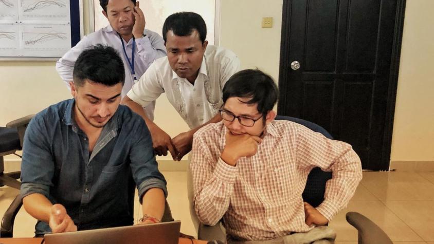
SERVIR-Mekong and Regional Flood and Drought Management Centre (RFDMC) conducted a study to evaluate the performance of the new data followed by two training workshops in Phnom Penh, Cambodia to work with the MRC Flood Forecasting Team, teaching them the new bias correction methodology. The trainings ultimately improved their technical capacity on utilizing up-to-date climate data to improve the accuracy of the data.
The service is being rolled out in two primary phases with data-sharing support from Hydro Informatics Institute in Thailand to help fill gaps in data coverage. The first phase involved development of the tool and training for short riverine forecasts; the second phase focused on medium riverine forecasts.
A key objective of the service was to implement the product and algorithm across the Lower Mekong Basin before the start of the monsoon season in June 2020.
Outcome of Use: SERVIR-Mekong updated its VRSGIS to include GPM data. The VRSGIS now automatically collects GPM satellite data automatically every 30 minutes to ensure minimum operational delay.
The open-sourced Global Precipitation Measurement –Bias Correction (GPM-BICO) tool enables the MRC to correct regional GPM data, which is more frequent, accurate and consistent.
The use of near real-time bias corrected precipitation data has improved the accuracy of flood forecasting and early warning reports to inform the National Mekong Committee and its constituents.
The enhanced capacity of the MRC Flood Forecasting Team enables them to use the new data products effectively and assist with training other MRC member countries.
When the improved flood forecasting system is formally adopted, MRC’s member countries will have access to daily flood information to more effectively prepare for and manage floods.
Future Collaborations: The SERVIR-Mekong and MRC teams will continue to collaborate on the use of GPM data and its application for flood forecasting in the region.
As an ongoing service, SERVIR-Mekong is planning future activities as part of the short and medium riverine forecasts In the first phase for short riverine forecasts, SERVIR-Mekong is working with Deltares and the MRC to integrate data collected from the GPM-BICO tool into the Mekong Flood Early Warning System. During the second phase for medium riverine forecasts, SERVIR-Mekong will conduct additional trainings as requested by RFDMC; and SERVIR-Mekong, RFDMC and HII are collaborating to submit three papers based on the work of the two phases.
In addition to these two confirmed phases, SERVIR Mekong is in discussions with RFDMC and MRC to create an entirely new flash flood service that would incorporate landslide data (supported by SERVIR-Mekong Applied Science Team Dr. Dalia Kirschbaum) . Both RFDMC and MRC have expressed interest in the service and all parties are currently working towards an official agreement.
Dr. Lam Hung Son, Head of the MRC Secretariat Regional Flood and Drought Management Center, previously expressed interest in reservoir monitoring. Currently, SERVIR AST Dr. Hyongki Lee is supporting activities for the Reservoir Mapping Tool, which focuses on monitoring and forecasting water levels of inundated areas. Eventually, these outputs will be integrated into VRSGIS, which will then be used by MRC.
Additional Resources: