
Regional Cropland Assessment and Monitoring Service
The Regional Cropland Assessment and Monitoring Service seeks to provide timely information for food security assessments through the development of national and regional crop monitors in East Africa. The crop monitors are helping streamline data collection and synthesize crop conditions through a combination of field assessments and earth observation data. Information about crop conditions is supplemented with climate outlook and market information. The resulting maps provide an understanding of crop conditions and drivers of less than favorable conditions. The service facilitates a crop modeling framework to assess drought and yield estimates using CHIRPS data for precipitation estimates and crop type maps derived from Landsat and Sentinel. Additional activities include supporting the Quality Agricultural Index Insurance Certification for East Africa (QUIIC) program and the Kenya Government crop insurance program by developing a geospatially informed sampling frame. The sampling frame has resulted in over 70% cost reduction and reduced sampling time, increasing efficiency and reducing bias in sample selection. Overall, the service supports enhanced food security decisions from the local to regional levels.
Rationale
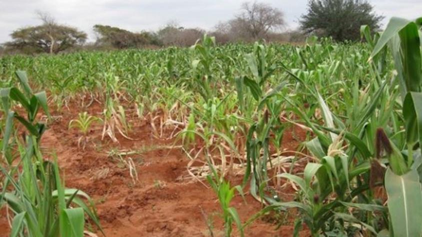
Climate variability coupled with an overreliance on rain-fed agriculture on smallholder farms highly impacts food security in the Greater Horn of Africa region. The additional pressure to feed a rising population on already strained land that is facing degradation and declining soil fertility, are also recurrent challenges. These issues are aggravated by extreme climatic events, such as droughts and floods, coupled with unpredictable rainfall and changing temperatures. All of these issues culminate in poor crop yields and food insecurity. At the regional and national levels, a lack of timely information and tools for monitoring crop conditions and assessing yields is a major challenge in food security assessments and decision-making.
-
Users
State Department of Crops Development in the Ministry of Agriculture Livestock Fisheries and Irrigation (Kenya)
IGAD Climate Prediction and Applications Centre
Famine Early Warning Network (FEWSNET)
Food and Agriculture Organization
Kenya National Bureau of Statistics
Extension officers and field agents
Farmers
Food security agencies
-
Using Satellite Imagery to Expand Crop Insurance in Kenya
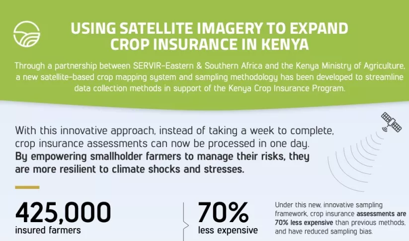
Through a partnership between SERVIR Eastern & Southern Africa and the Kenya Ministry of Agriculture, a new satellite-based crop mapping system and sampling methodology was developed to streaml
-
SAR Handbook

The SAR Handbook: Comprehensive Methodologies for Forest Monitoring and Biomass Estimation is the culmination of a two-year collaboration between NASA SERVIR and SilvaCarbon.

