
Enhancing Drought Resilience and Crop Yield Security for the Lower Mekong
The Enhancing Drought Resilience and Crop Yield Security for the Lower Mekong Service provides drought nowcasts and forecasts at the regional level in the Lower Mekong Region and provincial level in Vietnam using hydrological and crop model information through the Regional Hydrologic Extremes Assessment System (RHEAS), a state-of-the-art water resources nowcast and forecast framework. Through this service, the Mekong Drought and Crop Watch (MDCW) platform was developed to manage information needed to understand drought conditions and potential effects on crop yields. MDCW was co-developed by SERVIR Mekong, the Mekong River Commission (MRC), Vietnam Academy of Water Resources (VAWR), the NASA Jet Propulsion Laboratory, the University of Massachusetts Amherst, and the Stockholm Environmental Institute.
The MRC uses these products to generate drought warnings which are distributed through the MRC Drought Monitoring and Forecasting Portal to line agencies mandated with managing drought in the Lower Mekong countries. This service also seeks to improve VAWR’s ability to forecast and monitor drought conditions through the use of the RHEAS. VAWR now generates drought and crop yield forecasts to inform mitigative decision-making by the Ministry of Agriculture and Rural Development (MARD), Vietnam on issues including salt water intrusion, water allocation and distribution compensation, and other social welfare initiatives in the country. This service ultimately enables more comprehensive, accurate, and actionable warnings for decision-makers at regional, provincial, and local levels across the Mekong countries.
Rationale
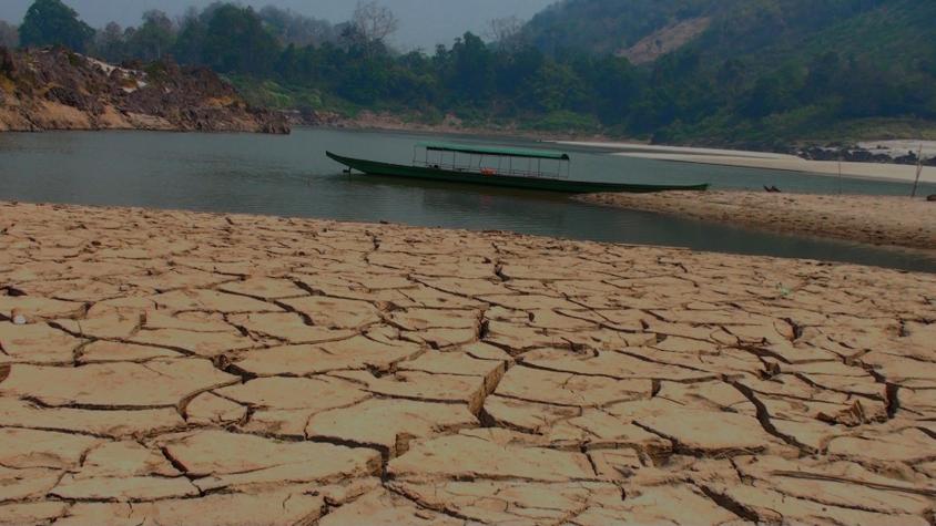
Countries in the Lower Mekong region heavily rely on agriculture and crops for their food security, rural livelihoods, and local and national economies. Predicting the timing of the wet and dry seasons is difficult, especially due to climate change altering the frequency, intensity, and timing of extreme weather. This is a challenge for water resource management, farming patterns and agricultural management, all of which rely on such information. The information generated by this service will assist farmers and water resources management authorities to make preemptive decisions about their water use, cropping and planting patterns, and market decisions.
-
Users
Mekong River Commission (MRC)
National Mekong Committee (NMC)
Vietnam Academy of Water Resources (VAWR), Vietnam
Institute of Agriculture and Environment (IAE), Vietnam
Institute of Water Resource Planning (IWRP), Vietnam
Ministry of Agriculture and Rural Development (MARD), Vietnam
Ministry of Natural Resources and Environment (MoNRE), Vietnam
Pacific Disaster Center (PDC)
United Nations World Food Programme (WFP)
-
External News/Resources
Improving Food Security Through Capacity Building
Mekong Drought and Crop Watch: Feature Articles and Knowledge Center
SERVIR-Mekong Improves Drought Resilience in Vietnam
Improving Drought Resilience and Water Resource Management in Vietnam
Mainstreaming Gender in Drought Forecasting
Stakeholder Workshop for the Regional Drought & Crop Yield Information System
Facilitating Decision Making: Tools That Monitor Drought Onset and Agriculture Productivity
Video: Drought and Food Security in the Lower Mekong (ADPC)
-
Enhancing Drought Resilience in Vietnam
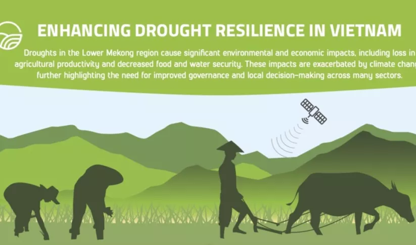
Droughts in the Lower Mekong region cause significant environmental and economic impacts, including loss in agricultural productivity and decreased food and water security.
-
Mekong Regional Land Cover Monitoring System (RLCMS)
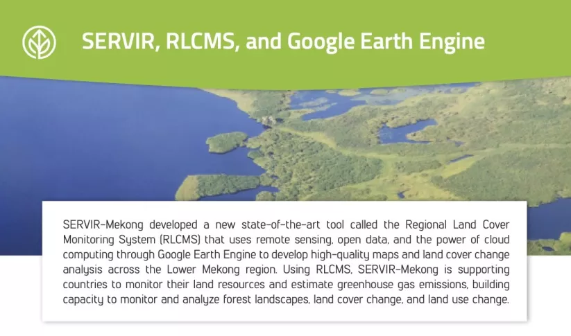
SERVIR-Mekong developed a new state-of-the-art tool called the Regional Land Cover Monitoring System (RLCMS) that uses remote sensing, open data, and the power of cloud computing through Google Ear
-
Use Case: Vietnam Academy for Water Resources (VAWR)
VAWR, which operates under Vietnam’s Ministry of Agriculture and Rural Development (MARD), is the leading institute for water resources, research and development within Vietnam.


