
Himalayan Storm Watchers Save Lives
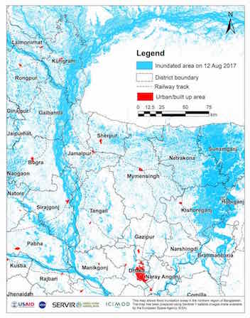 |
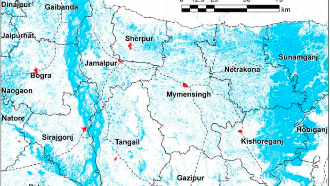
A recent Esri blog features advances made by ICIMOD towards improved disaster management, early warning and response in the Hindu Kush Himalaya region. SERVIR-Hindu Kush Himalaya, established in 2010 as a regional hub through ICIMOD’s Mountain Environment Regional Information System (MENRIS) initiative, supports informed decision making in the region by providing access to Earth observing satellite data and geospatial data products. ICIMOD’s Sudip Pradhan, interviewed in the blog, describes SERVIR-HKH activities in flood inundation mapping for regional disaster response, supporting organizations such as the World Food Programme. A partnership of NASA, USAID, and leading technical organizations such as ICIMOD, SERVIR develops innovative solutions to improve livelihoods and foster self-reliance in Asia, Africa, and the Americas. READ MORE