
Map Validation with Collect Earth Online in Ecuador
The Map Validation with Collect Earth Online (CEO) service enables more accurate forest monitoring data, which is necessary for the evaluation of public policy related to forest management, both for conservation, restoration and management measures, as well as for decision making and the development of measures and actions for the reduction of deforestation and forest degradation, and the implementation of incentives that improve the living conditions of people directly related to forests. The service can impact the global effort to reduce emissions by improving the Measurement, Reporting and Verification (MRV) system, which allows countries to measure their progress against reference emission levels reported to the UNFCCC (United Nations Framework Convention on Climate Change) and climate change mitigation funds, among others.
Rationale
Ecuador is engaging in national efforts to reduce carbon emissions from the forest sector as an integral part of the National Action Plan for REDD+. The country is implementing the National System for Forest Monitoring, with the objective of providing continuous and rigorous information about forest and other ecosystems’ status and changes. Improving the accurate assessment of land cover changes, implementing time series analysis and using Synthetic Aperture Radar (SAR) data are among some of the urgent needs highlighted by Ecuadorian authorities to improve their current system. This service builds on the assumption that making deforestation, forest degradation and vegetation regeneration processes transparent and known will lead to the prevention of irregular land-use because actors cannot hide it. As a result, more effective action to mitigate negative land-use trends because irregular or illegal activity will be known by control authorities and in some cases the media.
Initially, cooperation between SERVIR Amazonia and MAATE began with SERVIR Amazonia conducting general training workshops on data accuracy assessment and map validation using Collect Earth Online, and providing technical support. Following early workshops, SERVIR Amazonia conducted user-need analyses in order to develop specific CEO tools catered to the issues identified, expressed, and faced by members of the Ministry of Environment, Water, and Ecological Transition. By encouraging the participation of MAATE to adapt CEO tools on a case-specific basis, SERVIR-Amazonia helped to ensure that Collect Earth Online would have practical applications for the MAATE, namely, helping to provide and verify information to aid in generating public policy.
-
Users
Ministerio del Ambiente, Agua y Transición Ecológica (MAATE)
-
Tools
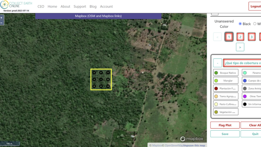
Collect Earth Online – Ecuador projects