
news updates
SERVIR Latest Stories
Stay up to date with the latest developments from the SERVIR Global Collaborative. Our news highlights partnerships, research breakthroughs, regional initiatives, and innovative tools that transform satellite data and geospatial science into real-world solutions. Through collaboration across Africa, Asia, and the Americas, SERVIR works with local institutions, governments, and communities to strengthen climate resilience, protect ecosystems, and support sustainable development.

UNU-INWEH and SIG-NAL Sign Memorandum of Understanding to Advance Earth Intelligence for Sustainable Development
New York, New York, 7 July 2026
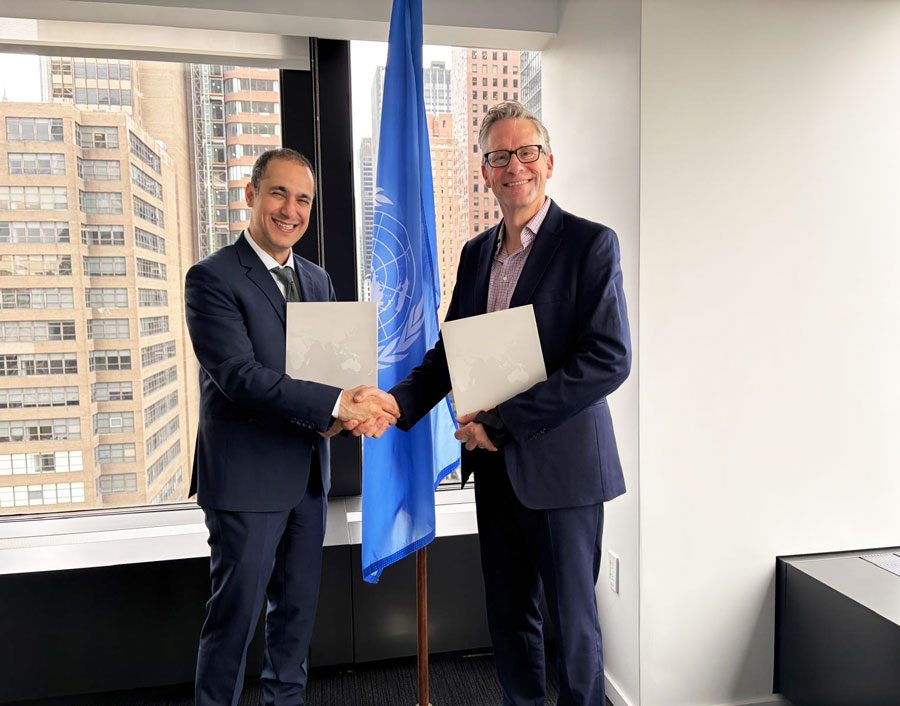
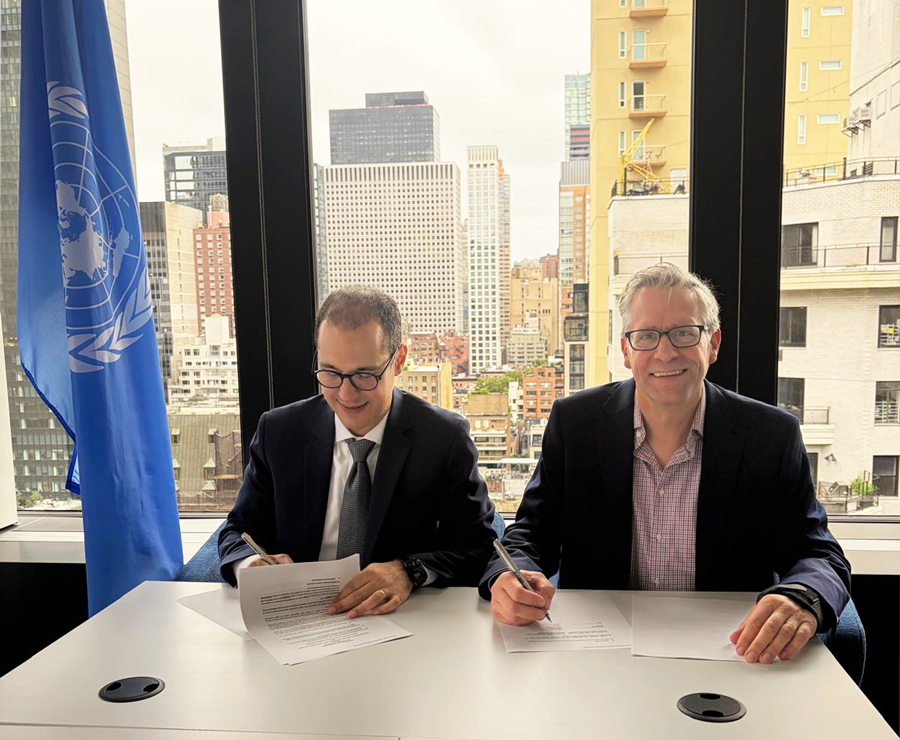
The United Nations University Institute for Water, Environment and Health (UNU-INWEH) and the Spatial Informatics Group – Natural Assets Laboratory (SIG-NAL), host of SERVIR’s Global Secretariat, have launched a strategic partnership to advance the use of Earth intelligence for sustainable development through joint research, capacity development, and global policy engagement. The partnership is formalized through a Memorandum of Understanding signed by the two organizations.
The collaboration brings together UNU-INWEH’s expertise in policy-relevant research, education, and capacity development with SERVIR’s globally coordinated, locally led network of regional hubs that translate satellite Earth observation, geospatial science, and GeoAI into operational tools and decision support for governments and communities. Together, the organizations will work to strengthen climate resilience, disaster risk reduction, water security, flood management, food security, and forest management through science, innovation, and locally grounded implementation.
“Communities across the Global South are on the front lines of the water and climate crisis, yet they often have the least access to the data and science needed to respond,” said Prof. Kaveh Madani, Director of UNU-INWEH. “Through this partnership with SIG-NAL and the SERVIR network, we can harness Earth observation science to generate insights and build capacity for better policy development across the globe.”
This partnership builds a framework for collaboration across several areas of mutual interest. Together, the organizations will contribute to flagship research and policy products that combine SERVIR’s geospatial datasets, Earth intelligence capabilities, and regional scientific expertise with UNU-INWEH’s leadership in policy synthesis, education, and dissemination. The organizations will also jointly develop training materials, certified learning opportunities, and capacity development initiatives that expand access to geospatial science and Earth intelligence through online and in-person learning.
Beyond research and education, the partnership will explore scientific collaboration, policy engagement, and joint resource mobilization. Through SERVIR’s regional hubs across Africa, Asia, and Latin America, the partnership will create opportunities for scientists, practitioners, and institutions to participate in science and policy dialogues, develop learning resources, strengthen technical capacity, and collaborate with UN entities and other partners on initiatives that advance shared development and environmental objectives.
“Tackling the world’s most pressing environmental challenges requires scientific excellence and strong partnerships,” said Pete Epanchin, SIG-NAL’s Director of Global Partnerships. “This collaboration brings together UNU’s global leadership in research and capacity development with SERVIR’s operational Earth intelligence network to help translate scientific advances into practical tools, knowledge, and decision support for governments and communities around the world.”
Initial areas of collaboration may include applied research, training, and decision-support activities related to flood preparedness and flood management, water security, drought resilience, forest conservation and management, food security, ecosystem monitoring, and other areas where Earth observation science can support policy, planning, and local action.
The collaboration reflects a shared recognition that addressing today’s environmental and development challenges requires more than scientific discovery alone. It requires trusted partnerships that connect Earth intelligence with policy, institutional capacity, and locally led implementation. By combining complementary strengths, UNU-INWEH and SERVIR aim to accelerate the translation of Earth observation science and GeoAI into measurable societal impact.
About UNU-INWEH
About SERVIR
About SIG-NAL
Fund for Science and Technology Awards Grant to SERVIR Global Collaborative to Advance Climate Resilience and Geospatial Innovation
Date: 04/07/2026
he United Nations University Institute for Water, Environment and Health (UNU-INWEH) and the Spatial Informatics Group – Natural Assets Laboratory (SIG-NAL), host of SERVIR’s Global Secretariat, have launched a strategic partnership to advance the use of Earth intelligence for sustainable development through joint research, capacity development, and global policy engagement. The partnership is formalized through a Memorandum of Understanding signed by the two organizations.
The collaboration brings together UNU-INWEH’s expertise in policy-relevant research, education, and capacity development with SERVIR’s globally coordinated, locally led network of regional hubs that translate satellite Earth observation, geospatial science, and GeoAI into operational tools and decision support for governments and communities. Together, the organizations will work to strengthen climate resilience, disaster risk reduction, water security, flood management, food security, and forest management through science, innovation, and locally grounded implementation.
“Communities across the Global South are on the front lines of the water and climate crisis, yet they often have the least access to the data and science needed to respond,” said Prof. Kaveh Madani, Director of UNU-INWEH. “Through this partnership with SIG-NAL and the SERVIR network, we can harness Earth observation science to generate insights and build capacity for better policy development across the globe.”
This partnership builds a framework for collaboration across several areas of mutual interest. Together, the organizations will contribute to flagship research and policy products that combine SERVIR’s geospatial datasets, Earth intelligence capabilities, and regional scientific expertise with UNU-INWEH’s leadership in policy synthesis, education, and dissemination. The organizations will also jointly develop training materials, certified learning opportunities, and capacity development initiatives that expand access to geospatial science and Earth intelligence through online and in-person learning.
Beyond research and education, the partnership will explore scientific collaboration, policy engagement, and joint resource mobilization. Through SERVIR’s regional hubs across Africa, Asia, and Latin America, the partnership will create opportunities for scientists, practitioners, and institutions to participate in science and policy dialogues, develop learning resources, strengthen technical capacity, and collaborate with UN entities and other partners on initiatives that advance shared development and environmental objectives.
“Tackling the world’s most pressing environmental challenges requires scientific excellence and strong partnerships,” said Pete Epanchin, SIG-NAL’s Director of Global Partnerships. “This collaboration brings together UNU’s global leadership in research and capacity development with SERVIR’s operational Earth intelligence network to help translate scientific advances into practical tools, knowledge, and decision support for governments and communities around the world.”
Initial areas of collaboration may include applied research, training, and decision-support activities related to flood preparedness and flood management, water security, drought resilience, forest conservation and management, food security, ecosystem monitoring, and other areas where Earth observation science can support policy, planning, and local action.
The collaboration reflects a shared recognition that addressing today’s environmental and development challenges requires more than scientific discovery alone. It requires trusted partnerships that connect Earth intelligence with policy, institutional capacity, and locally led implementation. By combining complementary strengths, UNU-INWEH and SERVIR aim to accelerate the translation of Earth observation science and GeoAI into measurable societal impact.
About the Fund for Science and Technology
Launched in 2025, the Fund for Science and Technology is a 501(c)(3) private foundation and part of the Paul G. Allen philanthropic ecosystem. Through transformational science and technology, FFST enables accelerated discovery and catalyzes progress for people and planet across its three focus areas of bioscience, the environment, and AI-for-good. In addition, the foundation funds the Allen Institute and Ai2, the Allen Institute for AI. Through his estate, Paul G. Allen (d. 2018), best known as the co-founder of Microsoft and among the world’s most generous philanthropists, directed the foundation’s formation and focus areas. Learn more about the Fund for Science and Technology at www.ff-st.org.