
Earth Observations Help to Monitor the Impacts of Cyclone Idai on People and Food in Eastern Africa
This post was written by Catherine Nakalembe (Department of Geographical Sciences, University of Maryland) and Lia Poteet (Applied Sciences Communications, NASA Earth Science), and was originally featured on Agrilinks. Click here to go to the original blog post.
Cyclone Idai left more than 1,000 people dead and thousands more missing, potentially affecting millions in Southern Africa. As emergency response and recovery efforts continue, another disaster is likely unfolding elsewhere on the continent: Idai pulled precipitation South, away from Eastern Africa, resulting in persistent dry conditions affecting crops at the start of the main growing season. That’s where NASA Earth Observations come in.
According to the Eastern Africa Crop Monitor, in Uganda, prices have already increased as a result of low market supplies from 2018’s below-average production. An upward trend in prices is expected to persist heading into the “lean period” of April to June. This creates an even more precarious situation for marginalized groups – women, children, refugees, indigenous peoples, people with disabilities, and many others. These groups are often disproportionately poor, overlooked, and sometimes face discrimination as they try to access and manage the food and safe water they need.
 |
 |
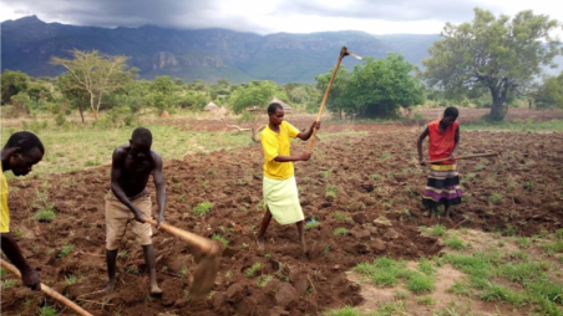
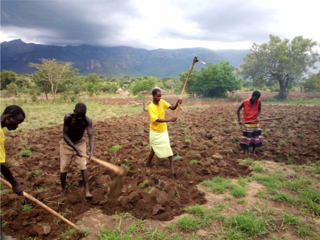
| Figure 1. Farmers who have been waiting for rain are still preparing fields for planting |
Figure 2. Status of early planted maize and beans crops in Karinga village, Moruita sub-county, Nakapiriprit |
NASA Harvest, in partnership with SERVIR, a joint venture between NASA and the U.S. Agency for International Development (USAID), is working with the government of Uganda to help predict crop failure and drought. NASA satellite observations and technologies are used by many countries to provide early warning of humanitarian risks like crop failures. Now, Uganda is using these data to respond proactively to food insecurity from drought and crop failure. In partnership with NASA Harvest and SERVIR, Uganda is using these tools to improve lives, save money, and increase food security under the Disaster Risk Financing (DRF) Program in the Office of the Prime Minister (OPM). This partnership prioritizes and is promoting national autonomy and resilience in the face of extreme weather events and population pressures on land and natural resources. This partnership has even improved coordination among national structures; for example, the National Center for Emergency Coordination (NECOC) now has a direct line of communication with the District Agriculture Officers who collect the field data needed to better interpret satellite data provided by NASA.
It wasn’t always this way. Martin Owor, Commissioner of the Office of the Prime Minister of Uganda notes that, “In the past we always reacted to crop failure, spending billions of shillings to provide food aid. 2017 was the first time we acted proactively because we had clear evidence from satellite data very early in the season.”
– Office of the Prime Minister, Uganda
The Global Agriculture Monitoring (GLAM) East Africa System shows crop and vegetation condition over time using NASA’s TERRA MODIS satellite data, allowing users to monitor crop conditions globally (Figure 2). In Karamoja Uganda, MODIS data is the primary trigger for Uganda’s Disaster Risk Financing (DRF) fund. But they also rely on in situ observations, partnering with local communities to get information on the ground. The DRF program utilizes a low cost, portable field data collection app that relies on wireless data connections to the DRF program office to substantiate and validate what the satellites see.
That’s why this early warning is key. Proactively assessing risk saves money and keeps food on the table for Ugandan families. By May 2017, satellite data showed drought conditions would cause widespread crop failure in Uganda. By August, the GEOGLAM Crop Monitor for Early Warning – an international report using satellite data to monitor crop conditions – confirmed poor production. The Ugandan government provided disaster relief aid to 31,386 households – about 150,000 people – and saved USD 2.6 million in the process. In early 2018, they paid USD 2.6 million to 23,388 households, strengthening food security for many who would have otherwise had to wait until the next season’s harvest or food aid from the government.