
Geospatial Training by Women, for Women
Because climate change disproportionately impacts women and girls, Earth science cannot be fully effective in addressing climate issues without including the realities and unique knowledge of women. Unfortunately, many women are excluded from participating in both the field of Earth science and in community decision-making. Throughout the SERVIR network, partners are taking action to involve women as both developers and users of Earth science.
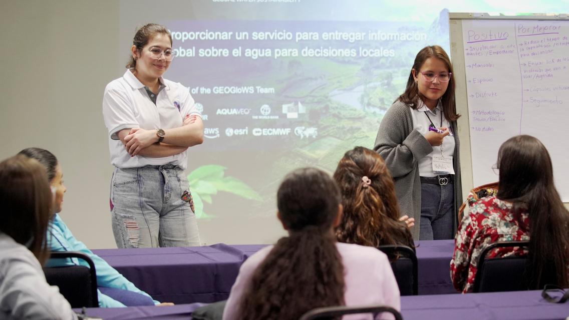
Recently, a group of SERVIR scientists traveled to Costa Rica to support an innovative workshop to engage women in Earth science. These workshops are an example of how to create supportive environments where women can apply their unique knowledge and lived experience to address climate issues. The women who participate in these workshops don’t just leave the workshop with a handout or lecture notes, but with a plan for climate action.
The GeoFem Workshops
María José Molina grew up in a rural farming community in Costa Rica. She eventually moved to the capital city of San José to become a geography professor at the University of Costa Rica. There, she noticed few other women engaging with geospatial technologies–tools used to map and understand issues in Earth science. Not only that, but most of the opportunities to learn geospatial technologies were in the city. This was particularly concerning for María José, because rural communities are the most impacted by climate issues and in need of geospatial tools, such as flood early warning systems or drought forecasts.
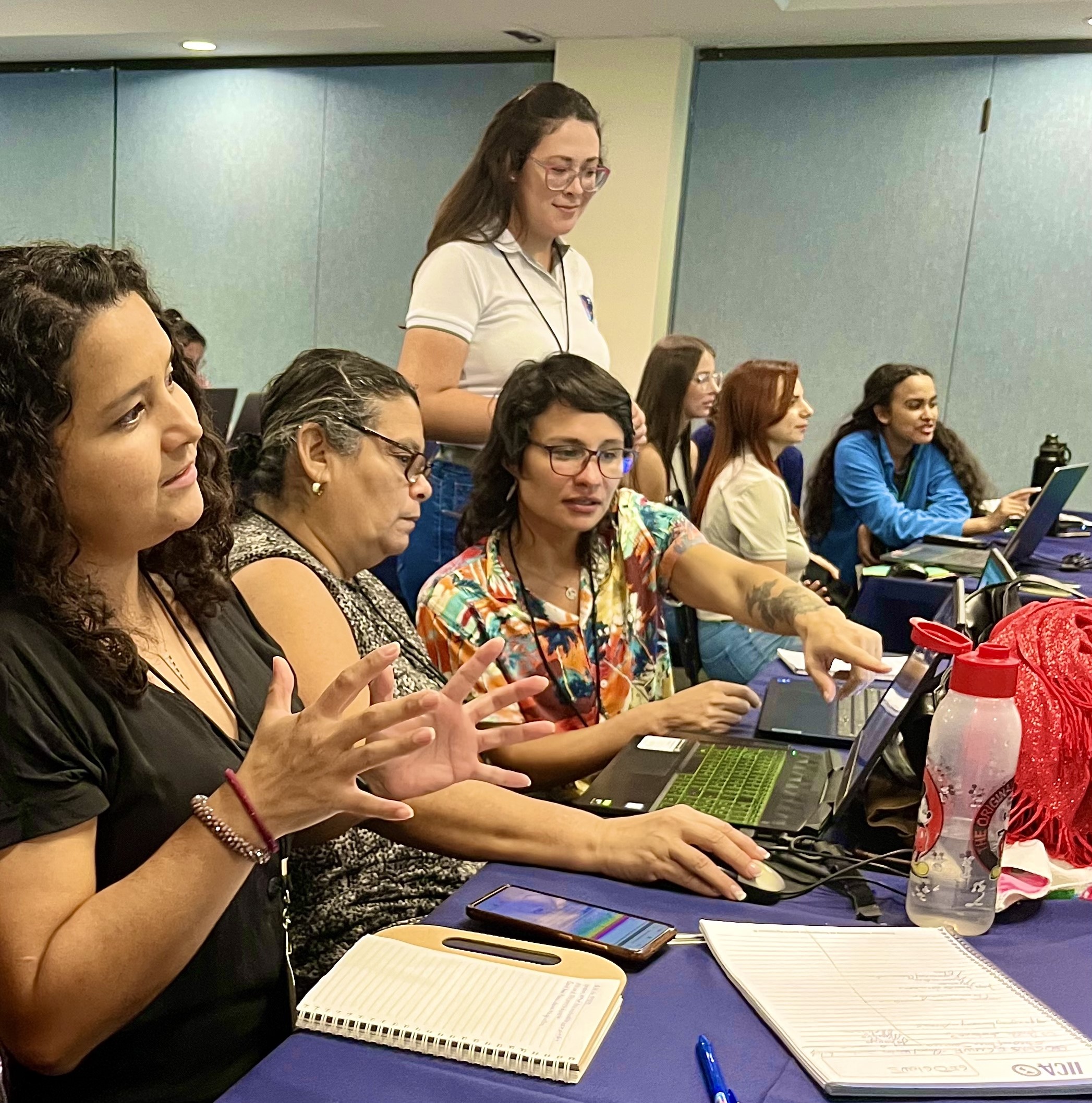
To address these gaps, María José created the GeoFem: Women in Geospatial Technologies workshops (Rally Femenino in Spanish) in 2019. GeoFem creates a supportive space where women, especially rural women, learn how to use geospatial technologies to address environmental and climate issues in their communities. To date, GeoFem has trained over 600 women and girls across Costa Rica.
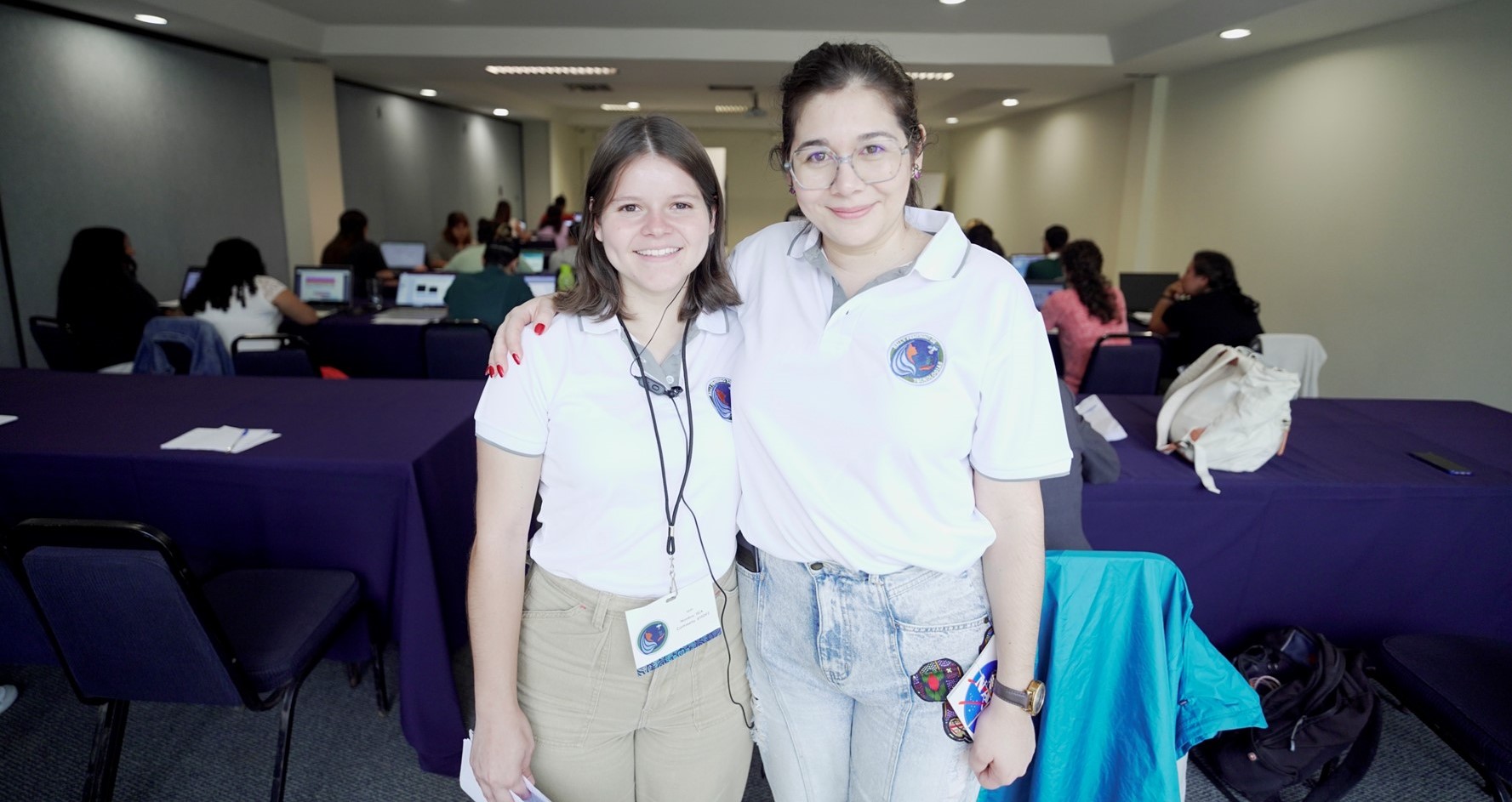
The Godmothers of Geospatial Technologies
To ensure that no one is left behind as the group learns new technology, GeoFem is run with a team of student mentors, referred to as “madrinas,” or “Godmothers” in English. The Godmothers circulate throughout the workshop to provide customized support and encouragement to each participant. Godmothers work to create a sense of agency and cooperation, asking participants what they’d like to learn and saying, “let’s figure it out together.”
“In these diverse rural communities, we can’t show up and say, ‘you’re going to learn from me!’” Carolina emphasized. “Everyone is going to learn from everyone, it’s a collective process.”
Carolina Guzmán has been a Godmother for twelve workshops and now helps to organize GeoFem. Through GeoFem, she has seen how rural women are discouraged from learning to use technology; it’s not uncommon for participants to not know how to turn on a computer. With some non-judgmental support from the Godmothers, these same women can maneuver innovative geospatial software to address climate issues in their community. Carolina wants each GeoFem participant to know that they are capable of using technology to create change.
Ageless Innovation
Often, younger women leave rural areas to pursue opportunities in the city, leaving older women to look after their communities. María José explained that geospatial technology is especially effective when put into the hands of these elders:
“When [elders] are empowered, there is a huge community impact, because they are already recognized as leaders. . they understand rural realities, and they are very involved in their communities.” Many of these participants share with María José that they never thought they were capable of learning something so technical, but the workshops gave them the opportunity to challenge this narrative.
The Power of the Prototype
María José recognizes that no matter how supportive and inclusive the GeoFem workshops are, participants need to be prepared to return to their communities and workplaces. In order to be heard by their male colleagues, women need to back up their ideas with data and a solid plan for action.
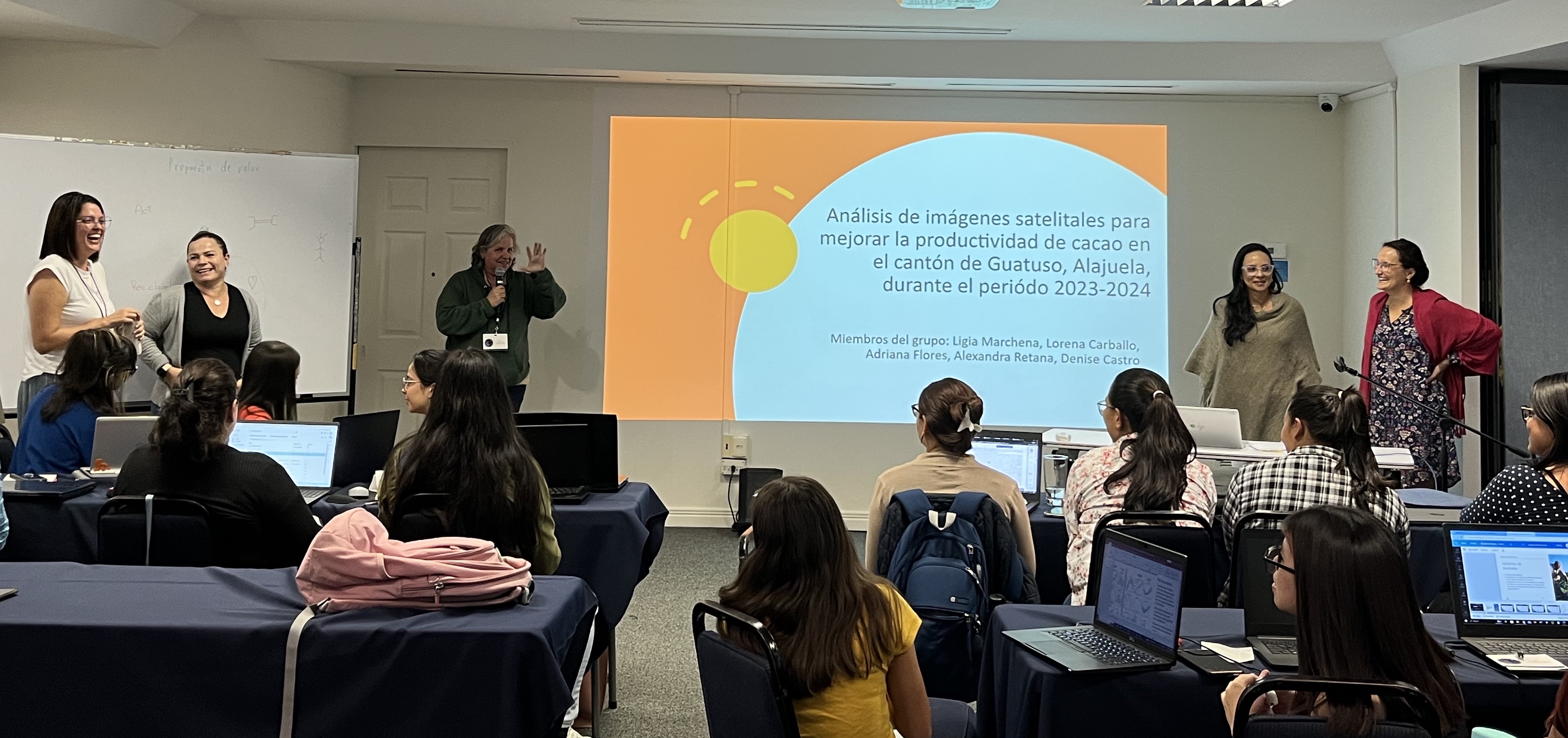
Since its inception, the GeoFem workshops have supported participants in developing a “prototype,” or project for using geospatial technologies to address an environmental or climate issue.
“I won’t just teach you how to use a geospatial instrument and tool,” María José shared. “You know your community, you know your reality, your problems, and you have knowledge that is much more valuable than these instruments.”
GeoFem’s prototype model has been extremely successful. María José constantly receives emails and letters from previous participants sharing what they’ve accomplished.
Here are some examples of the prototypes that GeoFem participants have successfully put into action. In each case, women have used their unique observations of the world around them to benefit everyone in their community.
Engaging Allies
Just as women need the prototype to back up their ideas with evidence, Maria Jose has also used successful prototypes as evidence that GeoFem is a worthwhile investment for other institutions in Costa Rica, many of which are led by men.
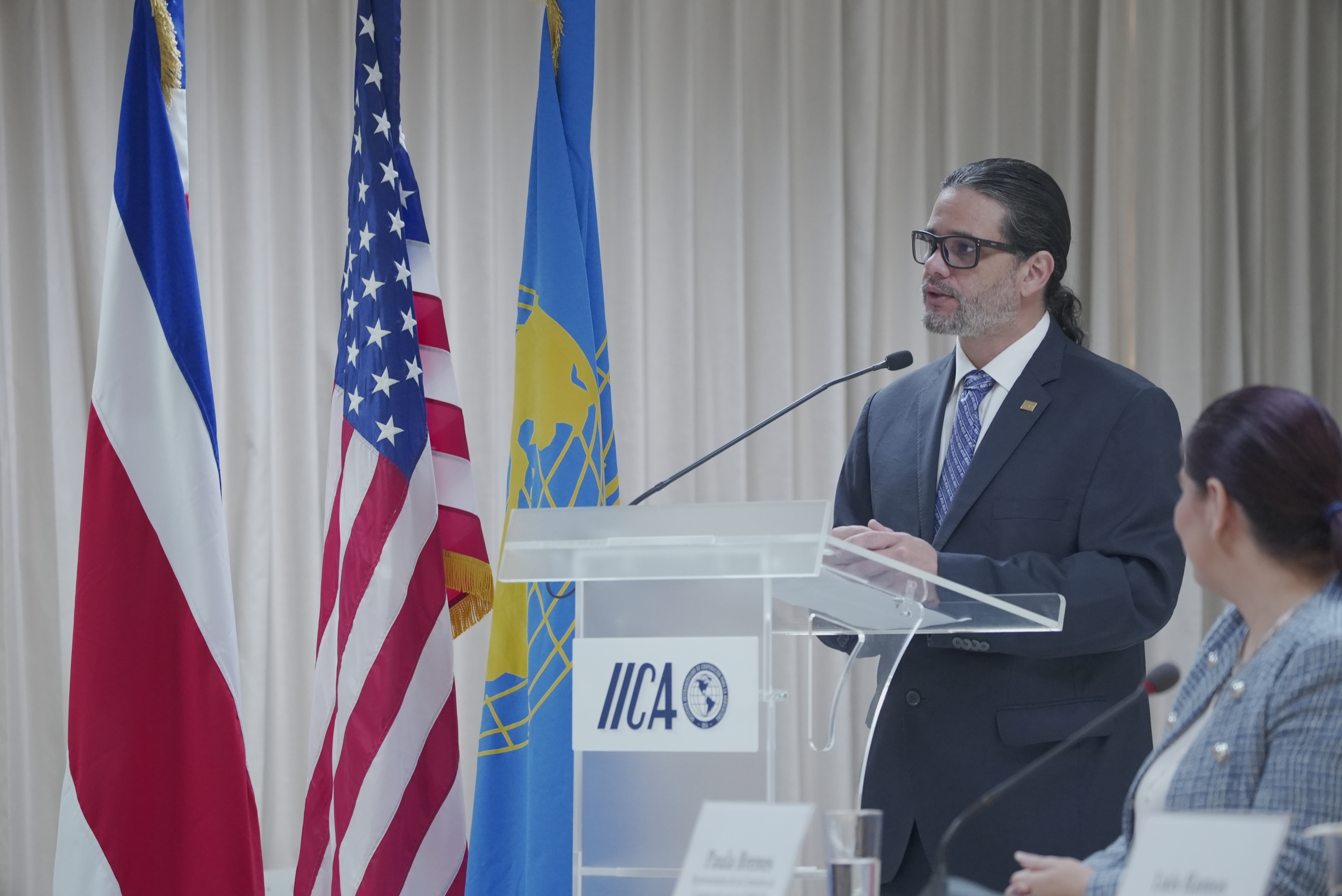
Early on, María José involved Jonathan Castro, a leader at the Inter-American Institute for Cooperation on Agriculture (IICA), who became an ally and advocate for GeoFem. Jonathan was able to use his institutional connections to provide greater resources and reach for GeoFem, but he was also careful to protect the workshops as a safe space for women, asking other male volunteers to let any instructions come from women: "Remember, the male voice can be extremely disruptive."
A Replicable Model
By creating a safe and supportive space, GeoFem has effectively enabled the empowerment of women to combine their lived experience with new technology for climate action. With the support of strategic allies, María José hopes to expand these workshops to other countries, where rural women can tailor Earth science applications to their own realities.
This article is the second installment in the SERVIR Gender Equity Miniseries. Click here to read the first one.