
How the SERVIR program connects space to village
This post was written by Timothy Mayer, Emil Cherrington, and Rebekke Muench from the NASA SERVIR Science Coordination Office, and was originally featured on Google Earth's Medium page. Click here to go to the original blog post.
Meet SERVIR
Thousands of miles away, satellites peer at distant planets, stars, and the far reaches of space. But from low and upper Earth orbit, they also help us look more closely at our planet, monitoring its health and dangers. The SERVIR program, launched in 2005, connects NASA, U.S. researchers, a network of development partners around the world, and companies like Google to harness the power of satellite observations — helping countries see, with greater clarity, how their environments affect well-being and safety.
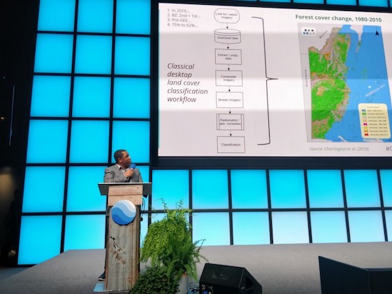
Dr. Emil Cherrington, SERVIR Science Coordination Office, presents at the Geo For Good 2019 Summit on
how classification workflows can be integrated into Google Earth Engine. (Image credit: Dr. Samapriya Roy, Planet)
Many local groups and agencies wrestle with problems like food security, disaster preparedness, and the impact of climatic variability — all areas where satellite data can shed light on solutions. SERVIR is a global network of five regional hubs in Asia, Africa, and the Americas, supported in partnership with the U.S. Agency for International Development (USAID) and NASA’s Capacity Building Program in the Earth Science Division’s Applied Sciences Program.
Dan Irwin, director and founder of SERVIR, chose the name of the program from the Spanish and French verbs meaning “to serve.” As Dan explained in his recent TED Talk about SERVIR, we don’t want to miss seeing the forest for the trees — that is, capturing details via space that are almost impossible to decipher here on the ground. SERVIR connects directly with people at various levels, from international groups to local partners to do just that — serving society with science and technology, connecting space to village.
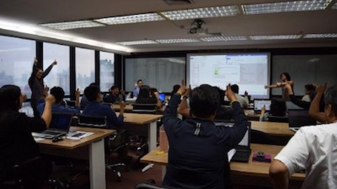
Tim Mayer and Helen Baldwin from the SERVIR Science Coordination Office lead a SAR Handbook-related training at the Asian Disaster
Preparedness Center (ADPC) in Bangkok, Thailand (left). Tim Mayer discusses techniques for estimating forest stand height using
Synthetic Aperture Radar with workshop participants (right). (Image credit: Dr. Nguyen Hanh Quyen, SERVIR-Mekong)
Connecting satellites to life here on Earth
Google Earth Engine is one of the tools that helps SERVIR put the power of satellite information into the hands of local people by improving access to data and reducing barriers to conducting research, especially in regions with limited bandwidth.
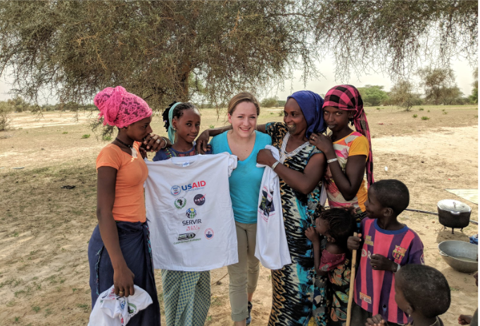
Rebekke Muench from the SERVIR Science Coordination Office, with pastoralists during a field site
visit in Senegal. (Image credit: Kel Markert and Adama Sarr)
With access to heaps of data, it’s critical to avoid burying local researchers and government workers in information without providing the support to interpret and explain its relevance. This is why assessing user needs is a vital first step. SERVIR hub scientists work alongside local stakeholders to identify ongoing challenges, organize in-region workshops and hundreds of training events such as Advanced Google Earth Engine training for forest and river monitoring, and co-develop relevant tools and services with NASA and USAID support.
SERVIR projects around the world
The SERVIR network is now able to create specific web applications that provide access to Google’s cloud-based multi-petabyte catalog of satellite imagery and geospatial datasets — helping people make decisions involving weather, land cover and land use, water resources, food security, and disaster management in-region.
Supporting flood emergency preparedness for Myanmar
Myanmar suffers from devastating flooding on a regular basis — including sudden-onset flash floods. Emergency response personnel need help with pre-planning to ensure the availability of supplies and shelters. SERVIR-Mekong, which helps countries in the Lower Mekong Region, developed a flood risk decision-support tool using Earth Engine and surface water maps derived from 30 years of Landsat imagery. With this tool, variable risk for floods and potentially for droughts can be found with identification of areas particularly prone to such disasters.
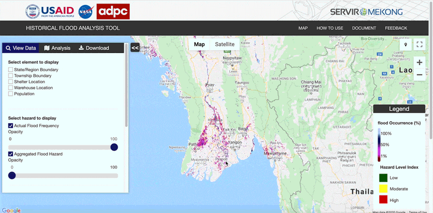
Historical Flood Analysis Tool powered by Google Earth Engine, highlighting actual flood frequency in the Mekong Delta from 2010 - 2011.
Mapping wheat area in Afghanistan
Wheat is a major crop and staple food for Afghanistan. However, wheat productivity is hampered by poor irrigation systems, droughts, changing farming practices, and crop disease. Even though Afghanistan is a significant producer of wheat, it still imports the cereal from other countries. SERVIR’s Afghanistan Wheat Mapping Application allows users to generate maps for wheat-growing areas in irrigated and rain-fed land parcels at the provincial or national level in Afghanistan. The maps help create timely forecasts of wheat production, which are useful for planning and ensuring food security when shortages are predicted.
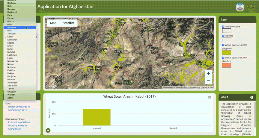
SERVIR's Afghanistan Wheat Mapping Application, showing the irrigated vs. rainfed area for the wheat sown in Faryab, Afghanistan (2017).
Tracking forest fires in Bolivia
The 2019 fire season in Bolivia included numerous and intense fires in the country’s Amazonian dry forests and savannas. Bolivia urgently needs real-time monitoring of active fires to support ongoing fire management efforts at the national level. SERVIR developed the Amazon Fires — Bolivia tool, which compares data about pollutant particles trapped in the air to recent satellite images to plot the locations of fires in near-real time.
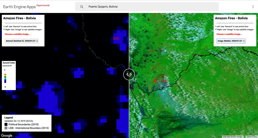
SERVIR's Amazon Fires — Bolivia tool comparing the Sentinel-2 Aerosol data to MODIS imagery in January of 2020.
History in the making
SERVIR’s connection to Google Earth Engine goes back over a decade. At Brazil’s National Space Research Institute meeting in 2009, Emil Cherrington was in attendance for the final meeting day where Rebecca Moore, Director of Engineering at Google, made a bold proposition: What if the processing algorithms for mapping forests — and the input NASA satellite data — could be placed on Google’s servers for countries to do their forest monitoring?
The proposition seemed ambitious and yet, a year and a half after the meeting, Google Earth Engine was officially released in late 2010. Almost 10 years later, the platform has expanded in focus, applying Earth observation data to address environmental and social issues. Over the past 15 years, the SERVIR program has directly empowered more than 10,000 people in 50 countries to use satellite data through hands-on events, trainings, and the creation of tools and applications.