
Knowledge Forum calls for Regional Cooperation on Early Warning for Flood and High-Impact Weather Events
The Hindu Kush Himalayan (HKH) region is no stranger to water- and weather-induced hazards. Every year, these disasters result in loss of lives, livelihoods, and damage to infrastructure throughout HKH countries. Climate change and other drivers of change have increased the frequency and magnitude at which disasters such as floods, droughts, landslides, and glacial lake outburst floods (GLOFs) take place in the region, further exacerbating vulnerabilities among mountain people, downstream environments and infrastructure.
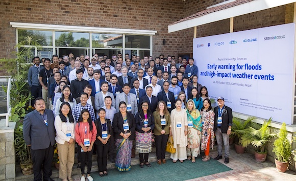
Group photo of the participants at the two-day regional knowledge forum.
In the face of disaster events, national hydrological and meteorological authorities help resilience and recovery in communities by providing early warning information. Concurrently, national and local decision makers also require actionable information to make the best possible decisions while committing resources before, during, and after disaster events. A lack of skilled human resources and standardized tools and technologies, and weak institutional setup and governance mechanisms impede efforts to generate and disseminate effective early warning information. As disaster events – particularly floods, which account for a third of all disaster events in the HKH – often transgress country boundaries, national efforts alone are not sufficient. Regional cooperation amongst neighbouring countries is essential.
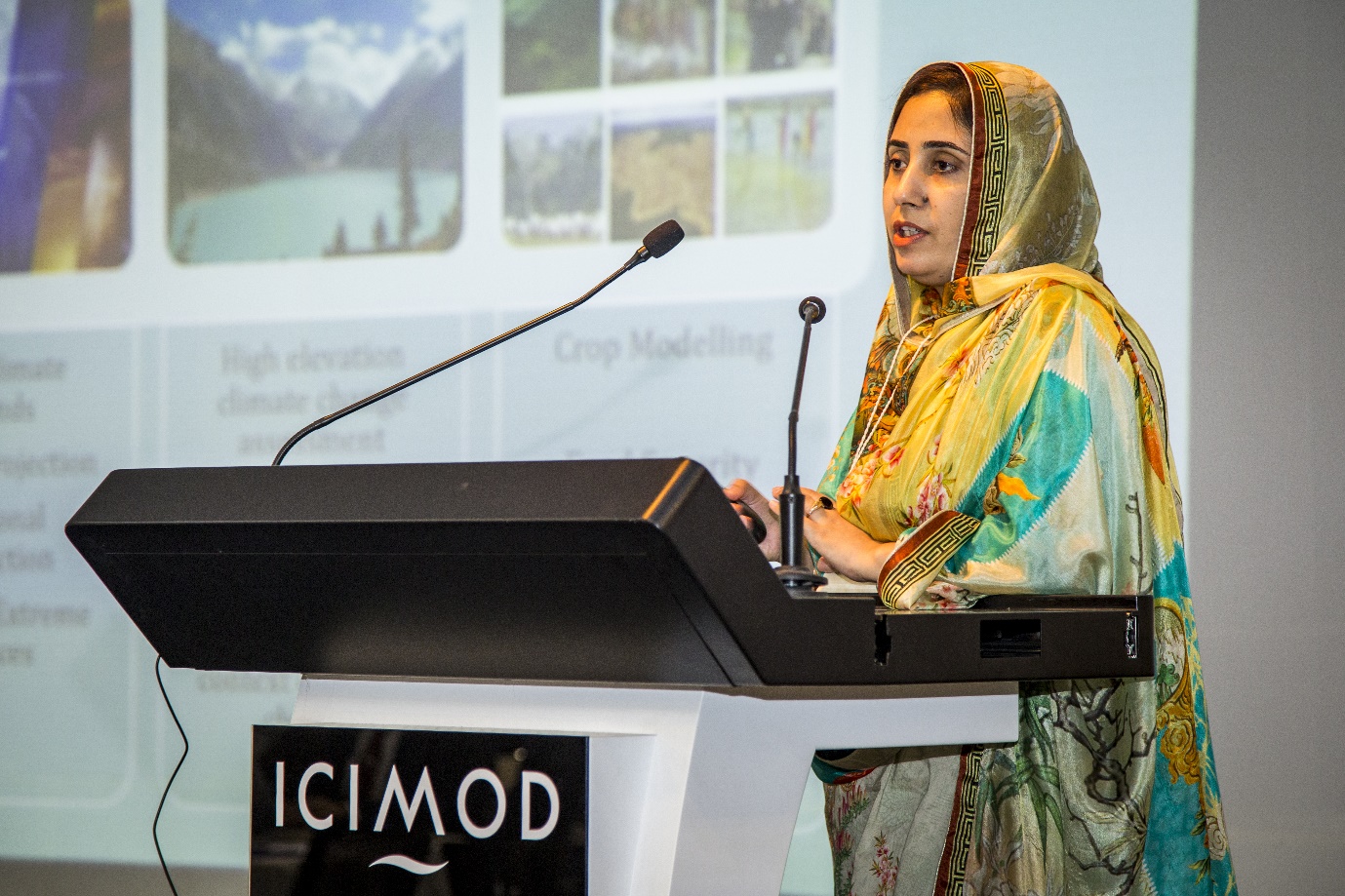
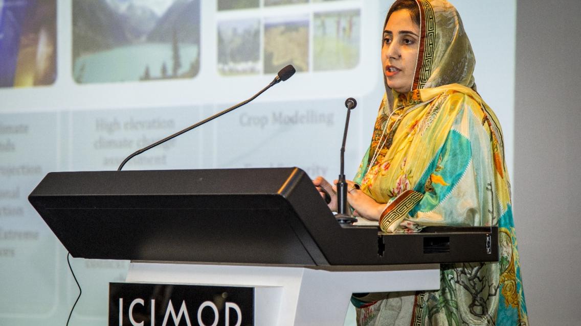
Nadia Rehman, Global Change Impact Studies Centre, shares current practices and
challenges in generating and disseminating early warning on natural disasters in Pakistan.
In light of these challenges, the International Centre for Integrated Mountain Development (ICIMOD) convened a regional knowledge forum on early warning for floods and high-impact weather events in Kathmandu, Nepal, from 22–23 October 2019. The two-day event was organized under ICIMOD’s SERVIR Hindu Kush Himalaya (SERVIR-HKH) and Himalayan GEOSS initiatives, jointly with GEO Global Water Sustainability (GEOGLOWS). The event brought together professionals and researchers representing regional, national, and local institutions engaged in providing extreme weather forecasts and flood forecasts, and establishing related Early Warning Systems (EWS).
The forum deliberated on key areas related to regional and national hydrological and meteorological services for EWS in South and Southeast Asia. This included ongoing efforts to generate and disseminate early warning effectively and efficiently across different levels, and computing infrastructure and hydroinformatics tools required to enable widespread use of Earth observation information.
Representatives from national hydrological and meteorological authorities, and nongovernmental/research organizations in Afghanistan, Bangladesh, Bhutan, India, Myanmar, Nepal, and Pakistan shared current practices and challenges in generating and disseminating early warning on natural disasters at the forum. Representatives from global and regional initiatives also shared progress, challenges, and best practices in implementing early warning systems in South and Southeast Asia.

Patrick Gatlin, NASA MSFC, shares experiences from implementing HIWAT,
and its capabilities in the Hindu Kush Himalayan region.
The event also shed light on ICIMOD’s collaboration with the SERVIR Applied Sciences Teams to enhance current flood forecasts by integrating global satellite and modelled data with regional and local forecasts. The collaboration has produced ongoing medium-range forecasts for every river stretch and accompanying retrospective hindcasts. Of particular note is the High Impact Weather Assessment Toolkit (HIWAT), a weather forecasting tool that provides additional lead time for forecasting authorities to reduce the impact of high-impact weather events. HIWAT’s forecasted precipitation is also routed to predict flooding extents. These regional services can strengthen and support national and local efforts and expertise in developing hydro-meteorological information that allows for investments to enhance decision-making practices.
During a dedicated session on the social components of EWS, communicating risks, and community-based forecasting, participants from ICIMOD, Mercy Corps, Practical Action, Red Cross Red Crescent Climate Centre, and the World Food Programme shared operational experiences in engaging communities in flood EWS and disaster preparedness activities.

Michael Ernst shares experiences from USAID/Office of US Foreign Disaster Assistance
in supporting disaster preparedness and management in the region
The forum provided a platform to discuss the challenges associated with the development, implementation, dissemination, and sustained use of information services for water and weather-induced disasters. Possible recommendations to address these issues were also discussed. Participants recommended leveraging expertise across national boundaries, holding regular quorums at the regional level, training forecasters to generate user-friendly forecasts, and training media persons and communities in understanding technical concepts in forecasts. They also recommended engaging community networks and the private sector to relay early warning information to end users.
A consultation workshop with partners followed the two-day event to discuss achievements and a way forward for early warning systems for flood and extreme weather events developed under SERVIR-HKH.
Written by Utsav Maden of SERVIR-HKH/ICIMOD. This article was originally featured on SERVIR-HKH's website. Click here to go to the original post.