
Protecting Amazonia Forests by Mapping Forest Degradation Using Cloud-Penetrating Satellite Imagery
This post was written by Kelsey Herndon and Africa Flores-Anderson from the NASA SERVIR Science Coordination Office, and was originally featured on Climatelinks. Click here to go to the original blog post.
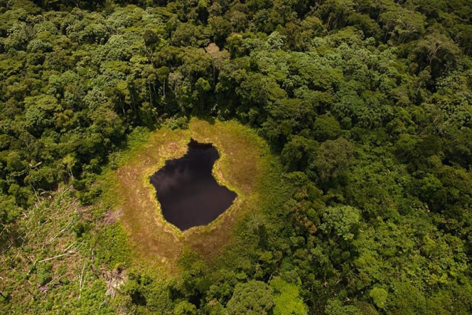
Lake with surrounding forest, Ucayali, Peru, March 2010. A mountain lake in Sierra del Divisor or "land of the brave".
(Credit: Thomas J. Muller / El Taller.pe)
One of the major challenges in monitoring forests is identifying forest degradation processes. Degradation events can be “small, subtle, and temporary,” making their identification difficult. However, recent years have seen advancements in satellite remote sensing technology, which has in turn revealed changed patterns of illegal deforestation activity in the Amazon rainforest. Forest disturbance has moved from primarily large-scale forest clearings to include many smaller events, such as selective logging. This highlights the need to develop methods and solutions for the timely detection of forest degradation events.
In the Amazon, mining, selective logging, fires, and floods all contribute to forest degradation. This degradation leads to higher carbon emissions, contributes to ecosystem disturbance, and is often a precursor to larger deforestation events. Detecting these events is a challenge, especially with optical remote sensing, which is limited by persistent cloud cover over the Amazon, with some areas going years without a cloud-free image. Satellite-based radar, on the other hand, is capable of penetrating clouds and can be used to identify areas of forest degradation on a more regular basis. Radar is also better suited to identify areas of forest degradation because of its sensitivity to forest structure.
SERVIR, a joint program between NASA and USAID, partners with regional centers of excellence to use geospatial technology in addressing pressing environmental issues. The newest hub, SERVIR-Amazonia, is headquartered at the International Center for Tropical Agriculture (CIAT) in Cali, Colombia, and includes other regional and international organizations: Asociación para la Conservación de la Cuenca Amazónica (ACCA), Instituto de Manejo e Certificação Florestal e Agrícola (Imaflora), and Spatial Informatics Group (SIG). CIAT and ACCA, among other partner organizations, identified a need to incorporate synthetic aperture radar (SAR) into their existing forest monitoring platforms. Incorporation of SAR can improve identification of degraded forests, specifically those caused by logging activities, to help identify emerging threats before they become full-fledged deforestation events.
To address this need to monitor forest degradation in the Amazon, SERVIR-Amazonia hosted a virtual workshop on using SAR time series to monitor forest degradation. This workshop built on previous regional workshops on SAR for monitoring deforestation, as well as a SERVIR and Silvacarbon initiative, the SAR Handbook, which provides practical guidance on using SAR for forest monitoring.
Dr. Josef Kellndorfer, SAR expert, founding member of Earth Big Data, and member of NASA’s NISAR science team, led 20 participants in using open source software, including QGIS and Jupyter Notebooks, to test several different forest degradation detection algorithms on the freely available Sentinel-1SAR time series stacks. Participants were able to identify areas of degradation in the imagery and apply various classifiers to automate the detection.
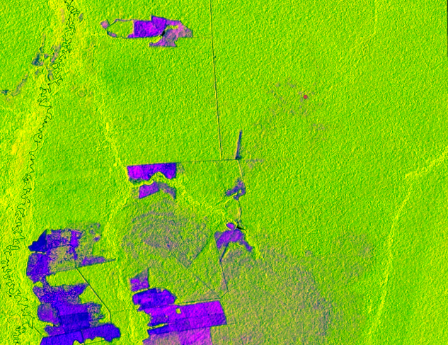
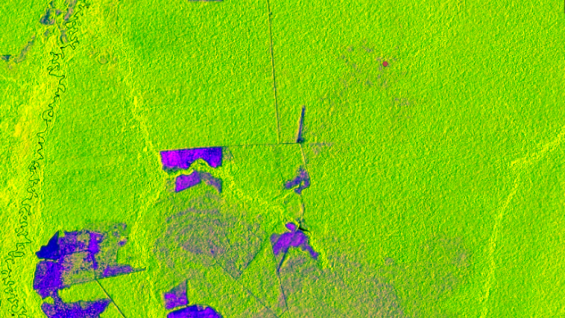
Sentinel-1 false color RGB (R: 95th percentile G: 5th percentile B: range) over the Brazilian Amazon.
This image shows undisturbed forests (bright green), deforested areas (vibrant purple) and degraded
forests (faded purple). The red dot indicates an area of degraded forests that is likely caused by selective
logging. The larger area of degraded forest in the bottom of the image was caused by a fire.
Contains modified Copernicus Sentinel data (2019), processed by ESA. (Credit: SERVIR)
Originally planned as an in-person workshop, it was redeployed as a virtual event in response to restrictions due to the COVID-19 pandemic. Thanks to the support of Amazon Web Services and the Amazon Sustainability Data Initiative, virtual machines were provided to all participants. This setup allowed attendees to work on computers much more powerful than their personal laptops and saved them time on setting up software and packages on their own machines.
Participants joined in from various countries and institutions throughout South America, including Colombia, Peru, Brazil, and Ecuador. These institutions included CIAT, ACCA, Imaflora, IDEAM, Instituto Chico Mendes de Conservação da Biodiversidade (ICMbio), Amazon Conservation Team (ACT), Universidad del Rosario, Instituto Brasileiro do Meio Ambiente e dos Recursos Naturais (IBAMA), and Instituto Socioambiental (ISA).
As an outcome of this workshop, participants are able to use SAR time series to identify potential areas of forest degradation. Lucio Villa of ACCA participated in the workshop and noted, “Using the SAR time series will allow us to more efficiently detect the changes generated by the drivers of forest degradation, with the possibility of expanding our monitoring throughout the Amazon region, thanks to cloud processing support.”