
RCMRD/SERVIR-Eastern & Southern Africa building Web Mapping capabilities in Namibia, South Africa, Botswana, and Kenya
The Web has changed every aspect of our lives, from daily events to professional undertakings such as work related activities. Geographic Information Systems (GIS) – tools that enable us to manipulate the geographic aspects of data – have also been affected by web technology. Web mapping is now widely used to serve geospatial data via online platforms. In short, web mapping delivers GIS content through the Internet using client-server architecture. A web browser is required to consume services such as interactive maps, GIS data, and location.
Today, most Internet users wield web mapping technology without even noticing it. For example, we use Google Maps and other online maps to find restaurants, hotels, and other destinations in unfamiliar cities. When we are lost, we can easily determine where we are and where we need to go by using our phone’s GPS system. These are a just few examples among many.
 |
| Group photo for the web mapping training workshop in Cape Town, South Africa |
Some people refer to this technology as Web GIS, while others call it Internet GIS. By any name, Web GIS content can be shared and consumed by many users around the world under the notion of ‘author once, publish and consume everywhere.’ Web GIS enables organizations to share maps, data, and other contents on the Web.
To improve web mapping capacities in Regional Centre for Mapping of Resources for Development (RCMRD) members States and enhance the use of geographic information by working groups, decision-makers, and the general public, RCMRD/SERVIR hosted training workshops in Botswana, South Africa, Namibia, and Kenya. Most participants were GIS professionals, cartographers, and other technical personnel with a background in computer applications and Internet.
The interactive five-day trainings, which included presentations, practical exercises, and discussions, were designed to introduce the attendees to basic theoretical and practical concepts of web mapping and teach them how to deliver and share geographic information online. The focus was on web mapping technology, including its architecture, application, and tools.
By the end of the trainings, the participants were able to share GIS maps, data, and work flows by creating, building, publishing, and sharing GIS services accessible from desktop computers, web browsers, and mobile devices.
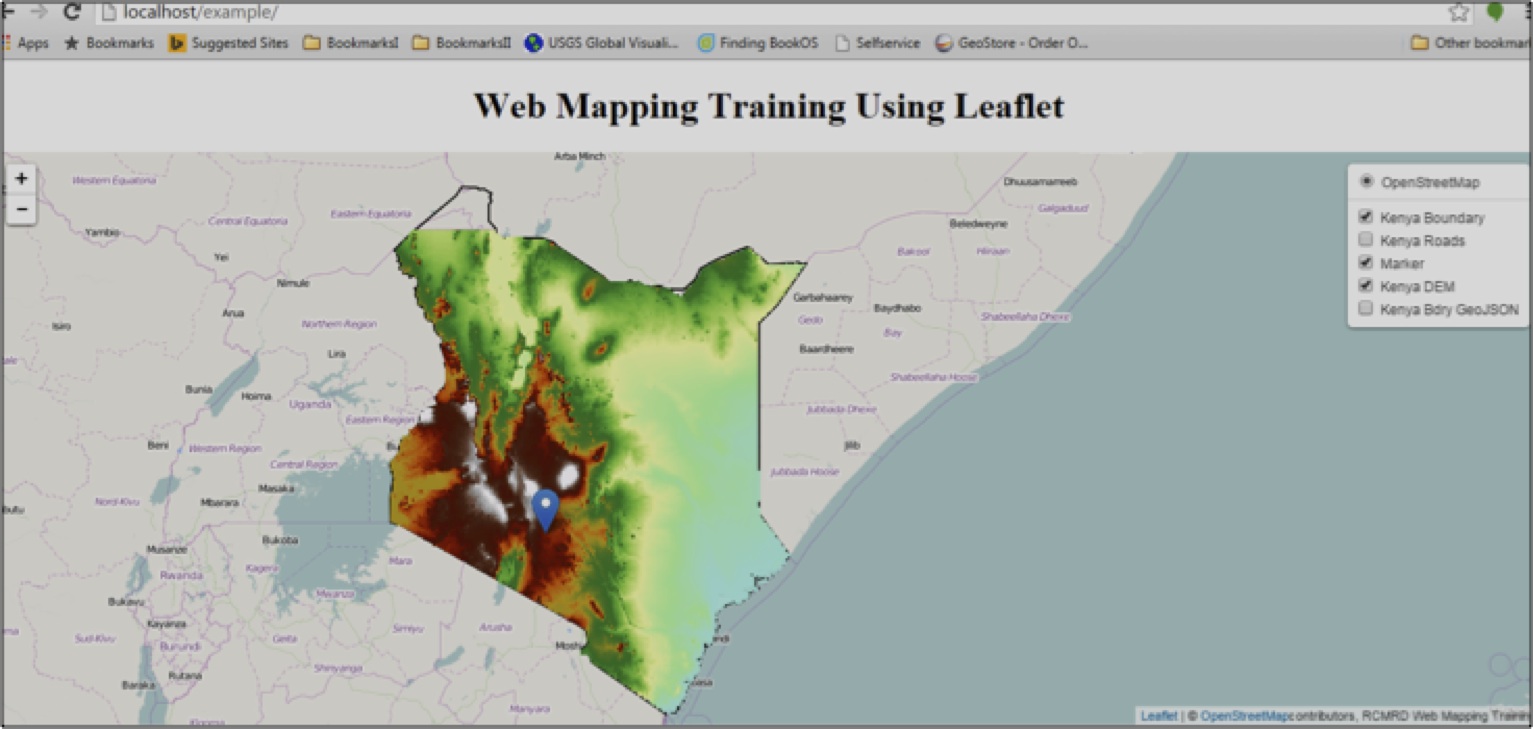
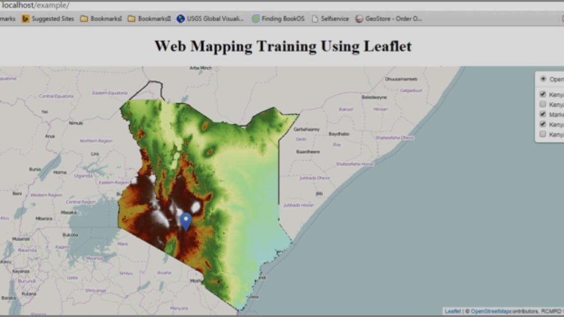
Screen shot of a web mapping application developed during the Kenya Web Mapping
Training Workshop held 31 August to 3 September 2015 at RCMRD GIS lab 1