
SERVIR Develops New Method for Afghanistan Wheat Mapping to Enhance Food Security
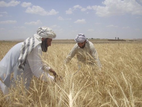
Wheat is one of Afghanistan’s largest agricultural products, with 2.7 million hectares dedicated to wheat cultivation across the country. Despite this scale, current production levels fail to meet increasing demand, and wheat remains one of the nation’s biggest imports. However, new methods for mapping crop area using remote sensing may help with food security planning. Afghanistan’s wheat production shortage has been identified as one of the highest agricultural priorities by in-region government agencies. Accurate estimations of domestic wheat production are crucial to addressing food security issues, and finding a method of mapping wheat that was high resolution—and preferably in season—could help.
Team members from the Ministry of Agriculture and Irrigation and Livestock (MAIL) in Kabul, Afghanistan, the International Centre for Integrated Mountain Development (ICIMOD) in Kathmandu, Nepal, and the NASA SERVIR Science Coordination Office (SCO) in Alabama, USA, worked to find a unique approach to aid food security planning. Outlined in Frontiers in Environmental Science, this new method developed by SERVIR scientists helps combat shortfalls in Afghanistan’s wheat production.
These advances in wheat mapping activities were a result of a combined effort across the SERVIR global network. The use of cloud-based systems allowed the project to succeed across international borders, according to team members. Lead author Varun Tiwari credits the collaborative team environment, the Google Earth Engine (GEE) platform, and high-resolution data in a project that is “the first of its kind…especially for Afghanistan.”
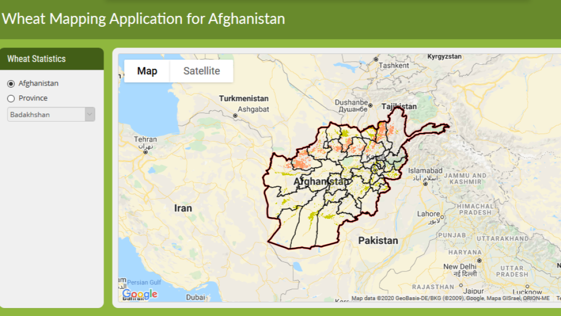
Producing in-season maps of wheat cropping areas enables the creation of yearly estimates of wheat production. This in turn aids the MAIL and other potential users to address agricultural challenges and drive increased production. SERVIR’s method relies on a more advanced, high-resolution system than conventional ground-based approaches conducted in the region. The project, which was able to be successfully implemented in Afghanistan for the 2017 wheat growing season, has begun to see expansion into other areas, and is currently being piloted in Bangladesh to support efforts to map rice fields.
“There has been no real systematic approach to understanding the wheat area on a continual, annual scale,” said SERVIR scientist Lee Ellenburg, “and so that was our goal…to provide a rough estimate at the beginning of the season, a refined midseason estimate, and a finalized harvest time estimate. The accuracy of that midseason estimate was over 85% and at harvest time, the accuracy increased to about 90% over rainfed areas.”
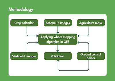
To do this, the GEE platform was used to leverage optical data from the Sentinel-2 satellite and from synthetic aperture radar (SAR) sensors aboard Sentinel-1. Using this method, the team was able to produce accurate estimates of wheat-cultivated areas throughout the target growing season. Additionally, the team has created a cloud-computing application to semi-automate the process using computer vision and machine-learning techniques. The team also produced a user manual outlining the process.
This information gleaned from SERVIR’s crop yield estimates, when combined with natural resource planning at the local level, is expected to significantly contribute to the sustainability of food security management in Afghanistan. The application can be alternately implemented to more effectively inform land management practice and bolster agricultural production and decision making in other areas. As SERVIR’s work in Afghanistan continues to expand into other regions, it maintains the communal and interconnective perspective of the team that worked to create it.
“[This project] is a perfect example of how SERVIR works,” Ellenburg says, “each of us bring our own unique perspective, but together we’re able to create this project that is truly needed.”
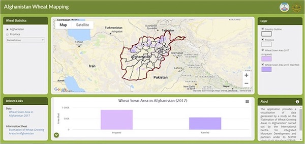
Estimation of Wheat Growing Areas in Afghanistan infographic
Learn more about SERVIR HKH and ICIMOD’s work with wheat mapping and view an online version of the application: https://servir.icimod.org/science-applications/wheat-mapping-application-afghanistan.