SERVIR Highlights from 2023

The end of one year and the start of the next provides an opportunity to reflect on past achievements and future goals. In 2023, the SERVIR network worked with local partners in the design and implementation of numerous geospatial services to address complex challenges related to climate change. To strengthen local capacity to use satellite data for development objectives, we facilitated 120 training events that reached over 2,900 people in more than 50 countries and improved the performance of 57 organizations across 17 countries. But what do those numbers really mean? We are proud to share some reflections on some of our work to broaden and deepen climate action and resilience around the world last year.
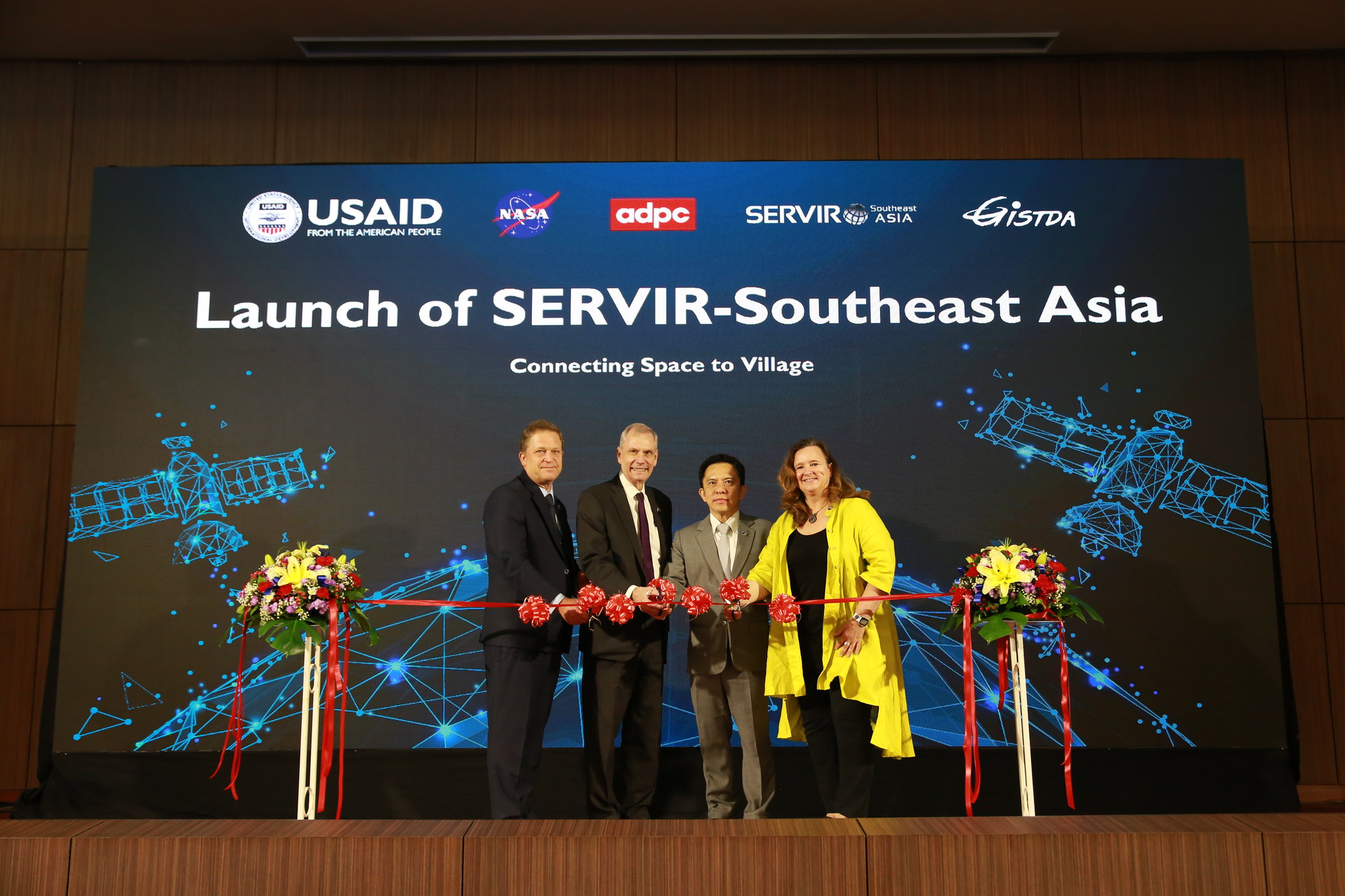
We extended and expanded work in Southeast Asia.
In January 2023, the USAID, NASA, and the Asia Disaster Preparedness Center (ADPC) launched the SERVIR Southeast Asia hub. Building off the successes of SERVIR Mekong (2014-2022), the Southeast Asia hub will extend its work and expand into Indonesia and the Philippines. “The Air Quality Explorer that was adopted by Thailand will be scaled up to address transboundary haze issues between Thailand and Laos, and eventually across Southeast Asia,” said Peeranan Towashiraporn, SERVIR Southeast Asia’s chief of party. “Similarly, the satellite-based tools for monitoring of flood and drought, successfully adopted by the Mekong River Commission, will be scaled out to support early warning systems in other countries in the region.”
Learn more about how we are Using Artificial Intelligence to Boost Air Quality in Southeast Asia.
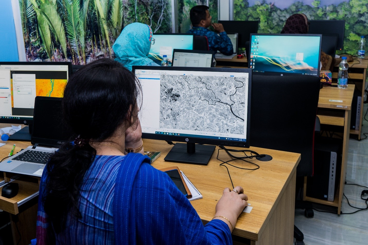
We bolstered our gender equity and social inclusion work.
In February 2023 we launched the Gender Analysis Tool which supports the SERVIR network in the successful inclusion of women as co-developers, users, and beneficiaries in the design of geospatial services. Throughout the year we provided specialized geospatial training for women across the network. For example, more than 600 women from 13 countries participated in the SERVIR Hindu Kush Himalaya virtual program on Empowering Women in Geospatial Information Technology. SERVIR Amazonia collaborated with FENAMAD, to build the capacity of 36 indigenous communities in Madre de Dios, Peru to use geospatial tools to support the conservation and protection of their land. After a series of trainings, these communities are now able to use open source GIS software to create detailed maps of their communities and identify potential threats to local land cover such as deforestation and mining.
Read more about Why Gender Equity Matters in Applied Earth Science.
We increased access to critical climate data and enhanced early warning systems.
SERVIR Hindu Kush and Himalaya (HKH) partner, the International Centre for Integrated Mountain Development (ICIMOD), developed the first early warning system for forest fires in Nepal. The two-day fire outlook enables government forest fire managers to anticipate and prepare for fires, making informed decisions about deploying resources, implementing fire prevention measures, and carrying out controlled burns to reduce risk.
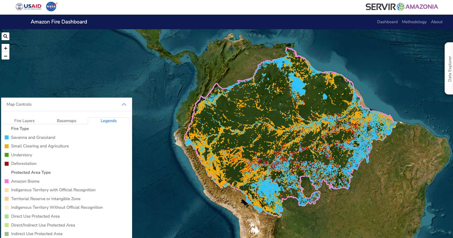
Similarly, NASA scientist Douglas Morton worked with SERVIR Amazonia to revamp the Amazon Fire Dashboard. The dashboard uses NASA satellite data to detect, classify, and monitor fires in near-real time. The new version provides decision-makers with easy-to-use daily updates to help identify what types of fires are burning and how they are spreading. This information is essential for managing fire danger.
In West Africa, SERVIR worked on developing seasonal and subseasonal forecast data, to help farmers in Burkina Faso prepare for potential droughts and floods over a month in advance. Watch the webinar video where Drs. Shrad Shukla and Abdou Ali describe this work.
Learn more about our work in support of the President’s Emergency Plan for Adaptation and Resilience (PREPARE).
We celebrated 5 years of climate efforts through SERVIR Amazonia.
In August 2023 NASA Administrator Bill Nelson visited the SERVIR Amazonia team at the joint campus of the Alliance of Bioversity International and International Center for Tropical Agriculture (CIAT) in Palmira, Colombia. At the event, SERVIR highlighted its work using NASA satellite data paired with local and international experts to train and support women in monitoring and managing coastal mangrove forests, detecting deforestation and illegal mining, monitoring streamflows and flooding. Over the course of five years, SERVIR Amazonia increased the capacity of hundreds of individuals and dozens of institutions in the region to use satellite data and geospatial information to foster sustainable natural resource management throughout the Amazon.
Learn more about how SERVIR supports biodiversity in the Amazon.