
Why Gender Equity Matters in Applied Earth Science: A SERVIR Miniseries
Satellites use a far-away vantage point to gain a clearer view of the blue marble that we call Earth. It’s hard to see our differences from such a distance; the unique features that make us human disappear within the broader landscape of land, ocean, and weather data that satellites collect.
This satellite view may seem like the most objective approach to understand our world, providing accurate snapshots without any bias or favoritism. But once satellite images return to Earth, we humans must make sense of this massive amount of data and decide how to translate that information into action within a specific community. It is here that our differences re-emerge.
As Earth scientists and government leaders create policies and tools that weave satellite data into our daily lives, an essential component of what makes us who we are is often overlooked: gender. Few women are involved in this process of applying Earth data, and their realities are frequently left unconsidered. In this miniseries, we explore why gender matters in applied Earth science, and how we can integrate gender more intentionally into geospatial work.
Women at the Forefront of the Climate Crisis
SERVIR partners with a global network of institutions and experts in using Earth data to address environmental and climate challenges. Our work spans five themes, including climate resilience, agriculture and food security, and ecosystem and carbon management. Within each of these themes, we see how the climate crisis intensifies existing inequities, leaving women even more vulnerable to environmental shocks.
Women experience the climate crisis very differently from men, often facing more extreme consequences of environmental challenges. Globally, women rely more on natural resources, yet hold less decision-making power over natural resource management. For example, in many parts of the world, women are responsible for obtaining water for their household, but are rarely consulted about how water should be allocated within a community. When climate change leads to water scarcity, women and girls must walk greater distances to retrieve water, experiencing negative impacts on their health, safety, and time left for education. Another important example can be found in agriculture, where women make up as much as 43% of the world’s agricultural workforce, but the vast majority of women do not have legal land ownership. This limits their ability to invest in their land in ways that support climate resiliency, such as switching to drought-resistant crops or using more efficient irrigation technology.
Because of global gender inequalities, women are more vulnerable to climate-related disasters, including droughts and floods. Women generally have less access to technologies like smartphones that are used to warn communities about severe weather. When a disaster strikes, women may also not be taught skills that are needed to evacuate, such as swimming or climbing. In some cases, women are not permitted to evacuate at all unless their husbands provide consent.
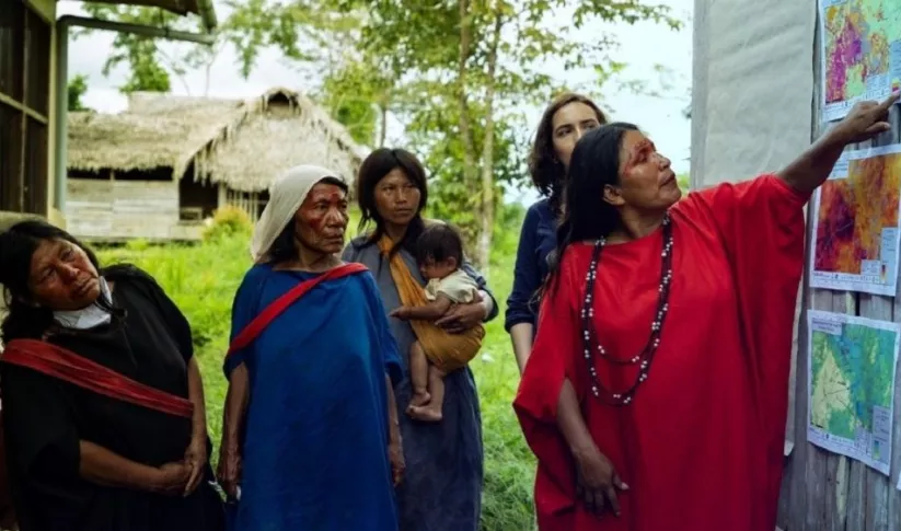
Whereas women are disproportionately impacted by environmental shocks, it is important to recognize that they are not simply passive victims of the climate crisis. Women often have a unique understanding of environmental challenges. For example, women who are tasked with gathering water for their households have detailed knowledge about local water availability and water quality. This knowledge is vital for creating geospatial tools that more effectively respond to climate change. Research shows that when women are empowered as leaders, their valuable expertise and environmental stewardship supports climate resiliency for everyone.
SERVIR’s Commitment to Gender Equity and Equality
SERVIR considers both gender equity and equality in its work to ensure that everyone is supported by geospatial services. Gender equality means that everyone is treated the same, with equal rights, responsibilities, and opportunities. Gender equality is a goal of SERVIR’s services, but we recognize that certain groups may face barriers that prevent them from having the same rights, responsibilities, and opportunities as others.
To work towards gender equality, SERVIR extends its focus to consider gender equity. A gender equity approach acknowledges that some groups may need different levels of support and resources to achieve equal outcomes, such as climate resiliency. Because women face more barriers to climate resilience than men, it is important that geospatial tools are developed and customized in ways that address these specific challenges.
The unique barriers that women face depend on the culture, economy or politics of their particular setting. What is expected of a woman in Brazil may be very different from what is expected of a woman in Senegal or in Nepal. Using SERVIR’s agriculture and food security theme as an example, here are some of the ways that gender inequities can emerge:
- Legal and customary rights: Women may not have formal land rights, which in many places are required to access technical or financial resources like bank loans, agricultural insurance, or drought-resistant seeds. If satellite tools are used to determine that farmers need government support, such as insurance payouts after a drought, women farmers may be overlooked and left without the same resources as men. To ensure that all farmers can withstand climate shocks, satellite tools need to consider how gender-specific rights may limit access to local resources.
- Roles and responsibilities: Time, space, and labor are often divided according to gender. For example, women are often responsible for growing different crops than men, including most of the crops that are used for household consumption. If crop monitoring data tools only consider the crops that are managed by men, decision-makers may not have a full understanding of the impact of climate change on local food security.
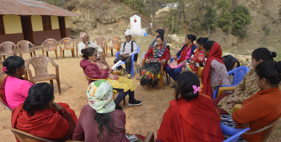
- Representation: In many settings, women are excluded from representing their communities as government leaders or official decision-makers. This may mean that women are not consulted when designing geospatial tools to address climate change. As a result, these tools can overlook the needs of women, or can even cause unintended harm to women. Without consulting women, geospatial tools may lack valuable context and insight about women’s unique experiences.
As we progress through this miniseries, we will share tools that you can use to identify the gender barriers that may impact your own projects.
Empowering Women in Applied Earth Science
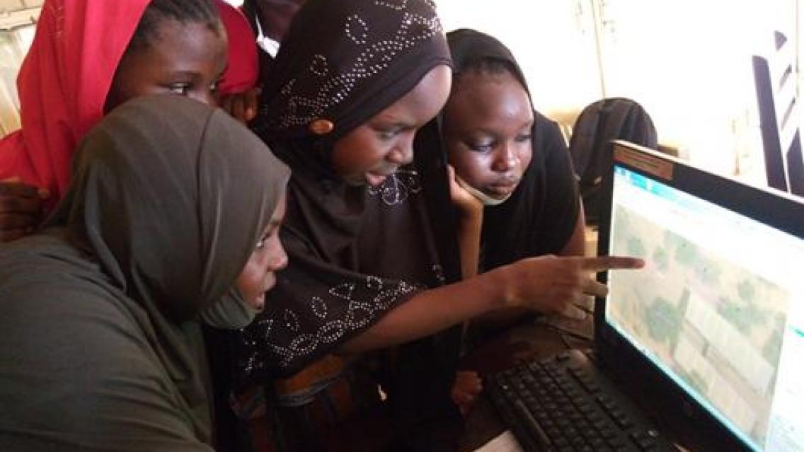
To address environmental challenges without reinforcing or exacerbating inequities, SERVIR recognizes that it is essential to include women at all stages of developing and applying Earth science. This includes training women in science, technology, engineering, and math (STEM) to address the fact that less than 30% of the world’s researchers are women. Women are often excluded from Earth science research, and as a result, their valuable perspectives and skills are underrepresented within the field. Women also occupy fewer decision-making roles on local, national, and international levels. This means that not only are women infrequently consulted in geospatial and Earth sciences, but they are also not involved in deciding how to apply that science to address climate concerns.
Empowering women as developers and users of Earth and geospatial science is an essential step to ensure that these fields are applied in accurate and effective ways. Satellite data always has gaps that need to be filled through ground truthing, which uses on-the-ground measurements to test the accuracy of remote sensing data to develop tools and resources that best represent reality. For example, data provided directly from farmers about the crops they are growing can be combined with satellite data to forecast regional crop losses. As we discussed above, women and men do not farm the same, often growing different crops on different land. If women are not involved in this ground truthing process, resources like regional crop forecasts may be unreliable and could perpetuate inequities by only representing the realities of men. This is why SERVIR is so committed to improving women’s access to tools like Collect Earth Online, which crowdsources land cover and land use information for a variety of resources, including crop forecasting.
SERVIR’s Gender Equity Miniseries
SERVIR’s work aims to include women both as beneficiaries of geospatial resources and as active collaborators throughout the design and implementation of its services. We recognize that there is a significant lack of available information about gender equity within applied Earth science. In this miniseries, we’ll be using examples of our work to help illuminate the importance of gender equity in the study, design, and implementation of geospatial services. We will share how SERVIR has supported projects across the globe that are responsive to gender, along with the SERVIR tools that you can use to consider gender within your own work. We welcome you into this space as we explore how applied Earth science can become more equitable for all.

-
SERVIR Gender Analysis Tool
This Gender Analysis Tool provides clear guidance on a foundational step for service design and programming, to contribute to SERVIR’s goals of ensuring that women, along with men, are realizing equal benefits from SERVIR’s geospatial services.
-
SERVIR Strategic Plan 2020-2025

This strategic plan identifies the next set of cross-cutting strategic priorities that will ensure SERVIR remains responsive to both NASA and USAID Agency goals and those of stakeholders and users in SERVIR regions.

