Articles & Stories
SERVIR Flood Mapping Service Brings Speed to Cambodia Disaster Management
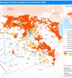
The new Hydrologic Remote Sensing Analysis for Floods (HYDRAFloods) service, co-developed by SERVIR-Mekong consortium members and the SERVIR Science Coordination Office, improves the frequency and resolution of map updates.