Strategy & Guidance USAID Geospatial Strategy USAID’s 2024-2028 Geospatial Strategy promotes leveraging the power of geospatial data and technology to target the delivery of international programs. November 15, 2023
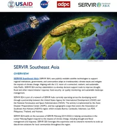
Fact Sheet Fact Sheet: SERVIR Southeast Asia This fact sheet outlines how the SERVIR Southeast Asia (SEA) Regional Hub uses publicly available satellite technologies to support regional institutions, governments, and communities adapt to transboundary climate issues and mitigate the impacts of climate change. August 31, 2023
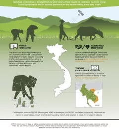
Infographic Enhancing Drought Resilience in Vietnam Droughts in the Lower Mekong region cause significant environmental and economic impacts, including loss in agricultural productivity and decreased food and water security. January 13, 2021
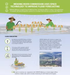
Infographic Mekong River Commission Uses Space Technology to Improve Flood Forecasting SERVIR-Mekong is supporting the Mekong River Commission (MRC) in using a new generation of satellite-derived precipitation products to increase flood forecast accuracy and lead time. December 13, 2020
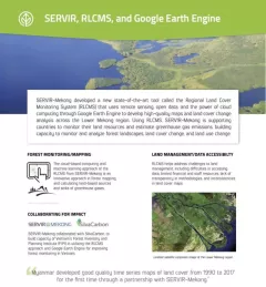
Fact Sheet Factsheet: Mekong Regional Land Cover Monitoring System (RLCMS) SERVIR, RLCMS, and Google Earth Engine December 13, 2020