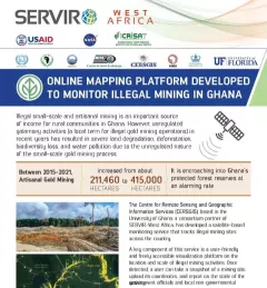
Fact Sheet Fact Sheet: Online Mapping to Fight Illegal Mining in Ghana This fact sheet highlights efforts to monitor illegal mining in Ghana. December 23, 2020
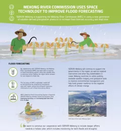
Infographic Mekong River Commission Uses Space Technology to Improve Flood Forecasting SERVIR-Mekong is supporting the Mekong River Commission (MRC) in using a new generation of satellite-derived precipitation products to increase flood forecast accuracy and lead time. December 13, 2020
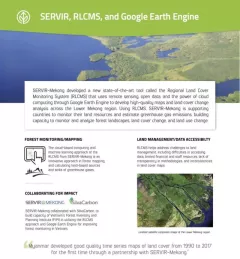
Fact Sheet Factsheet: Mekong Regional Land Cover Monitoring System (RLCMS) SERVIR, RLCMS, and Google Earth Engine December 13, 2020
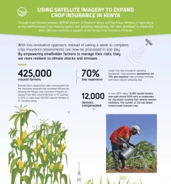
Infographic Using Satellite Imagery to Expand Crop Insurance in Kenya Through a partnership between SERVIR Eastern & Southern Africa and the Kenya Ministry of Agriculture, a new satellite-based crop mapping system and sampling methodology was developed to streaml October 23, 2020
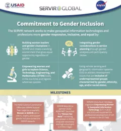
Infographic Commitment to Gender Inclusion Learn more about how the SERVIR network works to make geospatial information technologies and professions more gender responsive and inclusive. November 27, 2019