SERVIR Hubs

B. Hubs

Map: [World map highlighting the region]

client new demands
The geographic visualization now being requested requires expertise beyond my professional specialization. Please have the final map prepared by a graphic cartographer or mapping specialist with experience in this type of geographic visualization. Once the completed and approved map asset is provided, I can implement and visually integrate it into the website.
SERVIR works in more than 50 countries in Africa, Asia, Central and South America. In partnership with regional, technical organizations, SERVIR has established regional “hubs” within selected host institutions. Action: Link to our team page

B. Hubs

Regional Hub Teams

The SERVIR brings together people from diverse backgrounds and disciplines to address complex environmental challenges and deliver practical, science-based solutions to local decision-makers and communities. Our team spans independent regional hubs, research centers, universities, and partner institutions worldwide; uniting scientists, technicians, development practitioners, and subject matter experts in a truly global network. Together, we combine local knowledge with cutting-edge science to create solutions that are both impactful and sustainable.

2. Regions section

The Hubs

Tropical South America

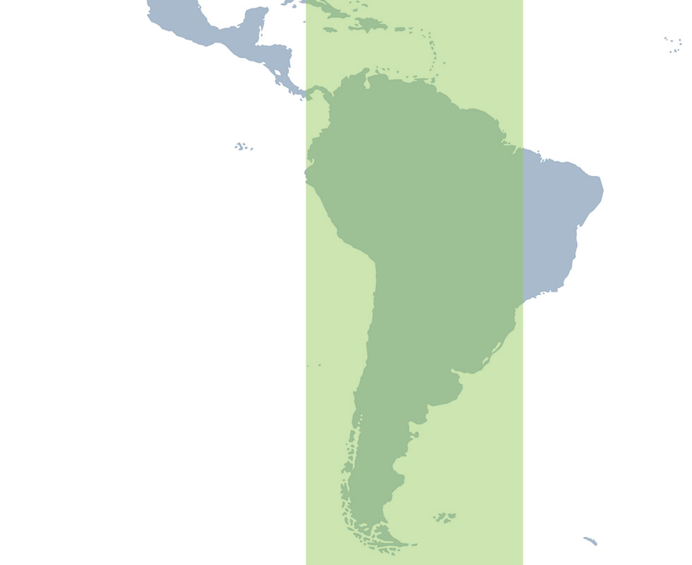
SERVIR Tropical South America

SERVIR Tropical South America brings together the International Center for Tropical Agriculture (CIAT) in Cali, Colombia, EcoCiencia in Quito, Ecuador, Imaflora, in Piracicaba, Brazil, Asociación para la Conservación de la Cuenca Amazónica (ACCA) in Lima, Peru, and Spatial Informatics Group (SIG) in California USA. This multi-institutional structure supports expertise and relationships across the region highlighting local to regional contexts.
Alliance of Bioversity International and the International Center for Tropical Agriculture (CIAT)
Conservación Amazónica ACCA
Fundación EcoCiencia
Instituto de Manejo e Certificação Florestal e Agrícola (IMAFLORA)
Spatial Informatics Group (SIG)

Mesoamerica

SERVIR Mesoamerica

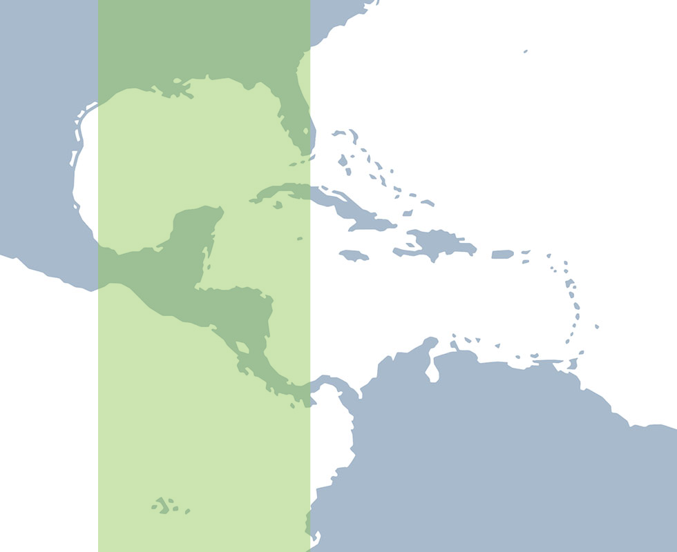
SERVIR Mesoamerica is based at the Centro Agronómico Tropical de Investigación y Enseñanza (CATIE) in Turrialba, Costa Rica. The hub works through CATIE’s regional relationships and expertise to connect geospatial science with environmental and development priorities across MesoAmerica.
Centro Agronómico Tropical de Investigación y Enseñanza (CATIE)

Southeast Asia

SERVIR Southeast Asia

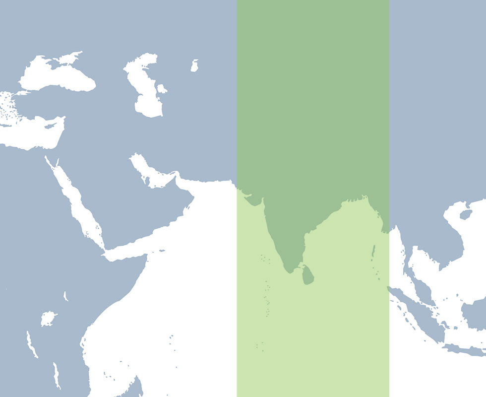
SERVIR South Asia is based at the International Centre for Integrated Mountain Development (ICIMOD). Through its regional relationships and scientific expertise, the hub works with institutions and decision-makers across South Asia to develop and apply locally relevant geospatial services.
International Centre for Integrated Mountain Development (ICIMOD)

East Asia and the Pacific

SERVIR East Asia and the Pacific

SERVIR East Asia and the Pacific is a consortium led by the Asian Disaster Preparedness Center (ADPC) in Bangkok, Thailand. ADPC works with the Spatial Informatics Group (SIG) and the Regional Community Forestry Training Center (RECOFTC) to bring together institutions that support locally-driven applications of Earth observation, geospatial technology, and applied science across Southeast Asia and the Pacific.
Asian Disaster Preparedness Center
Spatial Informatics Group (SIG)
RECOFTC

West Africa

SERVIR West Africa

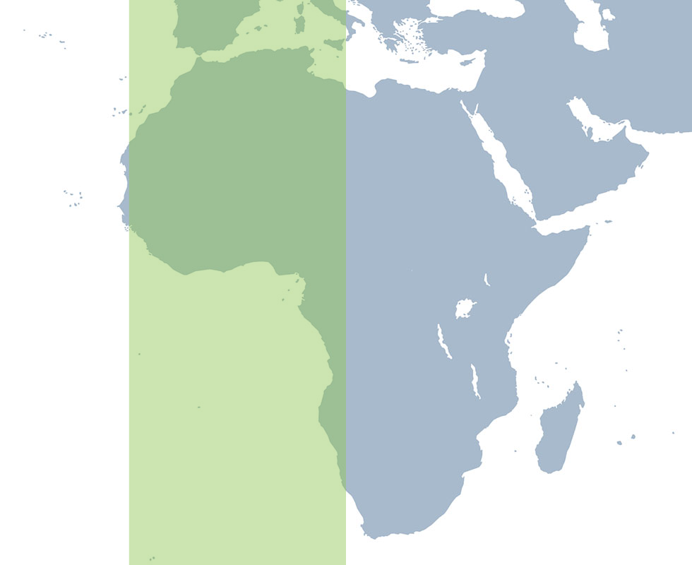
SERVIR West Africa is a partnership among the Centre de Suivi Ecologique (CSE) in Dakar, Senegal, Centre for Remote Sensing and Geographic Information Services (CERSGIS), in Accra, Ghana, and the International Crops Research Institute for the Semi-Arid Tropics (ICRISAT) in Bamako, Mali. The three institutions bring together complementary regional, scientific, and technical capabilities to the hub’s work across West Africa
Centre for Remote Sensing and Geographic Information Services (CERSGIS)
Centre de Suivi Ecologique (CSE)
International Crops Research Institute for the Semi-Arid Tropics (ICRISAT)

Eastern and Southern Africa

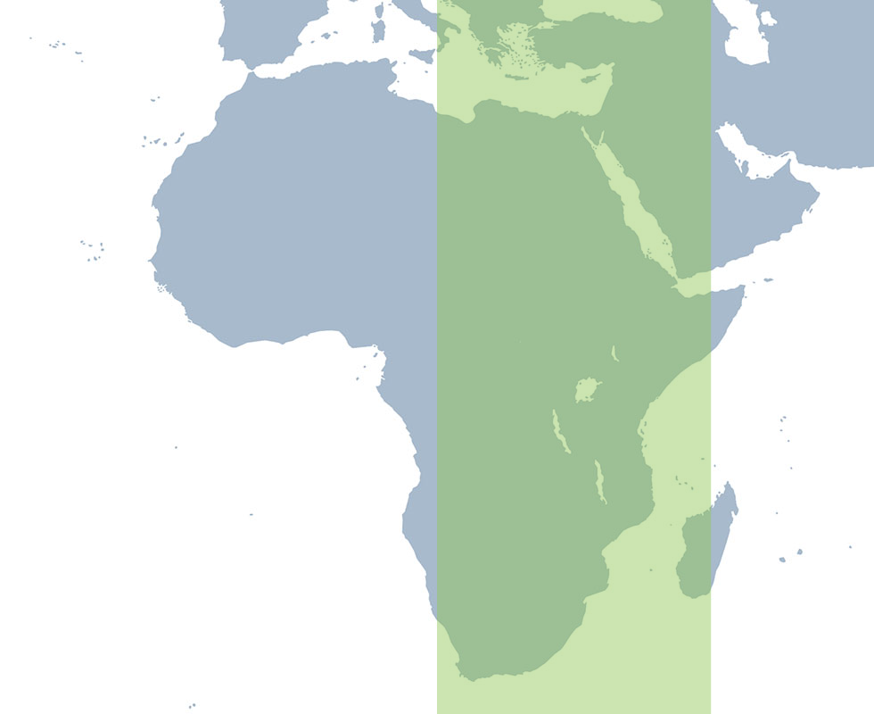
SERVIR Eastern and Southern Africa

SERVIR Eastern and Southern Africa is based at the International Center for Tropical Agriculture (CIAT) in Nairobi, Kenya. The hub connects regional knowledge, applied research, and geospatial innovation to support locally identified priorities across Eastern and Southern Africa.
Alliance Biodiversity CIAT

Where we work

SERVIR West Africa

SERVIR West Africa

Partner Countries

Benin
Benin
Burkina Faso
Burkina Faso
Côte d’Ivoire
Côte d’Ivoire
Ghana
Ghana
Guinea
Guinea
Guinea-Bissau
Guinea-Bissau
Liberia
Liberia
Mali
Mali
Niger
Niger
Senegal
Senegal
Sierra Leone
Sierra Leone
The Gambia
The Gambia
Togo
Togo

SERVIR Mesoamerica

Mesoamerica

Partner Countries

Belize
Belize
Costa Rica
Costa Rica
Cuba
Cuba
El Salvador
El Salvador
Guatemala
Guatemala
Haiti
Haiti
Honduras
Honduras
Jamaica
Jamaica
Mexico
Mexico
Nicaragua
Nicaragua
Panama
Panama

SERVIR Eastern and Southern Africa

SERVIR Eastern and Southern Africa

Partner Countries

Burundi
Burundi
Democratic Republic of Congo
Ethiopia
Ethiopia
Kenya
Kenya
Malawi
Malawi
Rwanda
Rwanda
Tanzania
Tanzania
Uganda
Uganda
Zambia
Zambia
Zimbabwe
Zimbabwe

SERVIR Tropical South America

Partner Countries

Bolivia
Bolivia
Brazil
Brazil
Colombia
Colombia
Ecuador
Ecuador
French Guyana
French Guyana
Guyana
Guyana
Paraguay
Paraguay
Peru
Peru
Suriname
Suriname
Venezuela
Venezuela

SERVIR East Asia and the Pacific

Partner Countries

Cambodia
Cambodia
Fiji
Fiji
Indonesia
Indonesia
Lao PDR
Lao PDR
Marshall Islands
Marshall Islands
Myanmar
Myanmar
Papua New Guinea
Papua New Guinea
Philippines
Philippines
Samoa
Samoa
Solomon Island
Solomon Island
Thailand
Thailand
Timor-Leste
Timor-Leste
Vanuatu
Vanuatu
Vietnam
Vietnam

SERVIR South Asia

Partner Countries

Bangladesh
Bangladesh
Bhutan
Bhutan
India
India
Nepal
Nepal
Pakistan
Pakistan