Video
Regional Drought Monitoring and Early Warning System
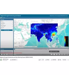
SERVIR scientists discuss the how the Regional Drought Monitoring and Early Warning System is being used in the Hindu Kush Himalaya region.

28 results
SERVIR scientists discuss the how the Regional Drought Monitoring and Early Warning System is being used in the Hindu Kush Himalaya region.
SERVIR Hindu Kush Himalaya helps improve environmental management and resilience in critical areas like food security, water resources management, disaster resilience, and sustainable lan
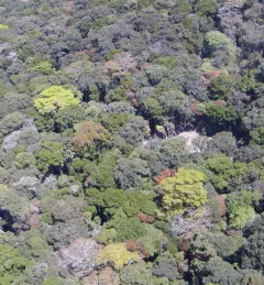
The Land Use Land Cover and Change Mapping Service was designed to provide governments with data, tools, and skills to better understand relevant intervention actions related to land conservation and management, ensuring that land resources can be efficiently monitored and regulated.
The Monitoring Extreme Weather in the Hindu Kush Himalaya (HKH) service provides a customized numerical weather prediction toolkit to assess high impact convective weather events over the HKH region.
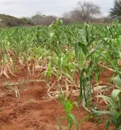
The Regional Cropland Assessment and Monitoring Service seeks to provide timely information for food security assessments through the development of national and regional crop monitors in East Africa.
The Satellite-Based Water Quality Monitoring Service leverages Earth observing satellite information to assess historical water quality changes of in-land trans-boundary lakes.
Across the globe, disasters and their impacts have been on the rise. Developing countries are especially vulnerable to risks from natural hazards such as floods, landslides, and droughts. SERVIR-Eastern and Southern Africa is helping such countries in their region leverage geospatial technologies to reduce disaster risk and enhance regional capacity in disaster management.
A new paper published recently in Environmental Research Letters – Reviews, led by SERVIR Applied Sciences Team member Scott Goetz, details the state-of-the art of techniques and tools available for keeping track of the Earth's forests and their changes.
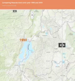
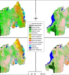
SERVIR's Susan Kotikot, a graduate research assistant from the University of Alabama in Huntsville, has created a compelling story map to reveal the effects of civil unrest on Rwanda's land cover.
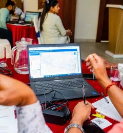
The Regional Center for Mapping of Resources for Development (RCMRD) in Nairobi and its partner organization, SERVIR-Eastern and Southern Africa, hosted two-day stakeholders’ and consultations workshops from 23-31 May 2016 in Uganda, Rwanda, and Tanzania, respectively.