Video
Regional Drought Monitoring and Early Warning System
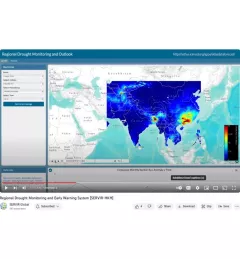
SERVIR scientists discuss the how the Regional Drought Monitoring and Early Warning System is being used in the Hindu Kush Himalaya region.

19 results
SERVIR scientists discuss the how the Regional Drought Monitoring and Early Warning System is being used in the Hindu Kush Himalaya region.
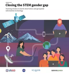
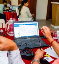
Between 2018 and 2021, SERVIR HKH trained 410 women in “Empowering women in GIT” to bridge the technology and gender gap in the region. Some of the key outcomes of these trainings are summarized in this report.
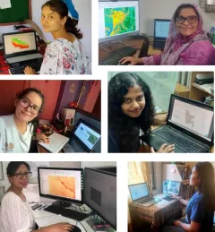
Since 2018, SERVIR has conducted 12 training programs for young and early-career women in geospatial information technology (GIT), reaching 1,490 women across the region. The training focuses on using technologies to collect, store, analyze, and visualize spatial or geographic data about observing the Earth’s surface and human activity. Participants learn about key concepts and how to use applications that depend on EO data and GIT.
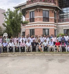
|Jaber Hassan and Poonam Tripathi, SERVIR HKH

SERVIR recently collaborated with the Central American Aerospace Network to lead the Jóvenes Geoespaciales (“Geospatial Youth”) workshop for 45 young students in San Miguel, El Salvador. The students used NASA Earth data and open access tools to create their own projects for local climate resilience, including maps for monitoring crop health, wildfires, and deforestation.
|Lena Pransky, NASA Science Coordination Office

At the Jóvenes Geoespaciales training in El Salvador, 45 talented young students worked in groups to use NASA satellite data and Google Earth Engine to develop projects for local climate resilience. Each group learned how to develop their own ArcGIS StoryMaps web page for displaying their data, which they can use to advocate for climate action.
|Lena Pransky, NASA Science Coordination Office
SERVIR Hindu Kush Himalaya helps improve environmental management and resilience in critical areas like food security, water resources management, disaster resilience, and sustainable lan
The Monitoring Extreme Weather in the Hindu Kush Himalaya (HKH) service provides a customized numerical weather prediction toolkit to assess high impact convective weather events over the HKH region.
Working in developing countries around the world, SERVIR seeks to incorporate regional knowledge and perspectives to best meet end user needs in addressing issues such as flood forecasting, forest fire management, landslide hazard, agricultural monitoring, and biomass estimation.

Meet Trilochana Basnett, intern for ICIMOD/SERVIR-Hindu Kush Himalaya.

Meet Finu Shrestha, GIS Research Associate for ICIMOD/SERVIR-Hindu Kush Himalaya.