Video
Regional Drought Monitoring and Early Warning System
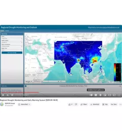
SERVIR scientists discuss the how the Regional Drought Monitoring and Early Warning System is being used in the Hindu Kush Himalaya region.

21 results
SERVIR scientists discuss the how the Regional Drought Monitoring and Early Warning System is being used in the Hindu Kush Himalaya region.
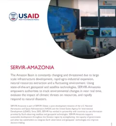
This fact sheet provides an overview of SERVIR-Amazonia, which is part of SERVIR Global, a joint development initiative of the U.S. National Aeronautics and Space Administration (NASA) and the United States Agency for International Development (USAID).
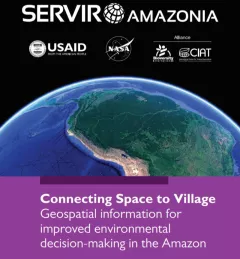
This brochure provides an overview about SERVIR Amazonia.
SERVIR Hindu Kush Himalaya helps improve environmental management and resilience in critical areas like food security, water resources management, disaster resilience, and sustainable lan
The Monitoring Extreme Weather in the Hindu Kush Himalaya (HKH) service provides a customized numerical weather prediction toolkit to assess high impact convective weather events over the HKH region.
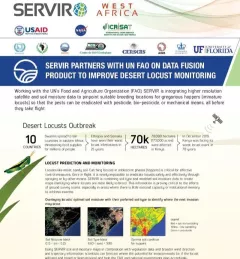
This fact sheet highlights how SERVIR is using satellite data to pinpoint breeding locations for locusts so that the pests can be eradicated before they take flight.

Meet Finu Shrestha, GIS Research Associate for ICIMOD/SERVIR-Hindu Kush Himalaya.
SERVIR West Africa promotes the use of publicly available satellite imagery and related geospatial tools and products to help key stakeholders and decision makers in the region make more informed d
The United States Agency for International Development (USAID) and the U.S. National Aeronautics and Space Administration (NASA) announced on March 8 a five-year project that will use satellite imagery to address environment and development challenges across the Amazon Basin.
A blog posted by Spatial Informatics Group (SIG) describes ways that the new SERVIR-Amazonia hub will bring geospatial information to assist with sustainable development problems and natural resource protection for the Amazonia region.