Video
Regional Drought Monitoring and Early Warning System
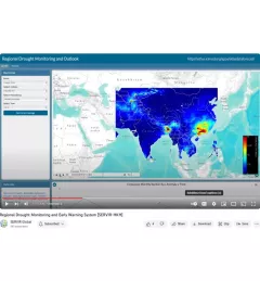
SERVIR scientists discuss the how the Regional Drought Monitoring and Early Warning System is being used in the Hindu Kush Himalaya region.

26 results
SERVIR scientists discuss the how the Regional Drought Monitoring and Early Warning System is being used in the Hindu Kush Himalaya region.
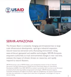
This fact sheet provides an overview of SERVIR-Amazonia, which is part of SERVIR Global, a joint development initiative of the U.S. National Aeronautics and Space Administration (NASA) and the United States Agency for International Development (USAID).
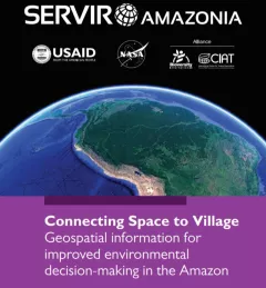
This brochure provides an overview about SERVIR Amazonia.
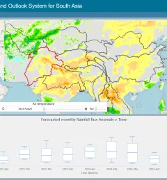
The Regional Drought Monitoring and Outlook System (RDMOS) was developed to help predict, mitigate, and adequately respond to drought vulnerabilities in the HKH region.

Mangrove forests do a lot of heavy lifting to mitigate the effects of coastal flooding. As NASA turns the spotlight on oceans this Earth Day, learn how the joint NASA-USAID SERVIR program is using Earth satellites to support these unique ecosystems that protect 15% of the world’s coasts.
|Stephanie A. Jiménez, Christine Evans, Vanesa Martín, Jacob Ramthun
SERVIR Amazonia, an initiative of USAID and NASA, addresses environmental and development challenges across the Amazon Basin using state-of-the-art geospatial technologies. The
SERVIR Hindu Kush Himalaya helps improve environmental management and resilience in critical areas like food security, water resources management, disaster resilience, and sustainable lan
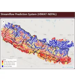
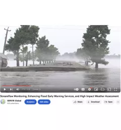
The Nepal DHM is the national agency responsible for monitoring and managing the hydrological resources of Nepal. This Use Case describes how they used the SERVIR Enhancing Flood Early Warning Services (EWS).
As part of this service, SERVIR HKH, with the technical support of Brigham Young University developed a streamflow prediction tool that incorporates all primary and secondary rivers in the HKH region