Fact Sheet
Fact Sheet: Online Mapping to Fight Illegal Mining in Ghana
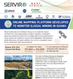
This fact sheet highlights efforts to monitor illegal mining in Ghana.

23 results
This fact sheet highlights efforts to monitor illegal mining in Ghana.
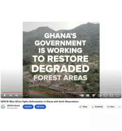
Ghana is home to some of the most biodiverse and carbon-dense forests in the world. But more than a third of them have been lost in recent decades.
Disaster preparedness and the water resource management require reliable and timely information. In many regions of the world, ground observation data is scarce. Here are three ways that SERVIR's innovative services and tools enable decision-makers and authorities to address water challenges.
|Chinmay Deval, NASA SCO Water Security Lead
With floods and droughts as two of the most catastrophic natural disasters in the regions it serves, SERVIR strives to be on the cutting edge in addressing challenges related to water.
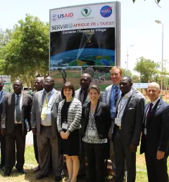
On July 14, 2016, NASA and the U.S. Agency for International Development (USAID) launched SERVIR-West Africa, a joint project to strengthen environmental monitoring in West Africa.
SERVIR graduate research assistant Kelsey Herndon is using Earth observation satellite data to map surface water and its changes in Niger, West Africa.

Meet Dieynaba Seck, Project Manager for Centre de Suivi Ecologique (CSE) (in French).

Meet Kelsey Herndon, a Graduate Research Assistant for the NASA SERVIR Science Coordination Office.

Meet Rebekke Muench, West Africa Regional Science Associate for the NASA SERVIR Science Coordination Office.
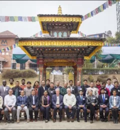
The crucial role forests play in our world cannot be underestimated. To enhance preservation and monitoring of this natural resource, SERVIR and SilvaCarbon launched a series of global workshops this year in West Africa, Eastern and Southern Africa, Hindu-Kush Himalaya, and the Lower Mekong region on Synthetic Aperture Radar (SAR) applications.