Articles & Stories
Making Big Data Bite-size
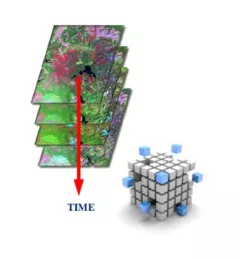
Earth Observation satellites beam enormous amounts of data to us about our planet every day. To manage and use this Big Data efficiently, scientists and technologists around the world need a way to ‘bite-size’ it.