Articles & Stories
Water and Disasters Thematic Lead Interview -- Mir Matin

Mir Matin, Science and Data Lead for SERVIR-HKH / ICIMOD and Theme Leader, Geospatial Solutions for ICIMOD, is profiled.

128 results
Mir Matin, Science and Data Lead for SERVIR-HKH / ICIMOD and Theme Leader, Geospatial Solutions for ICIMOD, is profiled.
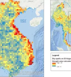
From 2014 to 2016, Vietnam experienced its worst drought in 90 years, with 52 out of the 63 provinces affected. This event and subsequent disasters emphasized the need for a reliable system that can provide forecast information about rainfall and drought.
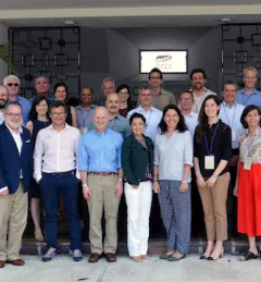
Since 2005, an ambitious collaboration between NASA and USAID has been quietly but steadily building the capacity of scientific organizations, government officials, emergency responders, and communities across the developing world to better handle environmental challenges.

Drought is threatening the lives of millions of farmers in Niger. With NASA’s help, we’re pioneering a new approach—hundreds of miles above the planet.
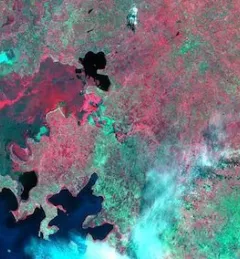
In recent years, weather-related disasters such as floods and storms have become frequent in the Lower Mekong Region. According to the United Nations Office for Disaster Risk Reduction, from 1995 to 2015, almost half of all the disasters across the globe were floods, which affected 2.3 billion people. The majority of these events occurred in Asia.
The ability to transform data into actionable information and obtain easily accessible, analysis-ready Earth observation (EO) data is often a critical missing link for decision makers in the developing world.
The United States Agency for International Development (USAID) and the U.S. National Aeronautics and Space Administration (NASA) announced on March 8 a five-year project that will use satellite imagery to address environment and development challenges across the Amazon Basin.
The U.S. Agency for International Development (USAID) with support from NASA have initiated activities for SERVIR-Amazonia, a five-year effort that will use NASA's unique observations of Earth to address environmental and development challenges in the Amazon Basin.
A blog posted by Spatial Informatics Group (SIG) describes ways that the new SERVIR-Amazonia hub will bring geospatial information to assist with sustainable development problems and natural resource protection for the Amazonia region.
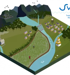
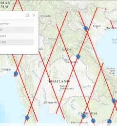
An innovative web-based platform combines hydrological modelling and stakeholder input to create a part tool, part game to improve management of river basins in Southeast Asia: Supporting Water Resources Management (SWARM).