
Monitoring of Mangroves in Ecuador
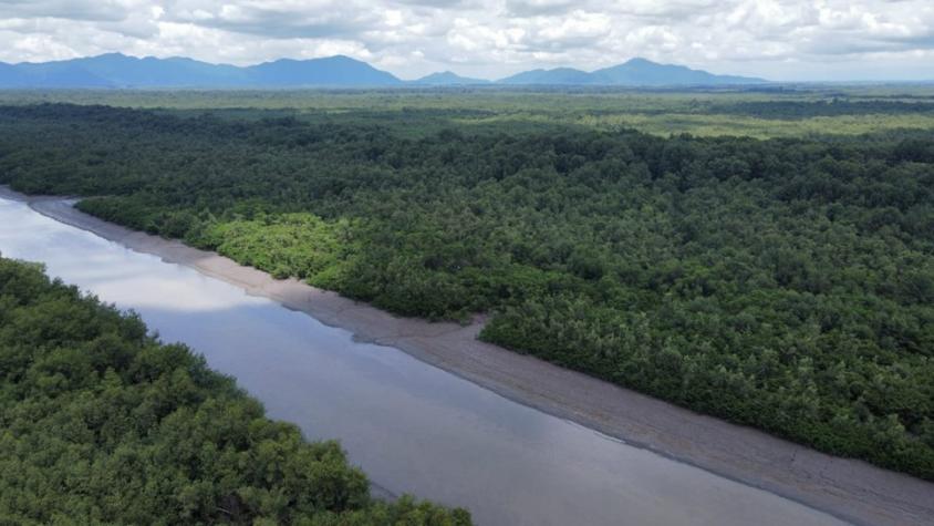
The Spatio-temporal monitoring of the mangrove ecosystem, in collaboration with the CIIFEN, generated a Google Earth Engine code to support the monitoring of mangrove change. This tool integrated optical and Synthetic Radar data (SAR) from missions Sentinel, machine learning (Random Forest) detection techniques, and cloud computing Google Earth Engine (GEE). To test the tool, the Guayas Mangrove was selected as pilot area and the analysis period was 2018 – 2022. The optical composite was created from the March to December Sentinel 2 data series for each year due to the cloud cover. For the SAR composite, images from September to December were used according to the availability of Sentinel 1 data. To accomplish this, the following specific objectives were set:
- Inventory Earth Observation data
- Collect reference information from different sources
- Obtain the mangrove maps for 2018, 2020 and 2022
- Obtain the change maps for 2018–2020 and 2020–2022
- Train local staff
Maps developed by this service will be used by CIIFEN, the Minister of Environment, and other stakeholders to manage and conserve mangroves.
This service also developed MANGLEE within GEE using the following steps:
- Create the mangrove map for Ecuador (Esmeraldas, El Oro, Manabi, Santa Elena and Galapagos)
- Create the change maps for Ecuador
- Local staff training and MANGLEE diffusion
MANGLEE is a tool created that integrates cloud computing, remote sensing and machine learning. The tool applies supervised classification algorithms (Random Forest) and is fed by optical and radar data from the Copernicus project.
Rationale
Mangroves are highly productive ecosystems that provide multiple ecological services: carbon storage, biodiversity, habitat for aquatic species, and cultural identity and ties for local communities. Despite the multiple ecological services provided by mangrove forests, they are under constant threat. In the last 20 years more than 5245 km2 have been lost. In Ecuador, the mangrove forest has been historically threatened by aquaculture. In 2022, Ecuador doubled its exports from 600 to more than 1000 tons. These days, Ecuador is the leading worldwide exporter of shrimp. The tool will help to monitor changes in the mangroves, but above all it will help to know the current state of this ecosystem. The tool's results will contribute to coastal management and decision making.
-
Tools
-
Training Materials