
Spatio-Temporal Monitoring of Soil Erosion for Ecuador
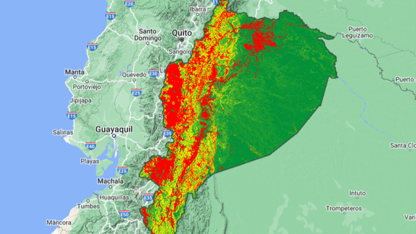
The Spatio-temporal monitoring of soil water erosion service, in collaboration with the Ecuadorian Ministry of Agriculture and Livestock (MAG), will generate a Google Earth Engine app to support the monitoring of soil water erosion and the analysis of its impact in the Ecuadorian Amazon basin. This service will evaluate the soil loss caused by water erosion by applying the Revised Universal Soil Loss Equation (RUSLE) at several temporal intervals and at a spatial resolution of 30 meters. Several driving factors such as the rainfall erosivity, soil erodibility, slope length and steepness, crop management, and management practice factors will be modeled. This service will use data such as the digital soil property maps developed in the Mapping Soil Fertility in Ecuador service, land use and cover map developed by MAPBIOMAS, as well as the ASTER Global Digital Elevation Model (GDEM), climate data (field rainfall measurements and CHIRPS satellite rainfall estimates), and Landsat satellite images. Maps developed by this service will be used by the MAG to support its efforts to reduce soil degradation in Ecuador.
Rationale
One of the main causes of soil degradation is the water erosion, which refers to the soil detachment, transport, and sedimentation that represents a threat to the environmental, social, economic, and cultural structures of the planet. The main consequences of soil loss is the reduction of soil biodiversity and its capacity to store water and nutrients, the increase of soil organic carbon release into the atmosphere, and in severe cases, it could generate mass movements and desertification processes. On the other hand, the accumulation of sediments downstream increases water bodies pollution, damages hydraulic and irrigation infrastructures, reduces the navigability of rivers, and increases the risk of flooding.
The Ecuadorian Amazon basin, despite having a flat/slightly undulating topography and high density of vegetation cover, soil degradation driven by soil water erosion is an imminent risk if its causes are not controlled. The increase in the intensity of precipitation caused by climate change and the progressive human intervention in the Amazon rainforest (deforestation, agriculture, livestock, oil and mining, among others), can increase erosion processes, making them catastrophic and irreversible for the ecosystem. Thus, the identification and quantification of soil water erosion using geospatial technologies is an important input in the monitoring and reduction of soil degradation.
-
Users
Ministry of Agriculture and Livestock of Ecuador
-
Related Services