
Supporting Better Riverine and Flash Flood Forecasting for the Lower Mekong
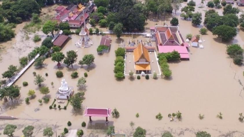
The Supporting Better Riverine and Flash Flood Forecasting for the Lower Mekong service improves riverine flood forecasts and enhances flash flood guidance monitoring in the region. The service provides decision-support tools to the Mekong River Commission (MRC) and governments in the region with a range of applications such as: flood forecasting and mapping, early warning systems and river basin management alongside capacity building activities. For example, SERVIR Mekong is working with the MRC to enhance its existing Flash Flood Guidance System with a rainstorm tracker to monitor and forecast potential rainstorms and assess the impact of floods on critical infrastructure. The MRC has also adopted SERVIR Mekong’s new generation satellite-based rainfall data and products to increase the effectiveness of their flood forecasts, improving flood forecasting accuracy and providing first responders with 15 days of lead time (as opposed to 7 days previously). Moreover, the impact of flooding on critical infrastructure will be assessed, allowing decision makers to come up with measures to reduce or prevent the impact beforehand. Lastly, the service enables the MRC to monitor and forecast water inflows and outflows from dam reservoirs – critical information for flood and drought management.
Together, the applications provided through this service enable the MRC and local governments to better respond to extreme monsoon rains and tropical storms, thereby reducing flood risk. These applications have been identified in the MRC multi-year work plan 2021-2022 with ADPC and other partners. These applications support the MRC and member countries by not only improving current flood and drought assessment capability but also by supporting the MRC’s Flood Management and Mitigation (FMM) Strategy and Drought Management Strategy 2020-2025 respectively. The MRC has integrated the inputs from these applications to their existing MRC Flood Early Warning System and MRC Data portal to distribute the information from regional to the local level in order to reduce flood risks.
Note: Data from the SWOT (Surface Water and Ocean Topography) mission is not yet available.
Rationale
Countries in the Lower Mekong region experience seasonal floods, caused by heavy monsoon rain and tropical storms that can trigger riverine and flash floods, affecting a high proportion of the region’s population that maintain water-related livelihoods. Unlike many other disasters, occurrences of floods can be estimated scientifically, and warnings can be issued ahead of time to ensure protection of life and property. At the regional level, the Mekong River Commission (MRC) has a mandate to support its member countries (Thailand, Laos, Cambodia, and Vietnam) monitor and respond to floods and related environmental issues. Since all countries in the Lower Mekong region rely on early warnings and weather forecasts to prepare for and respond to floods, there is strong demand for more reliable and accurate flood forecasts to save lives and property.
-
Users
The Regional Flood and Drought Management Center (RFDMC), Mekong River Commission (MRC)
National Mekong Committee
Cambodia: Department of Meteorology, Ministry of Water Resources and Meteorology, The Department of Hydrology and River Works
Laos: Department of Meteorology and Hydrology, Ministry of Natural Resources and Environment
Thailand: Ministry of Information and Communication Technology, Department of Water Resources, Ministry of Natural Resources and Environment
Vietnam: National Centre for Hydro-Meteorological Forecasting (NCHMF), Southern Regional Hydro-Meteorological Center