
Ecosystem & Carbon Management
Monitoring and Evaluation of Mangroves in Guyana
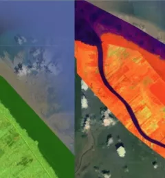
The Monitoring and Evaluation of Mangroves in Guyana service brings Synthetic Aperture Radar (SAR) and other remote sensing resources to map the extent and structure of mangrove forests along the coast of Guyana.