
Monitoring and Evaluation of Mangroves in Guyana
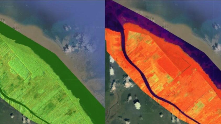
The Monitoring and Evaluation of Mangroves in Guyana service brings Synthetic Aperture Radar (SAR) and other remote sensing resources to map the extent and structure of mangrove forests along the coast of Guyana. The service consists of a platform for automating the analysis of radar and optical imagery going back several years and setting a year-2020 baseline for future analysis. It makes mangrove-related land-use change transparent and makes the resulting analysis publicly available for use by government and civil society. This enables them to:
- act on hotspots of deforestation and stop them on time
- engage in land-use planning, policy-making, and actions that protect mangroves from being converted to other land uses; and
- plan mangrove protection efforts for farmers in low-lying coastal regions.
The service also serves larger efforts of forest and biodiversity conservation in Guyana.
Rationale
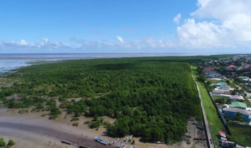
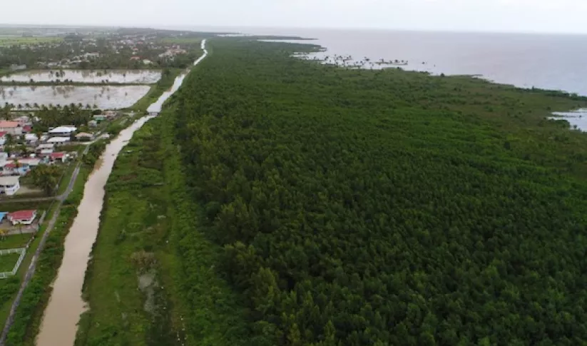
Mangrove forests make up much of the coast of Guyana and they are under threat from growing population and land-use change. Rising sea levels and coastal development also threaten mangroves. Because much of the coast of Guyana is below sea level, the mangroves serve as a natural barrier, protecting inland ecosystems from flooding and saltwater intrusion, which reduce yields of rice and other crops. Urban dwellers are also affected by higher intensity floods. Guyana lacks a mangrove monitoring and evaluation system using remote-sensing analysis to measure and monitor the spatial and temporal trends in mangrove growth. This service will help Guyanese government and civil society to better manage their fragile mangrove environments.
-
Users
National Agricultural Research and Extension Agency of Guyana (NAREI)
University of Guyana (UG)
Centro Internacional para la Investigación del Fenómeno de El Niño (CIIFEN)
-
External News/Resources
-
Protecting Guyana's Mangroves and Communities with NASA Satellites
SERVIR is helping protect biodiversity and human lives in Guyana by working with communities to keep a watchful eye on the health of coastal mangrove forests.
-
Ensuring Resilience for People and Ecosystems: Guyana Advances Mangrove Monitoring with Satellite Technology
While mangroves ordinarily provide multiple benefits to Guyana's coast, they are currently under threat due to rising sea levels, deforestation, and coastal erosion.

