
Early Warning Systems Aid Malawi
This story was originally published on ClimateLinks.
Malawi suffered terrible losses after Cyclone Idai ravaged the country in 2019, resulting in roughly 1,500 deaths, with another 2,300 people reported missing. Still reeling from the aftermath, local authorities collaborated with the SERVIR program in Eastern and Southern Africa and its partner organizations to reinforce the country’s flood warning systems. When Cyclones Ana and Gombe struck the country in early 2022, the resulting community-based flood early warning systems (CBFEWS) saved the country more than $40 million in losses according to estimates from Malawi’s Department of Disaster Management Affairs. Now, the Government of Malawi, SERVIR, and other critical partners are planning to build on these successes and upscale the CBFEWS system to 10 southern districts frequently affected by cyclones.
SERVIR scientists at the Kenya-based Regional Centre for Mapping of Resources for Development (RCMRD) led an initiative to replicate the flood early warning service developed in Asia’s Hindu Kush Himalaya by SERVIR scientists with the International Centre for Integrated Mountain Development (ICIMOD) to work in the flood-prone districts of Malawi. By the time Cyclones Gombe and Ana hit in early 2022, the community-based flood early warning system was up and running with an operational 15-day forecast thanks in large part to the efforts of Brigham Young University’s Jim Nelson and the Group on Earth Observations for Global Water Security’s European Centre for Medium-Range Weather Forecasts Streamflow Model. This significant extension of lead time from hours to days gives people and communities the time needed to prepare and take action before a predicted flood.
“With that type of warning being generated from the instruments that we have installed through technical support from RCMRD,” began Samuel Gama, Principal Mitigation Officer at Malawi’s Department of Disaster Management Affairs, “We have been able to at least spare some lives that would have been affected by such disasters.”
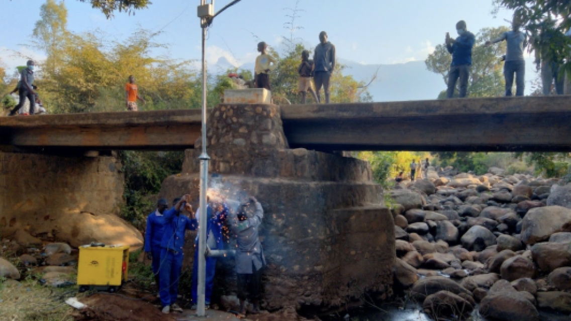
The community-based flood early warning systems program initially started primarily by projecting flood risk with data from ground-based water level sensors installed at river locations upstream of the floodplain-affected areas. SERVIR scientists working in partner organizations around the world helped expand the program's capabilities with the inclusion of satellite data, allowing early warning systems to alert communities even earlier so that they can take actions that reduce risk and build resilience to flood disasters.
The system was a herculean effort to initiate, requiring the dedication and collaboration of several key international players, such as the United Nations Development Programme (UNDP), International Centre for Integrated Mountain Development (ICIMOD), Regional Centre for Mapping of Resources for Development (RCMRD), and the Malawi Red Cross Society. SERVIR’s structure aids in supporting this level of international collaboration by connecting stakeholders with open science and a global network of expertise. The CBFEWS project particularly benefited from this network, as it was informed by work done at SERVIR’s Hindu Kush Himalaya hub and adapted from ICIMOD’s successful strategy.
“This locally-led effort convened an impressively wide range of collaborators to work together to strengthen the resilience of Malawians to flood risk,” says Pete Epanchin, a Senior Climate Adaptation Advisor and SERVIR manager with USAID. "Community-based Flood Early Warning Systems (CBFEWS) demonstrate the power of demand-driven climate adaptation and its ability to deliver real impacts that save lives and protect livelihoods.”
Following these successes, the World Bank is aiding the effort to expand the program by providing significant funding. These funds, along with those already provided by the Green Climate Fund through the UNDP, will be used to implement CBFEWS in other districts where floods pose a significant threat. Nelson will also continue to collaborate with RCMRD and partners to extend Group on Earth Observations for Global Water Security streamflow services in Eastern and Southern Africa as part of the SERVIR Applied Sciences Team.
“The advantage that we have appreciated from these instruments is beyond what our physical eyes [are] able to see:” Gama says. “The reduction of loss of life as a result of the disasters that we have experienced.”
The collaboration demonstrated by SERVIR’s partners in this project has proven valuable in addressing climate change and related disasters. Success stories like CBFEWS will continue to show the value of collaboration on climate adaptation, especially as the program continues to grow and positively affect additional flood-prone communities.

