
Land cover mapping leads Nepal’s climate action strategy through data innovation
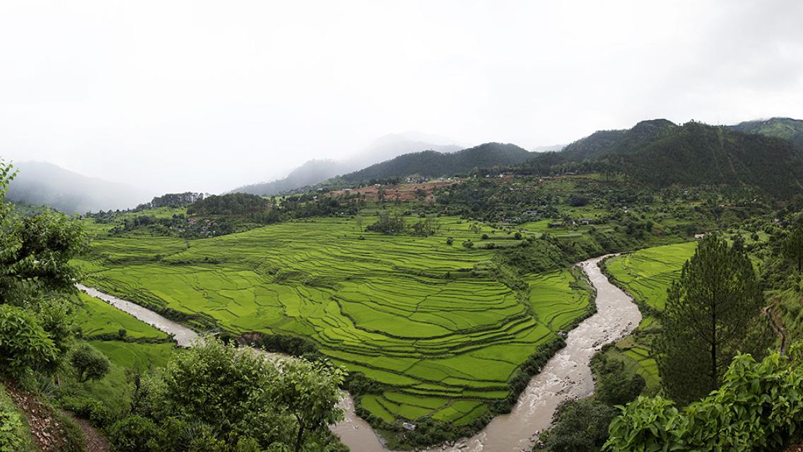
When countries need to make sustainable decisions about how best to use their land, they need highly detailed and current information—but accurately measuring how much of a country is forested or not (including land used for farming or undergoing urban expansion) can be incredibly difficult. More and more countries like Nepal are using satellite technology to address this challenge and create their own land monitoring systems.
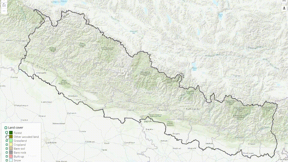
Nepal’s National Land Cover Monitoring System (NLCMS) represents a pivotal achievement and is poised to significantly enhance the country’s climate data and efforts to cut emissions and adapt to climate change. This system holds immense importance for assessing and overseeing the ever-changing landscape, which is crucial for the sustainable stewardship of Nepal’s natural resources.
Since 2018, SERVIR HKH has been continuously collaborating with Nepal’s Forest Research and Training Centre (FRTC), the nationally mandated agency for forest cover data, to develop an operational NLCMS for Nepal.
The NLCMS uses publicly available satellite imagery like Landsat combined with robust methodologies to regularly generate annual land cover data for the entire country. Data from the land cover map, which includes the forest cover extent, is used to generate estimations of land-based greenhouse gas emissions from forest loss.
Why land data matters to Nepal
FRTC uses the land cover maps for national and international reporting on forest cover change and preparing a long-term strategy for achieving Nepal’s Nationally Determined Contribution (NDC) targets for addressing climate change. It also serves as a foundational dataset to advance evidence-based planning and policy development.
The NLCMS addresses the challenges of long-term data gaps by providing consistent geospatial data crucial for various sectors such as forestry, climate action, and research. NLCMS data played a pivotal role in setting climate targets for Nepal’s commitments to the Paris Agreement and is being extensively used in forest degradation mapping, climate change action, and academic research.
Bimal Kumar Acharya, Senior Remote Sensing Officer from FRTC states, “The NLCMS results are useful in the planning and policy-making processes of Nepal's federal, provincial, and local governments. It is also useful for reporting on Nepal’s national and international obligations.”
NLCMS land cover data has become the national data to help the government and members of civil society to understand the geographic distribution of different land cover types present in Nepal. The Government of Nepal, through FRTC, has adopted this system, establishing it as a credible and authentic data source for official use. The National Statistics Office uses the data and map for generating land cover statistics for international reporting, such as for the Second NDC, which was developed based on this data.
Collaboration for success and sustainability
Continuous capacity strengthening with relevant stakeholders in Nepal has been critical to the success and final endorsement and implementation of the NLCMS. The partners in Nepal have invested time and personal resources to efficiently contribute and co-develop the system and advance a sustainable pathway for the NLCMS to be an essential platform for years to come.
Computing resources and expertise from SERVIR’s Applied Sciences Team member Peter Potapov from the University of Maryland significantly enhanced the value of the land cover map through the incorporation of Tree Canopy Cover, Tree Canopy Height, and various other data layers. These additional datasets have played a pivotal role in improving the overall accuracy and precision of the data included in the NLCMS.
“Our approach to co-developing the NLCMS product by partnering with the National Agency (FRTC) and Applied Science Team (University of Maryland) brought cutting-edge technologies and built the capacity and confidence of national stakeholders on the use of the new mapping method and the land cover data. The web-based, easy-to-use interface of the product is built utilizing a cloud processing platform and openly available time series satellite images, making the product efficient and replicable relatively easily at significantly low costs for any country annually anywhere in the world, ensuring the sustainability for the longer term.” - Rajesh Bahadur Thapa, Science and Data Lead, SERVIR-HKH
