
Locally Led Development Drives Climate Action at the SERVIR West Africa Hub
In its first phase, the SERVIR West Africa hub was implemented as a consortium led by the Agrometeorology, Hydrology and Meteorology (AGRHYMET) Regional Center in Niamey, Niger. AGRHYMET serves 13 member countries in West Africa and is a subsidiary of the Permanent Inter-State Committee for Drought Control in the Sahel (CILSS).
SERVIR West Africa’s five consortium partners included:
- Centre de Suivi Ecologique (CSE), based in Senegal
- Center for Remote Sensing and Geographic Information Services (CERSGIS), based in Ghana
- African Regional Institute for Geospatial Information Science and Technology (AFRIGIST), based in Nigeria
- International Crops Research Institute for the Semi-Arid Tropics (ICRISAT), based in Mali
- African Centre of Meteorological Application for Development (ACMAD), based in Niger
The SERVIR West Africa hub and its five consortium partners used satellite imagery, geospatial data and analysis, maps, tools, and services to tackle critical economic, environmental, and social issues and improve the region’s climate resilience. The hub worked side by side with decision-makers in government and in local communities to customize geospatial products and services to help address development needs.
Below are a few examples of how SERVIR’s West Africa hub worked with local governments and communities to manage challenges – in areas of food security, water resources, weather and climate, land use, disasters, and air quality – that are increasingly made more difficult by a changing climate.
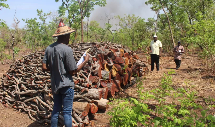
Charcoal Monitoring Production Sites for West Gonja and Sene Districts in Ghana
In Ghana, SERVIR West Africa, in partnership with its consortium partner, CERSGIS, created a service to monitor charcoal production sites for the West Gonja and Sene districts. SERVIR West Africa joined forces with A Rocha Ghana (ARG), a local environmental NGO that had been working with the local authorities and communities for several years to address an array of existing environmental and livelihood issues and to understand the full scale and complexity of the charcoal production problem.
Before partnering with SERVIR West Africa, ARG sent field officers into the field to manually collect data on the number of active and inactive charcoal production sites. However, this in situ data collection process was inefficient, because it was exceedingly labor-intensive and could monitor only a small portion of affected areas. After conducting a needs assessment with ARG and local officials, SERVIR West Africa created a tool that used Earth observation technology to identify and monitor charcoal production sites and estimate change in tree cover density in the West Gonja District in northern Ghana. SERVIR West Africa also partnered with the University of Oklahoma to develop an algorithm that mapped tree cover density.
SERVIR West Africa has enabled regional actors to quantify the number of trees that can be harvested with minimal impacts to tree cover and ecosystem function. District and land use planners are then able to incorporate population statistics for nearby communities to better gauge fuel wood demand and more aptly designate tree lots that can be sustainably co-harvested by selected communities to contain and minimize deforestation.
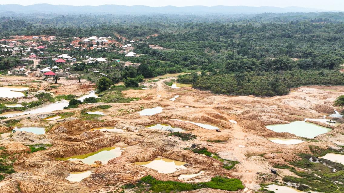
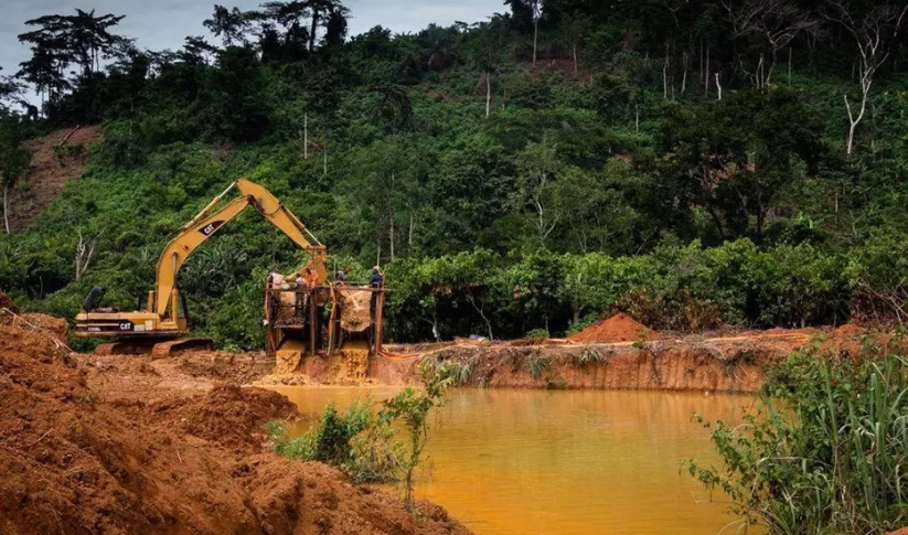
Supporting Government Officials to Monitor Illegal Mining Sites in Ghana
In Ghana, SERVIR West Africa, in partnership with its consortium partner CERSGIS, developed a satellite-based monitoring service to provide accurate information about the location and scale of illegal mining sites.
While artisanal mining is a major source of income for many rural people in Ghana, in recent years the increase in unregulated galamsey activities – illicit small-scale mining – has resulted in severe land degradation, biodiversity loss, and the pollution of water bodies from the use of toxic chemicals, including mercury and cyanide. Between 2015-2018, illegal mining increased from 13,000 hectares to 29,000 hectares and is steadily encroaching into Ghana’s protected forest preserves.
The collected data from the monitoring service provides critical intelligence to government officials and local non-governmental organizations that can be used to identify areas requiring increased law enforcement and environmental restoration.
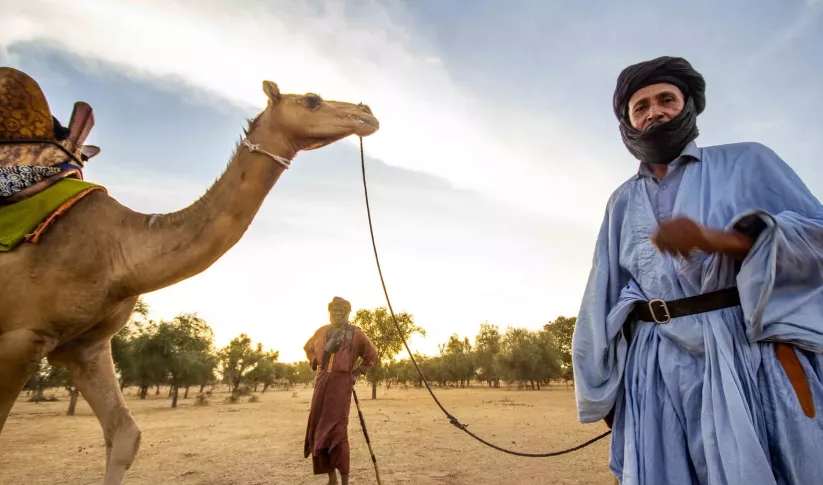
Supporting Pastoralists to Find Watering Holes During the Dry Season in the Ferlo Region
In north-central Senegal, SERVIR West Africa, in partnership with its consortium partner, CSE, developed a new service that provides accurate and timely information concerning the availability of water in all parts of the Ferlo region throughout the dry season.
The Ferlo region is a vast expanse of dry savannah covering over a third of the country’s total area. With only a few small, scattered settlements, the region is almost exclusively reserved for pastoralism, by both tradition and government policy.
During the rainy season from July to September, water and forage are fairly abundant for livestock. But when the dry season comes, pastoralists sustain their animals by relying on ephemeral water bodies – temporary ponds that hold remnants of water left over from the rainy season. In the past, during the dry season local populations could rely on historical knowledge, passed on from generation to generation, to find these watering holes. However, climate change has made the historical knowledge of weather patterns less reliable, requiring a different approach.
SERVIR is exploring the utility of high-resolution commercial imagery (such as Planet and Digital Globe) in detecting water in the ponds. This service monitors the location of watering holes and produces high-resolution maps with sufficient accuracy to assist local authorities in natural resource management. The information generated by this system is disseminated directly to affected populations, including Entente des Groupements Associés pour le développement à la Base (EGAB), a consortium of village community development associations in the region, through cell phone text messages and local radio broadcasts. Improvements are currently underway to integrate information on vegetation condition—this will facilitate the consideration of both food and water in livestock management decision making.
Learn more about how SERVIR’s locally led development is driving climate action across its five hubs: Out in Front: How SERVIR's Locally Led Development is Driving Climate Action.
-
Charcoal Production Site Monitoring Service for West Gonja and Sene Districts in Ghana
The Charcoal Production Site Monitoring Service is a web-based platform for visualizing the spatial distribution of charcoal production sites, thereby facilitating forest degradation monitoring in the study areas.
-
Monitoring Ephemeral Water Bodies in Ferlo, Senegal
The Monitoring Ephemeral Water Bodies in Ferlo, Senegal Service is a web-based platform for assessing water availability in all known ponds, thus facilitating water management in arid areas such as the Ferlo Region of Senegal.
-
Monitoring of Artisanal Mining (Galamsey) in Ghana
The Monitoring of Artisanal Mining (Galamsey) in Ghana Service is a monitoring platform with information on the location of illegal mining sites across Ghana and their associated land degradation.


