Video
Regional Drought Monitoring and Early Warning System
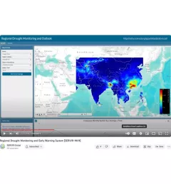
SERVIR scientists discuss the how the Regional Drought Monitoring and Early Warning System is being used in the Hindu Kush Himalaya region.

31 results
SERVIR scientists discuss the how the Regional Drought Monitoring and Early Warning System is being used in the Hindu Kush Himalaya region.
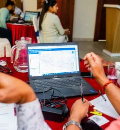
The Web has changed every aspect of our lives, from daily events to professional undertakings such as work related activities. Geographic Information Systems (GIS) – tools that enable us to manipulate the geographic aspects of data – have also been affected by web technology.
|Patrick Kabatha, RCMRD/SERVIR
SERVIR Hindu Kush Himalaya helps improve environmental management and resilience in critical areas like food security, water resources management, disaster resilience, and sustainable lan
The Climate Change Vulnerability, Impacts and Assessments Service assesses climate change impacts on vulnerable communities, water resources, and ecosystems in order to better address resilience building activities.
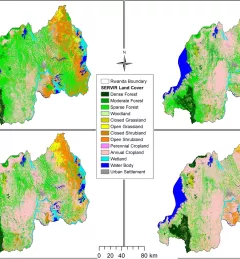
The Land Use Land Cover and Change Mapping Service was designed to provide governments with data, tools, and skills to better understand relevant intervention actions related to land conservation and management, ensuring that land resources can be efficiently monitored and regulated.
The Monitoring Extreme Weather in the Hindu Kush Himalaya (HKH) service provides a customized numerical weather prediction toolkit to assess high impact convective weather events over the HKH region.
The Regional Cropland Assessment and Monitoring Service seeks to provide timely information for food security assessments through the development of national and regional crop monitors in East Africa.
The Regional Stream Flow Monitoring and Forecasting Service was designed to provide real-time streamflow forecasts for several watersheds in East Africa and bias-corrected satellite precipitation products to enable the timely prediction and monitoring of extreme events.
The Satellite-Based Water Quality Monitoring Service leverages Earth observing satellite information to assess historical water quality changes of in-land trans-boundary lakes.
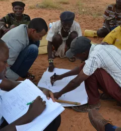
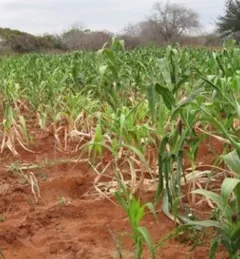
Agriculture is the backbone of economies in East African countries such as Tanzania. To succeed they need more information about droughts and dry spells, yet getting that information to farmers remains a challenge.