Infographic
SERVIR's Service Approach
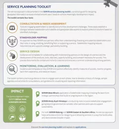
SERIR uses a "service" approach to identifying and addressing climate challenges.

7 results
SERIR uses a "service" approach to identifying and addressing climate challenges.
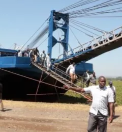
The Regional Stream Flow Monitoring and Forecasting Service was designed to provide real-time streamflow forecasts for several watersheds in East Africa and bias-corrected satellite precipitation products to enable the timely prediction and monitoring of extreme events.
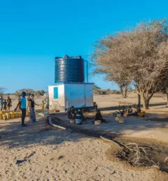
The Satellite-Based Water Quality Monitoring Service leverages Earth observing satellite information to assess historical water quality changes of in-land trans-boundary lakes.
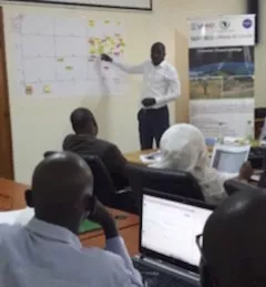
The Uganda Directorate of Water Resources Management manages and develops Uganda’s water resources in an integrated and sustainable manner.
SERVIR improves local and regional capacity to provide tools, products, and services that empower decision makers to better address critical issues related to food security, water resources, natural disasters, land use, and extreme weather. Building on thirteen years of experience, SERVIR has grown in its geographical reach and has adapted its approach based on lessons learned.
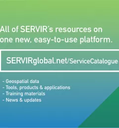
The newly-launched SERVIR Service Catalogue is improving access to geospatial services to inform decision making and improve resilience in critical areas like food security, water management, disaster resilience, and sustainable land and ecosystem management.
A recent NASA article highlighted Applied Sciences Team Principal Investigator Dr. Evan Thomas and the Drought Resilience Impact Platform (DRIP).