Video
Regional Drought Monitoring and Early Warning System
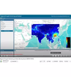
SERVIR scientists discuss the how the Regional Drought Monitoring and Early Warning System is being used in the Hindu Kush Himalaya region.

20 results
SERVIR scientists discuss the how the Regional Drought Monitoring and Early Warning System is being used in the Hindu Kush Himalaya region.
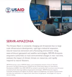
This fact sheet provides an overview of SERVIR-Amazonia, which is part of SERVIR Global, a joint development initiative of the U.S. National Aeronautics and Space Administration (NASA) and the United States Agency for International Development (USAID).
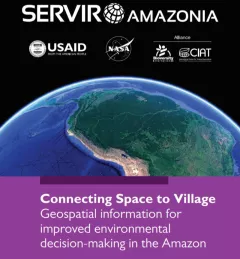
This brochure provides an overview about SERVIR Amazonia.
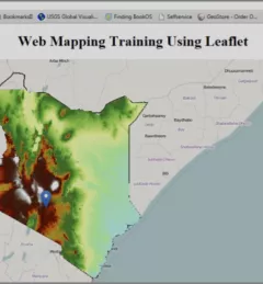
The Web has changed every aspect of our lives, from daily events to professional undertakings such as work related activities. Geographic Information Systems (GIS) – tools that enable us to manipulate the geographic aspects of data – have also been affected by web technology.
|Patrick Kabatha, RCMRD/SERVIR
SERVIR Hindu Kush Himalaya helps improve environmental management and resilience in critical areas like food security, water resources management, disaster resilience, and sustainable lan
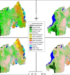
The Land Use Land Cover and Change Mapping Service was designed to provide governments with data, tools, and skills to better understand relevant intervention actions related to land conservation and management, ensuring that land resources can be efficiently monitored and regulated.
The Monitoring Extreme Weather in the Hindu Kush Himalaya (HKH) service provides a customized numerical weather prediction toolkit to assess high impact convective weather events over the HKH region.
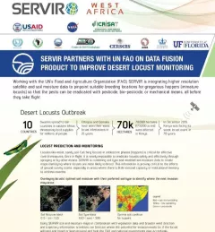
This fact sheet highlights how SERVIR is using satellite data to pinpoint breeding locations for locusts so that the pests can be eradicated before they take flight.

Meet Finu Shrestha, GIS Research Associate for ICIMOD/SERVIR-Hindu Kush Himalaya.
The United States Agency for International Development (USAID) and the U.S. National Aeronautics and Space Administration (NASA) announced on March 8 a five-year project that will use satellite imagery to address environment and development challenges across the Amazon Basin.