Articles & Stories
Making Forecasts a Breeze
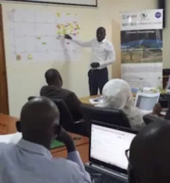
NASA supports local experts around the world to help their communities access and use weather and climate information.

12 results
NASA supports local experts around the world to help their communities access and use weather and climate information.
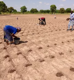
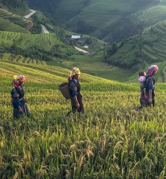
This service focuses on the production of seasonal crop-related weather forecasts for improving the quality of products disseminated to end users such as farmers.
USAID’s 2024-2028 Geospatial Strategy promotes leveraging the power of geospatial data and technology to target the delivery of international programs.

SERVIR will be at the American Geophysical Union (AGU) fall conference December 11 - 15, 2023. We have compiled a list of SERVIR affiliated colleagues who will be presenting throughout the week. Please come and meet us at our talks and posters.

The end of one year and the start of the next provides an opportunity to reflect on past achievements and future goals. In 2023, the SERVIR network worked with local partners in the design and implementation of numerous geospatial services to address complex challenges related to climate change.
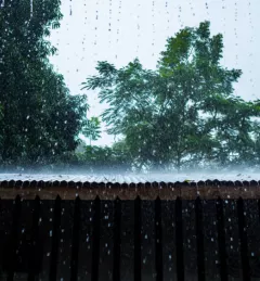
When irrigation isn't available, it's important to know when to expect rain. But with changes to our climate, farmers in West Africa can no longer count on a predictable weather. To mitigate this, SERVIR West Africa works with AGRHYMET to improve access to reliable weather and crop forecasts.
|Jacob Ramthun, SERVIR Science Coordination Office
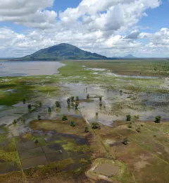
Disaster preparedness and the water resource management require reliable and timely information. In many regions of the world, ground observation data is scarce. Here are three ways that SERVIR's innovative services and tools enable decision-makers and authorities to address water challenges.
|Chinmay Deval, NASA SCO Water Security Lead
SERVIR improves local and regional capacity to provide tools, products, and services that empower decision makers to better address critical issues related to food security, water resources, natural disasters, land use, and extreme weather. Building on thirteen years of experience, SERVIR has grown in its geographical reach and has adapted its approach based on lessons learned.
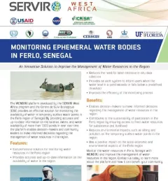
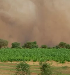
This fact sheet describes how SERVIR West Africa works with local stakeholders to strengthen the resilience of pastoral systems in Senegal.
ClimateSERV is a web-accessible system that allows users to access, visualize, and analyze historical Earth observations useful to decision-making across multiple sectors.