Articles & Stories
Making Forecasts a Breeze

NASA supports local experts around the world to help their communities access and use weather and climate information.

48 results
NASA supports local experts around the world to help their communities access and use weather and climate information.
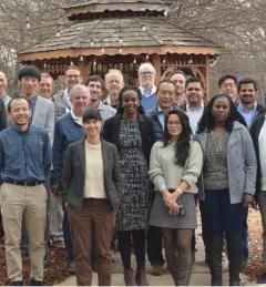
In February 2023, SERVIR officially welcomed its fourth Applied Sciences Team. For the next three years, they will support SERVIR’s efforts to deliver geospatial tools for communities in Asia, Africa, and Latin America.
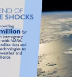
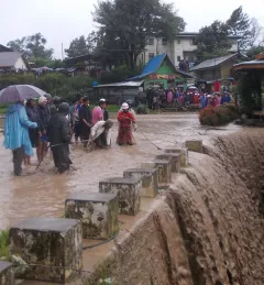
On January 30, 2024 Administrator Samantha Power announced new initiatives to accelerate and expand programs that contribute to the President’s Emergency Plan for Adaptation and Resilience (PREPARE), aimed at preparing communities and building their resilience to these perpetual and deadly climate “shocks.”
With support from organizations such as the Asian Disaster Preparedness Center, SERVIR scientists like Dr. Narendra Das of Michigan State University are working with our regional hubs and other stakeholders on models that will better predict crop yields in the face of climate change.
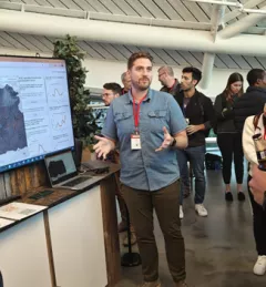
At Google’s Geo for Good (G4G) Summit 2023 in Mountain View, California, SERVIR scientists explained how and its collaborators are using artificial intelligence (AI) get more out of Earth data.
| Jake Ramthun, Biplov Bhandari, and Tim Mayer, NASA Science Coordination Office
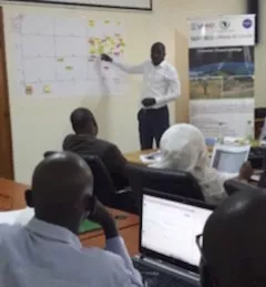
SERVIR improves local and regional capacity to provide tools, products, and services that empower decision makers to better address critical issues related to food security, water resources, natural disasters, land use, and extreme weather. Building on thirteen years of experience, SERVIR has grown in its geographical reach and has adapted its approach based on lessons learned.
We're partnering with ResilienceLinks to host a webinar highlighting how USAID and NASA are strengthening access to critical water data to promote climate resilience. Join us Wednesday, May 22, 2024, 9:00AM - 10:15AM, GMT -4. Register online to attend.
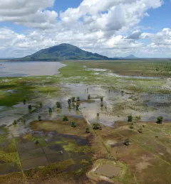
The objective of the Supporting Near Real-Time Flood Monitoring in Myanmar Service was to develop a multi-sensor based near real-time flood monitoring tool to support the Myanmar Department of Disaster Management (DDM) in monitoring flood events.