Infographic
SERVIR's Service Approach
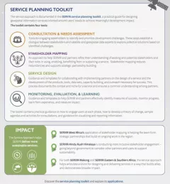
SERIR uses a "service" approach to identifying and addressing climate challenges.

11 results
SERIR uses a "service" approach to identifying and addressing climate challenges.
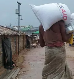
Enhancing Anticipatory Actions for Disaster and Climate Resilience aims to reduce the loss of lives and damage to properties and crops from floods and droughts by improving early warnings using satellite data and geospatial information.

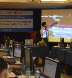
The Supporting Better Riverine and Flash Flood Forecasting for the Lower Mekong service improves riverine flood forecasts and enhances flash flood guidance monitoring in the region.
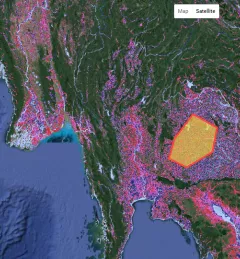
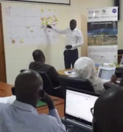
Through the Supporting Flood Emergency Preparedness for Myanmar Service, SERVIR Mekong co-developed and supported the use of a systematic decision-support tool for the Myanmar Department of Disaster Management to identify areas with high flood risk.
The objective of the Supporting Near Real-Time Flood Monitoring in Myanmar Service was to develop a multi-sensor based near real-time flood monitoring tool to support the Myanmar Department of Disaster Management (DDM) in monitoring flood events.
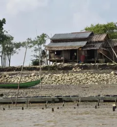
Densely populated communities living along low-lying deltas in Southeast Asia are dependent on the underground water stores these deltas provide for their livelihoods. Read about recent SERVIR activities toward helping this region use NASA's publicly available satellite data to support decision making on water resources issues.
SERVIR improves local and regional capacity to provide tools, products, and services that empower decision makers to better address critical issues related to food security, water resources, natural disasters, land use, and extreme weather. Building on thirteen years of experience, SERVIR has grown in its geographical reach and has adapted its approach based on lessons learned.
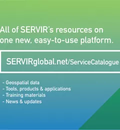
The newly-launched SERVIR Service Catalogue is improving access to geospatial services to inform decision making and improve resilience in critical areas like food security, water management, disaster resilience, and sustainable land and ecosystem management.
Changes in river morphology including floods, erosion, and landslides are affecting ecosystem habitats and the lives and livelihoods of communities living along Myanmar's rivers. SERVIR-Mekong is using satellite-based monitoring tools to support Myanmar agencies and communities to manage the risks better.
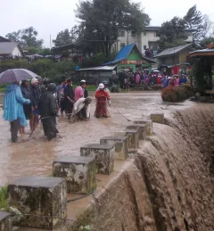
The Hindu Kush Himalayan (HKH) region is no stranger to water- and weather-induced hazards. Every year, these disasters result in loss of lives, livelihoods, and damage to infrastructure throughout HKH countries.