Articles & Stories
Applied Sciences Team project informs decision makers with fire season forecast
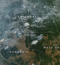
SERVIR AST member Doug Morton discusses the upcoming fire season in Amazonia in a new NASA article.

82 results
SERVIR AST member Doug Morton discusses the upcoming fire season in Amazonia in a new NASA article.
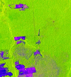
One of the major challenges in monitoring forests is identifying forest degradation processes. Recent years have seen advancements in satellite remote sensing technology, which has in turn revealed changed patterns of illegal deforestation activity in the Amazon rainforest.
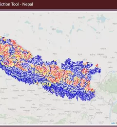
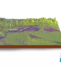
![SHUKLA_Shrad_photo[1].jpeg](/sites/default/files/styles/card_flag/public/article/image/SERVIR-HKH_thematic_illustration.jpg.webp?itok=isSkllDk)
The International Centre for Integrated Mountain Development (ICIMOD) has been implementing the SERVIR-HKH Initiative — one of five regional hubs of the SERVIR network — in its Regional Member Countries, prioritizing capacity building and science activities in Afghanistan, Bangladesh, Myanmar, Nepal, and Pakistan.
During this year's monsoon, a teacher was able to use a SERVIR-HKH science application to predict flooding in a river stretch and relay this information to concerned authorities — saving property and possibly lives.
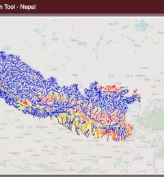
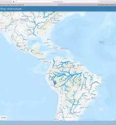
SERVIR AST PI Jim Nelson of BYU was featured in a recent news article posted online by the university, focused on his AST streamflow forecasting project in the HKH region.
SERVIR Hindu Kush Himalaya partnered with the University of Alaska Fairbanks to organize a training titled HydroSAR: Extracting flood information from SAR to advance the use of SAR at ICIMOD and across the HKH region.
The Crop Monitoring and Assessment service enhances the use of geospatial information to develop sustainable methods and tools which will improve the quality of agricultural statistics for major staple crops based on the integral use of Earth Observation (EO) technologies.
ICIMOD, under its SERVIR-HKH Initiative, is collaborating with Brigham Young University, NASA's Jet Propulsion Laboratory, and national partners to enhance flood early warning systems in Bangladesh and Nepal
In line with its service co-development approach, SERVIR-Amazonia is bringing diverse Brazilian stakeholders together to identify local development problems and identify solutions in form of tools, data sets, training resources and capacity building activities that use satellite data, Earth science, and geospatial technologies.
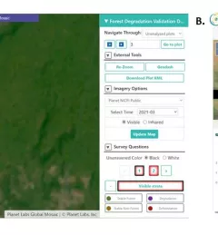
Users of Collect Earth Online (CEO) around the world are taking advantage of a CEO feature called the Geo-Dash Degradation Tool that allows them to monitor forest degradation, a major source of carbon emissions.